Iceland Laugavegur trail is the most popular hike in stunning Iceland and one of the world’s most beautiful hikes according to National Geographic. It was one of the most strenuous and the most magnificent routes I’ve done across 5 continents in recent years.
Iceland is a true uninhabitable wasteland! The route is not technically demanding but due to its length and diverse terrain, it can be very challenging. The Laugavegur hike is normally done in 5 days from north to south. However, we decided to undertake a 4-day Iceland Laugavegur trail from south to north: Skogar to Landmannalaugar. It’s much tougher but comes with lots of advantages, including ending near amazing hot springs in Landmannalaugar, where you can soak your tired body in steaming natural water.
Here is all you need to know about how to successfully prepare for the 4-day Laugavegur trail and Icelandic highlands in terms of equipment, outfit, camping and mountain huts experience.
93% of Iceland is empty!
4-day Iceland Laugavegur trail in Iceland.
Along with the surreal Iceland landscape, hiking Laugavegur you’ll get to experience 4 seasons in only 4 or 5 days (depending on how you plan your route).
This four-day trek is a challenging yet rewarding journey, showcasing Iceland’s diverse terrain, including glaciers, hot springs and volcanic landscapes. Here is a full guide on how to prepare for the magnificent Laugavegur trail – after hiking this trail I can recommend what was most crucial for this adventure.
Laugavegur means "Hot spring route".
Important advise on Laugavegur trail.
MOUNTAIN HUTS: Most of the mountain huts are very basic – the better ones offer sleeping places with a kitchen and shower, while the rest only offer cabins – no shops, and no restaurants are available.
RUBBISH: You will have to carry your rubbish for most of the trail. There are no bins along the way.
CHARGING STATIONS: Bring power banks – only a few mountain huts offer charging stations.
NETWORK: The network signal is very poor in some stages of the trail. Thus it’s good to have an iPhone 😉 which enables Emergency calls without a network.
WEATHER: Unpredictable, fast-changing, windy and rainy for most of the time! Laugavegur trail was completely closed and all people were evacuated a week before our arrival (August). The storm was so strong the route was closed for a few days.
Wild camping in Iceland is strictly prohibited!!
Do you need a guide for Laugavegur hike?
There are many organized hiking groups from all over the world on Laugavegur trail, in groups of 5-8 people per guide. In my opinion, there’s no need to hire a guide for this hike. I would never recommend hiking this route alone, as it can still become very challenging in bad weather conditions, but the trail is well marked and if you have a good hiking experience it’s perfectly doable. My friend always wanted to go for this hike, so we decided to share this adventure combining sleeping in a tent and mountain huts. Adventure of a lifetime 😉
Where to sleep during Laugavegur hike.
First of all, you should consider how you want to accommodate yourself during the trek. There are two options:
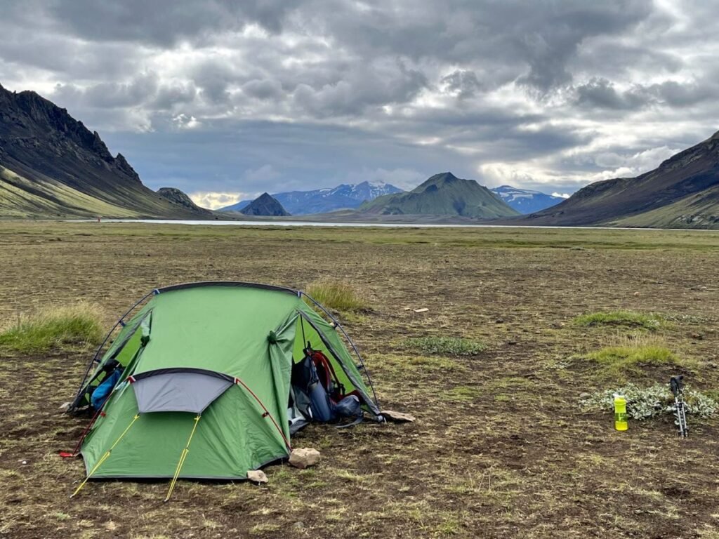
- TENT – sleeping in a tent gives you much more flexibility, although camping is only allowed in Iceland in designated areas. There is always a place to camp around the cabins/mountain huts. Remember to own your sleeping bag along with a sleeping mat. ADVANTAGES: cheaper, provides more flexibility on your itinerary. It’s also a great adventure and it’s more private. DISADVANTAGES: Weather can be nasty: rain, wind and cold nights. A tent is an additional equipment to carry throughout your trek, extra kilos make a difference if you hike 20+ kilometers per day.
- HUTS – this is a much more comfortable and warmer option than a tent, however you should know the huts are mostly dorms (20-40 people in the room) and you should make reservations even few months in advance.
How much is camping in Iceland?
Average Hut Price: 13000 ISK/per person.
Average Camping Price: 2,300 ISK/per person.
Shower at huts: 500 ISK.
Hot water – usually free but it’s not available in every hut.
How to pack for 4-day Iceland Laugavegur trail?
- Pack lightweight, quick-drying clothing,
- Ensure you have sturdy hiking boots with ankle support,
- Water shoes (I skipped flipflops, to avoid extra weight),
- Hiking poles (extremely helpful on this trail!),
- Sun lotion, Sunglasses, warm hat,
- Windproof and rainproof jacket is a MUST! Do not even try to travel across Iceland without it.
- Leave your jeans at home!
- Inflatable pillow – a great solution for a tent or a mountain hut (you need to bring your sleeping bag).
- Power bank,
- Headlight! Extra batteries,
- Water bottle,
- I can’t go without a thermos with hot ginger, lemon and honey tea.
What food should I carry?
- Bring some tea bags and coffee,
- Isotonic powder,
- Snacks, chocolate, protein bars,
- Nuts and dry fruits are great nutrition and bring lots of energy,
- It’s crucial to remain hydrated, so bring a refillable water bottle,
- Canned fish or meat,
- I brought packed bread,
- Sliced cheese,
- Canned veggie paste,
- Veggie sausages,
Packaged Instant Soups! Great to warm up!
Tap water in Iceland is drinkable!
How hard is the Iceland Laugavegur trail?
DIFFICULTY: Generally, 4-day Iceland Laugavegur trail is considered a challenging hike. But I would say it’s moderate, as it does not require any technical skills. Hiking conditions depend on the season – the trail would be much more demanding in the winter months. July-August is considered relatively easy for this hike.
LENGTH: 80 kilometers
DURATION: 4 days (normally 5-6 days)
ASCENT: 2600m
DESCENT: 2000m
BEST TIME TO HIKE: June to September.
WEATHER: In August we had 12-14 degrees Celsius during the day, night temperatures dropped to 4-5 degrees.
DIFFICULTY: Challenging/moderate.
Bus to Skogar from Reykyavik.
The bus from Reykjavik to Skogar takes about 2.30-3h. It’s crucial to book your ticket in advance! Bus tickets sell out quickly as there are many people traveling from Reykjavik to Skogafoss.
- Reykjavík (Campsite Hostel) at 06:30am and
- Reykjavík (BSÍ Bus Terminal) at 07:00am.
Our 4-day Laugavegur trail.
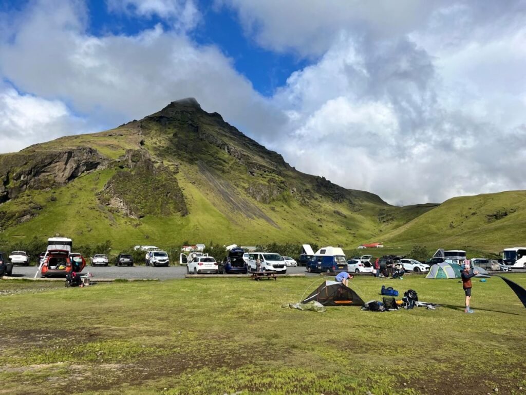
The journey begins in Skogar with the breathtaking Skogafoss waterfall. Skogar is a big camping site and a starting point for the Fimmvörðuháls trail.
Most picked organized tours:
DAY 1: Skogar to Þórsmörk
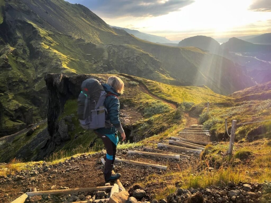
The Fimmvörðuháls trail in Iceland is a 25 km long including 1000m of climbing hike – leading from (from Skogar to Porsmork). As you set off, be prepared for a day of diverse terrain, including river crossings and steep ascents.
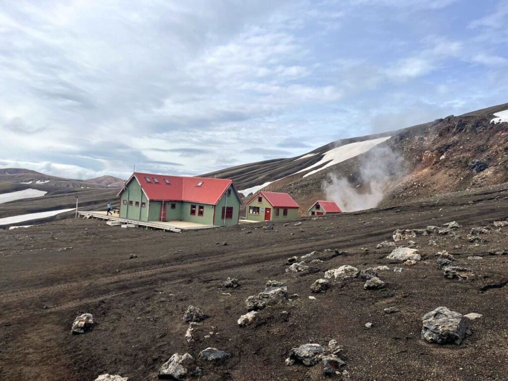
Baldvinsskáli hut.
The first half of the trail leads through magnificent valleys, green lava fields, and many stunning waterfalls. Baldvinsskáli hut marks the first half of the trail (in the photo below). The hut is small – ir can accommodate only 16 people – that’s why if you’re planning to sleep in the hut you should book months in advance.
We made a short stop for lunch in the hut, it’s possible to get some hot water indoors and consume your lunch away from the wind. There is NO SHOP in the hut – you’ll be only able to buy some chocolate bars and small snacks.
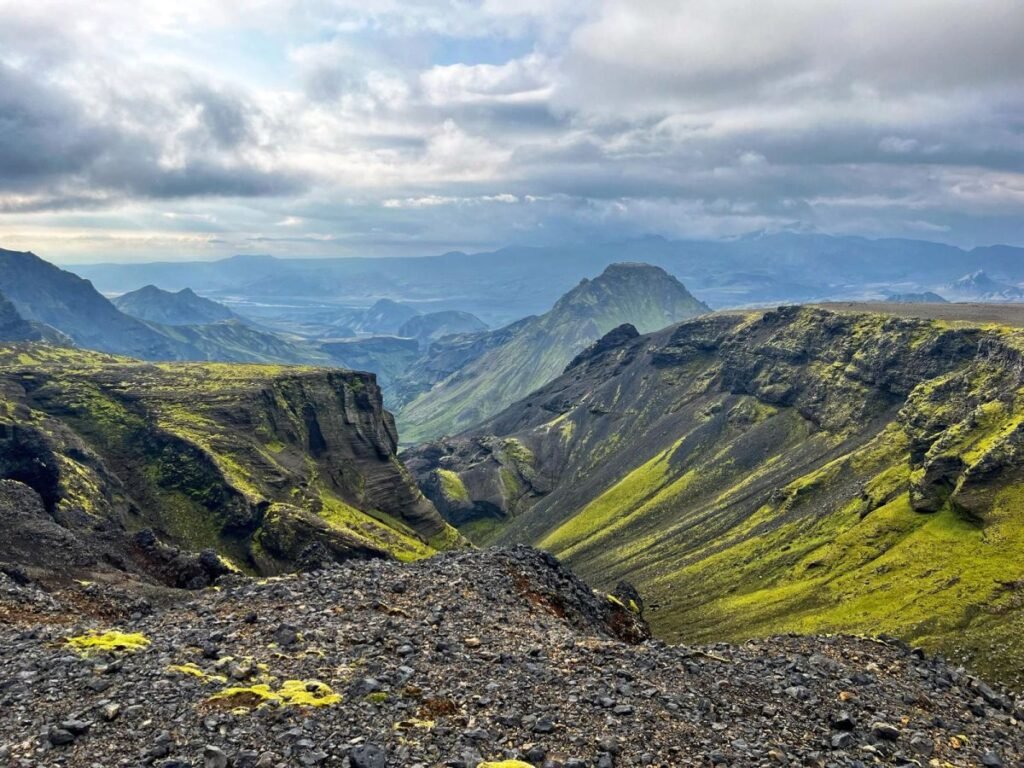
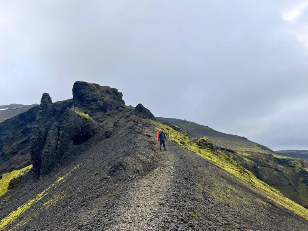
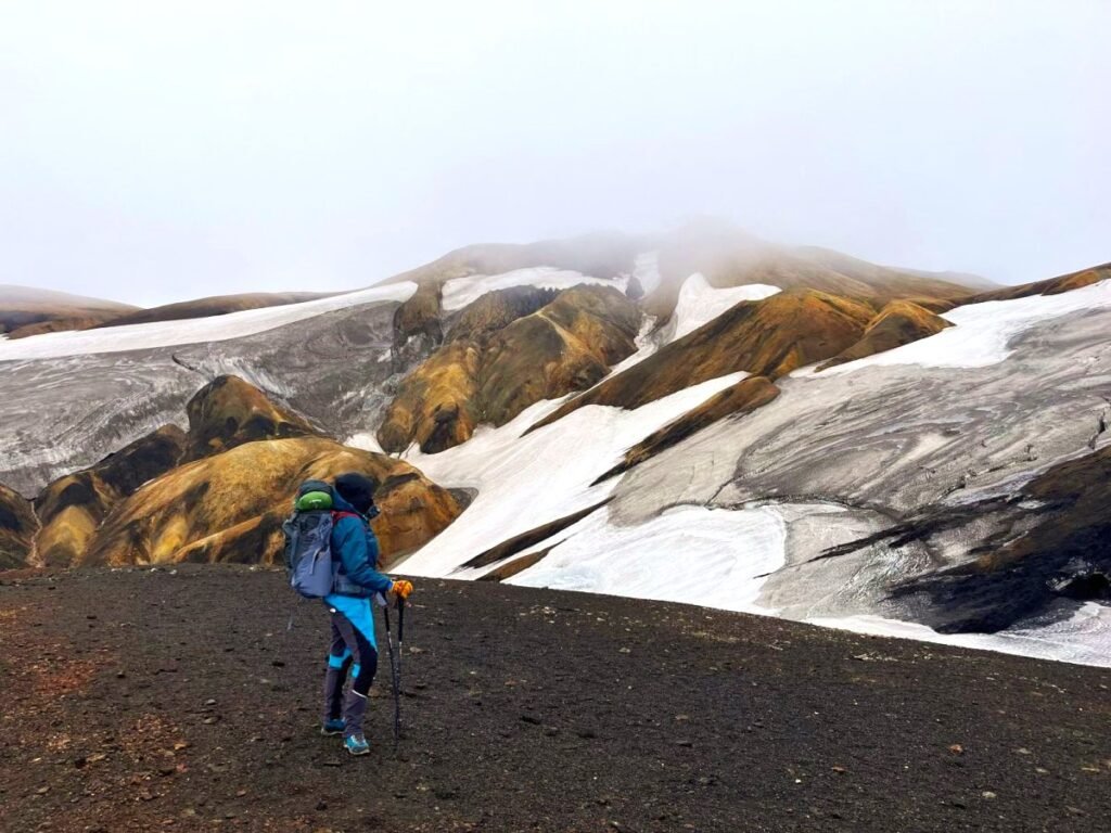
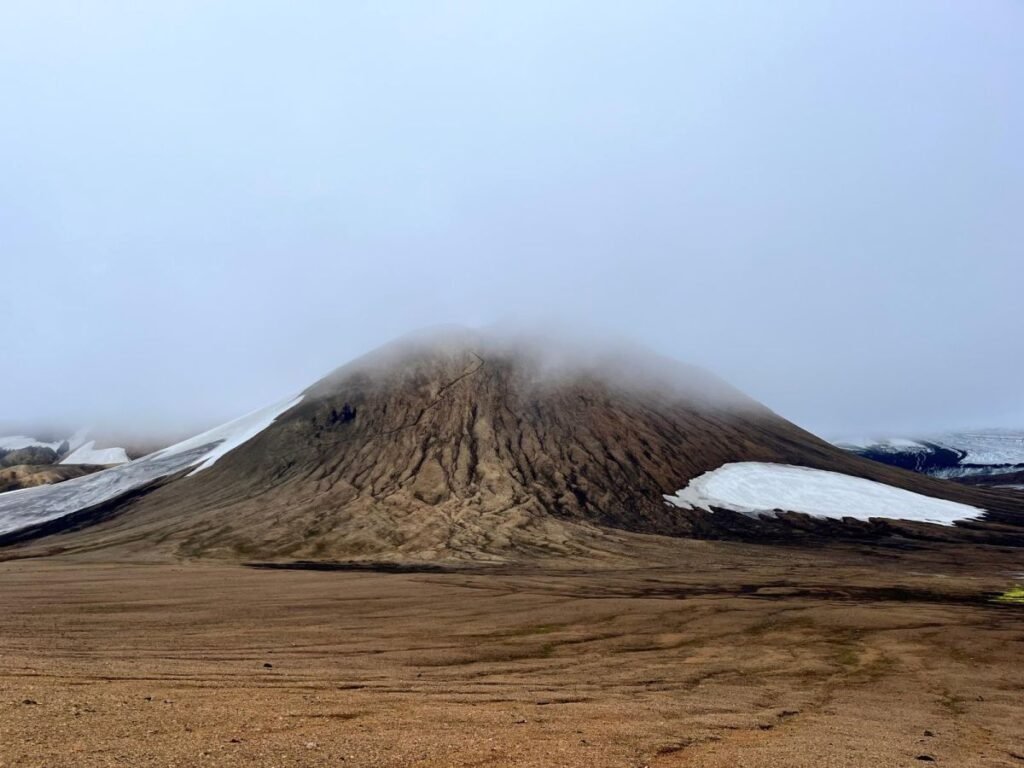
From the Baldvinsskáli hut the trail gets a bit tricky, you can witness 4 seasons within 4 hours. Poles will mark your trail, which leads through muddy lava fields, glaciers (be careful it can be extremely slippery) and a steep gravel ascent.
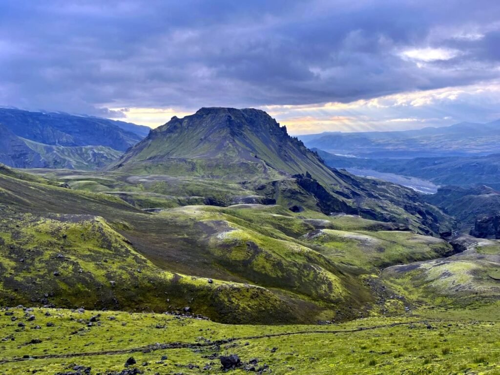
After this stage, you’ll get to witness one of the most magnificent Icelandic landscapes. You be walking down surrounded by the views of dramatic valleys and volcanic formations to hit the most challenging spot of the whole trail – Cat’s Spine Ridge – a steep ascent along the chains followed by a narrow ridge.
I’ve done almost vertical trails along chains, but I have to say this is unpleasant passing and I can’t imagine doing this in rainy weather. The last 3 kilometeres will leave you breathless with the views with few more challenging ridges. Hiking poles were extremely helpful there.
I was delighted to see Porsmork camping! Although we were planning to sleep in a tent, we booked a hut for the first night, knowing we would be exhausted after doing the 2-day trek in one day.
DAY 1 SUMMARY:
DISTANCE: Approximately 25 kilometers (16 miles).
DURATION: It took us 10.5 hours. Typically takes 8 to 12 hours to complete, depending on fitness level and weather conditions. We started at 9.40am to finish around 8pm.
ELEVATION GAIN: About 1,000 meters (3,280 feet) with stunning views.
STARTING POINT: Skogafoss Waterfall.
ENDING POINT: Basar Hut in Thórsmörk Valley – Porsmork (huge camping site accessible by car).
DIFFICULTY: Challenging
Basar Hut in Porsmork.
Basar Hut is really amazing – there are two main cabins, one accommodating 20 and the other one 50 people. The kitchen is greatly equipped and it’s very spacious. You’ll be even able to charge your phone and bin your rubbish. It’s warm and cozy inside, especially on the top floor 😉 You need to have your sleeping bag. The best thing I can recommend is an inflatable pillow!
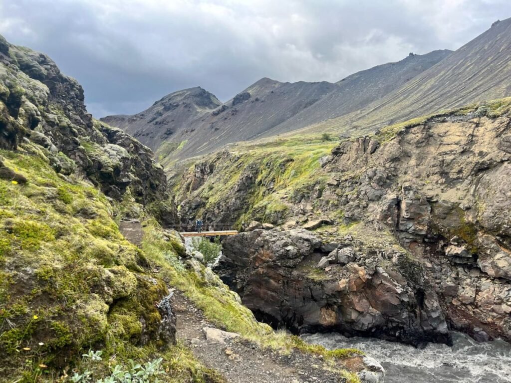
DAY 2: Þórsmörk to Emstrur (Botnar).
Day two presents its own challenges, with river crossings and rocky terrain. This river crossing can be challenging depending on water levels. There are remote bridges but they are washed out during heavy rains. We had blue poles marking the easiest way through the river. We were advised that if we want to avoid walking through the river the only way is to stop and ask one of the jeep drivers to give you a lift. There are many cars crossing the river, mostly tour jeeps. Eventually, we walked through the water – the level was decent just above our knees. You’ll have to wear water shoes, as the river bottom is slippery and the current is ruthless!
On the way to Emstrur, you get stunning views of the surrounding mountains and glaciers.
How to cross rivers in Iceland safely?
While hiking a 4-day Laugavegur trail you will need to cross many glacier rivers – cold and rough! The currents are very strong in Icelandic glacier rivers. We heard people were crossing the river with the water level at their waist – which is totally crazy! During our trek we heard 4 people were taken away by the river, luckily they all were rescued. Here are safety tips for crossing Iceland rivers:
- Always use the bridge if in place – most of the bridges in Iceland are remote, so they can change their locations.
- Assess water levels – seek advice from locals or tour guides who are familiar with the area and water levels. In rainy conditions, it may not be possible to cross the rivers.
- If you have a chance to get a lift through the river, take it!
- Choose the right spot when crossing the river – look for shallow areas (search for the widest and shallowest point of the river).
- Look for poles marking the safest river crossing.
- Avoid fast currents – stay clear of areas where the water is flowing rapidly, as this can be dangerous.
- Wear water shoes – river stones are slippery.
- If available, wear a life vest and carry a rope for extra safety.
- Use hiking poles to maintain stability. Move slowly and take small, deliberate steps.
- Listen to your instincts – if the river looks too dangerous or unpredictable, do not attempt to cross. It’s better to find another route.
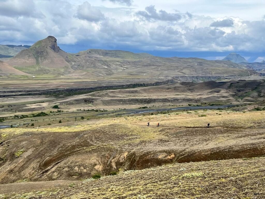
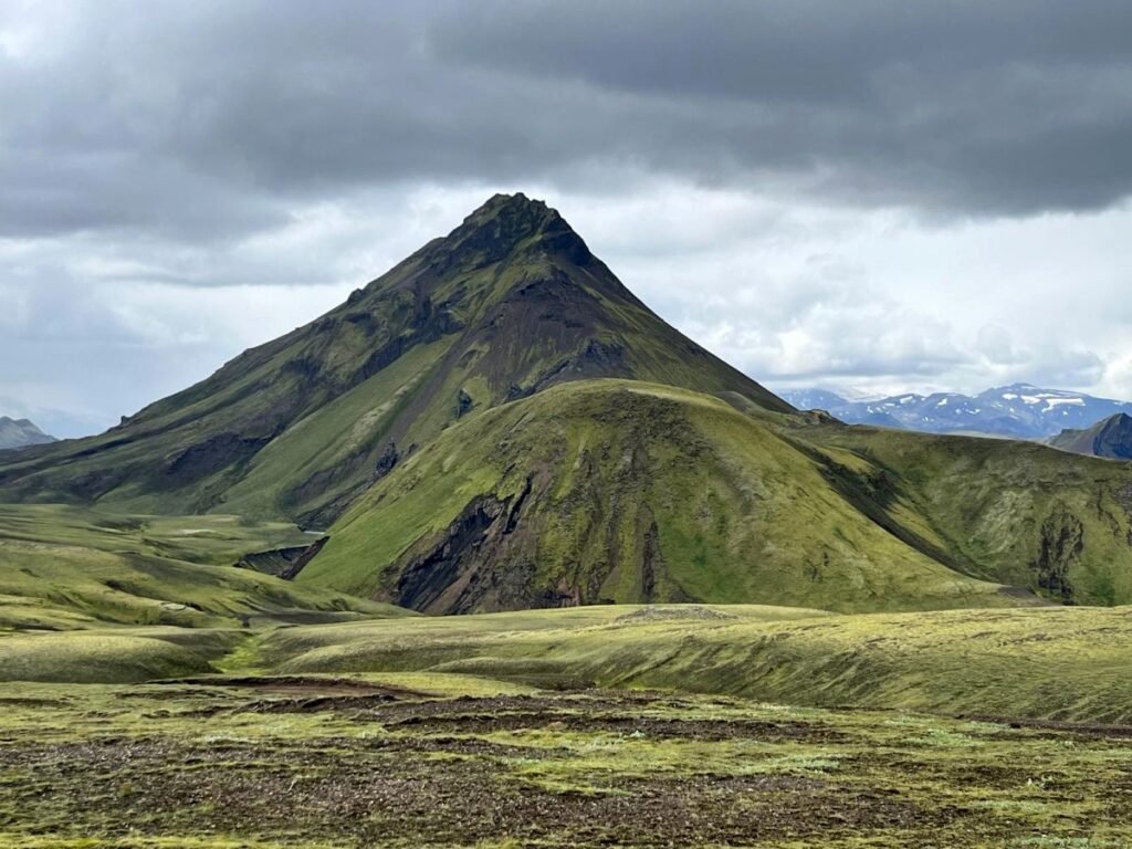
Day 2 is much easier than one – physically less demanding and shorter. You’ll have plenty of flat stages, lava paths leading through a complete wilderness. There are very few people hiking the Laugavegur trail from south to north, so most of the people you’ll meet on the trail will be walking in the opposite direction.
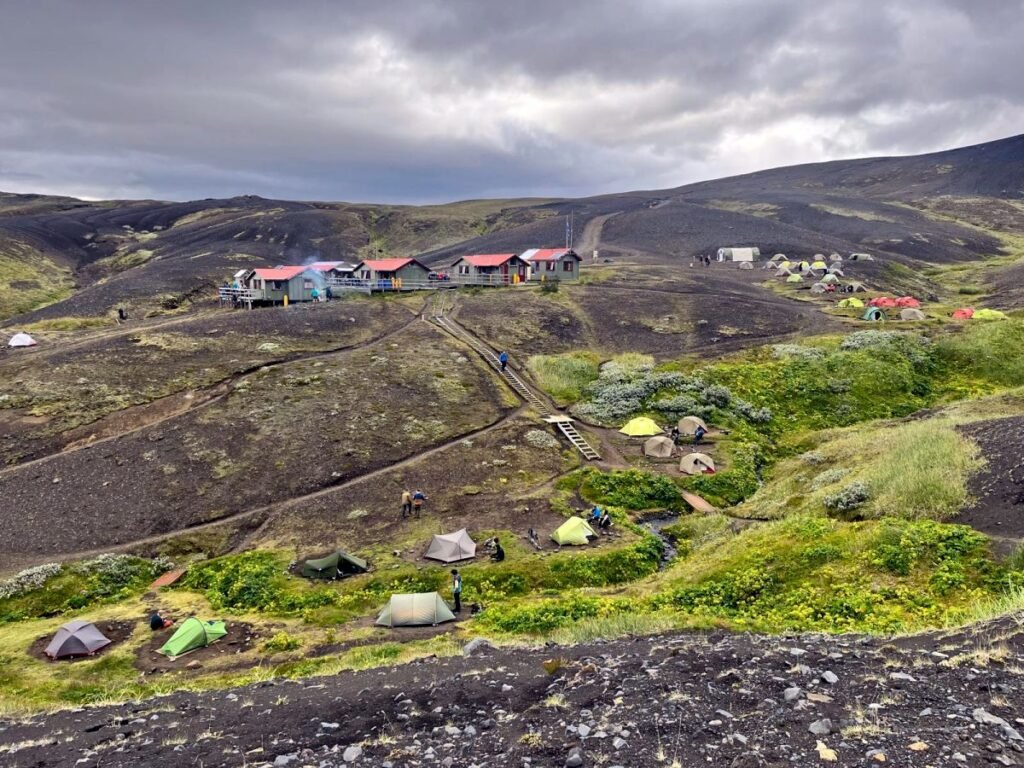
Emstrur-Botnar Hut.
Emstrur-Botnar Hut is a nice camping site located in a magnificent valley. Tent spaces are located along the river. There is a small shop in the reception area. What I didn’t like is the lack of hot water or any kitchen facilities. You need to have your own cooking accessories, otherwise you will not be able to get hot water to prepare your food. This is not right – I saw cars parked near the reception – which means it is accessible by road, so setting up a basic kitchen should not be an issue. The 4-day Laugavegur trail is tough, it gets cold at night and in windy conditions, you can easily get hypothermia. Hot water should be indisputably provided in such places.
There is NO NETWORK in Emstrur Hut. You need to climb a nearby hill to get a signal.
DAY 2 SUMMARY:
DISTANCE: 16 kilometers (10 miles).
DURATION: It takes 5-7 hours.
STARTING POINT: Porsmork Camping Site (Basar Hut).
ENDING POINT: Emstrur.
DIFFICULTY: Easy to moderate.
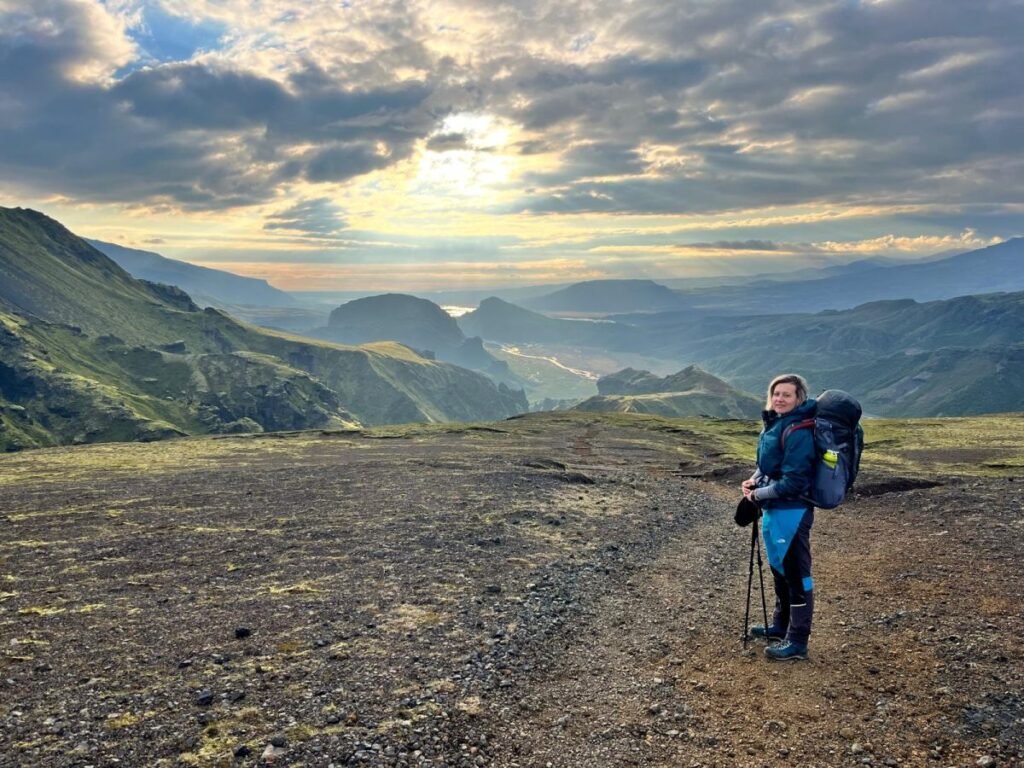
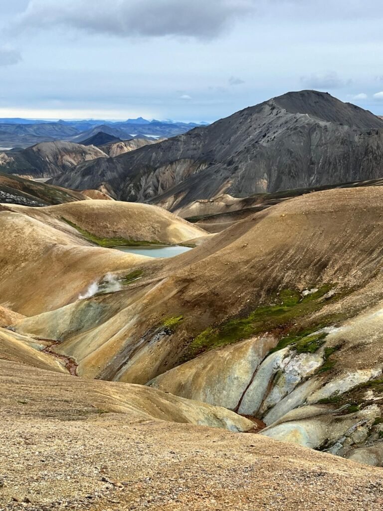
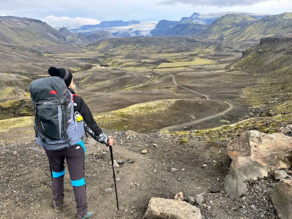
DAY 3: Emstrur (Botnar) to Alftavatn.
The third day brings a mix of black deserts and green valleys, providing a striking contrast to the previous days’ landscapes. At that point, I was already using blister plasters for minor injuries or ailments on my feet. It’s hard when you constantly have to cross rivers, plasters are washed away and you have to place them over again.
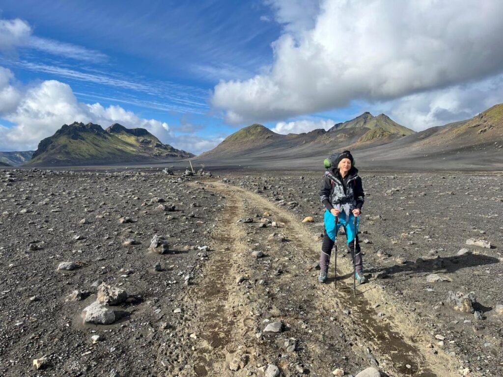
Emstrur (Botnar) is a popular base for hikers. You will encounter several rivers and streams. After the first 5 kilometers, you’ll arrive at the Hvanngil Hut, which can accommodate around 60 people (phone number is 853 9081). There are signs at crossroads, make sure to follow the right trail. The Laugavegur trail leads through lava fields and gravel paths.
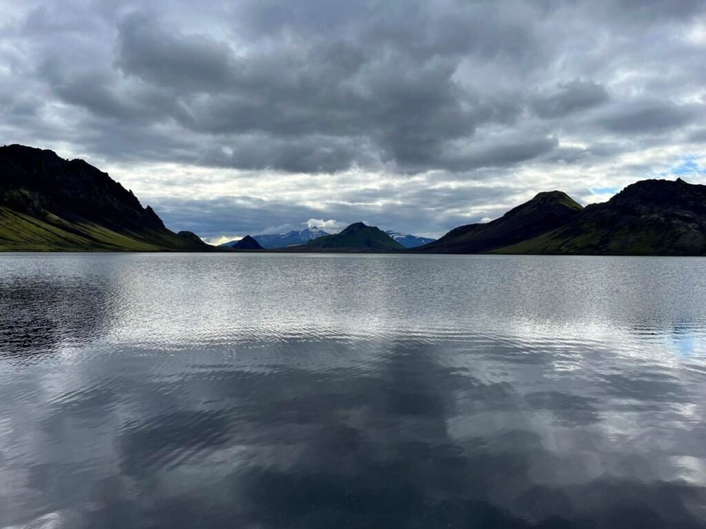
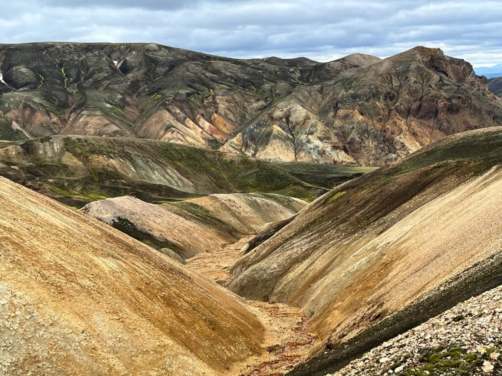
The trail gradually descends towards the Álftavatn area. Here, you’ll get your first glimpses of the beautiful Álftavatn Lake, surrounded by stunning mountains.
Sleeping in a tent being surrounded by a stunning natural beauty of the mountain lake was one of the most beautiful pictures in my life. At Álftavatn you’ll find a camping area, restaurant, small shop and sleeping huts.
Álftavatn Hut.
Alftavatn Hut is located near one of the most breathtaking natural landscapes I’ve seen. The tent area is facing mountains and the glacier lake. A lot of people would be taking a swim in the freezing waters of the lake.
The hut can accommodate 72 people. Prices in the restaurant are surprisingly affordable. For dinner, you would need to book a table in advance as it gets busy.
DAY 3 SUMMARY:
DISTANCE: 15 kilometers (10 miles).
DURATION: It takes 6-8 hours.
STARTING POINT: Emstrur (Botnar)
ENDING POINT: Alftavatn.
DIFFICULTY: Easy to moderate.
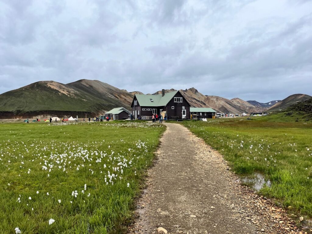
DAY 4: Alftavatn to Landmannalaugar.
It was raining heavily all night in Alftavatn. Tour guides told us it might be really windy at the top of the mountain. We were a bit skeptic but decided to pack quickly to hit the road as early as possible. It got windy with a little rain but it was actually acceptable.
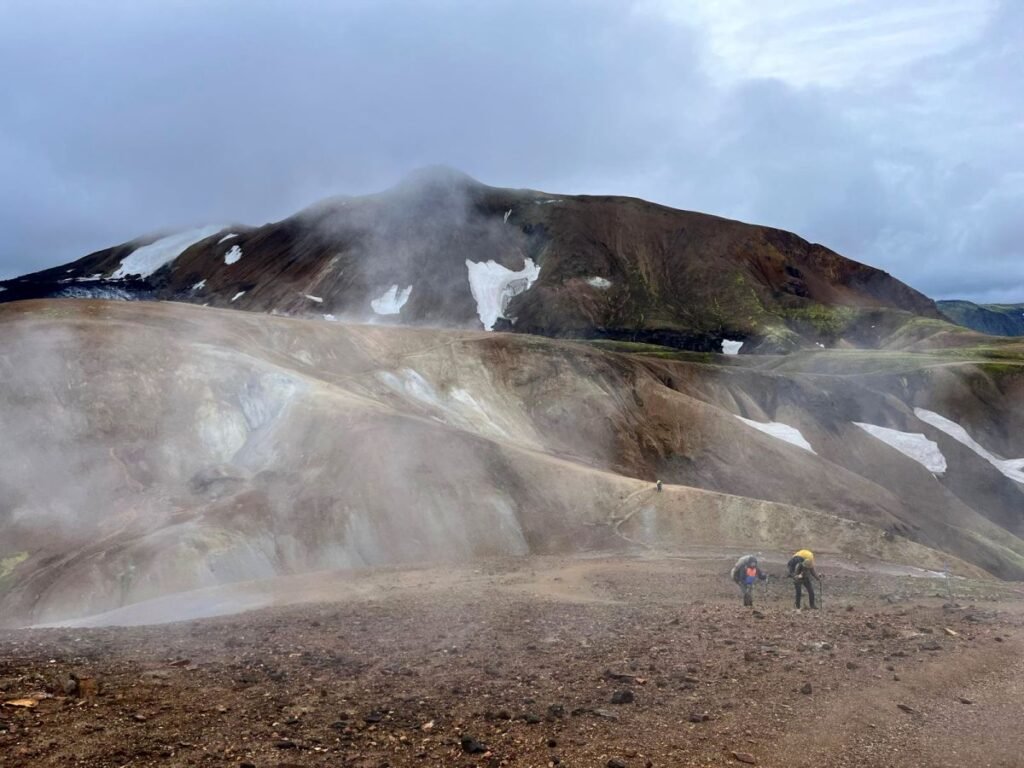
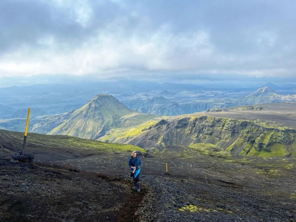
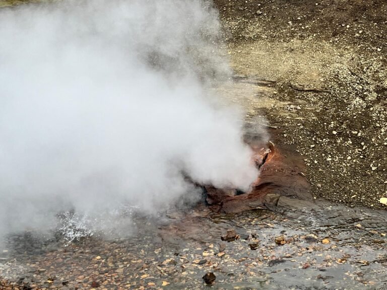
As you approach the final stretch of the Iceland Laugavegur trail, prepare for the otherworldly beauty of the Landmannalaugar region. The colourful rhyolite mountains and natural hot springs shape a surreal and rejuvenating conclusion to the 4-day Laugavegur trail.
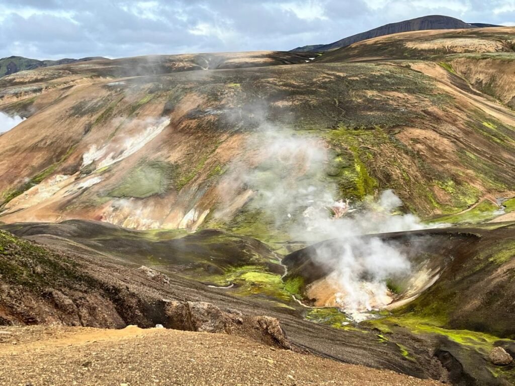
The landscape is really extraordinary, from snow mountains and ice caves to smoking gazers – feels like on another planet. For most of the trail, you will hike up and down, which can be a bit exhausting at the end. The final stage is flat and gets really busy. Additionally, it started to rain an hour before the end of the hike, which makes you even more tired and cold.
The weather gets worse closer to the top of the mountain. There are often strong winds in this stage of the trail. There’s a mountain hut halfway with some camping site – however, a lot of hikers told us the camping site is quite exposed and it gets really windy there. It would not only be difficult to set up a tent but it’s better to have a proper/advanced tent for extreme conditions.
Additionally, it’s shocking but there’s nothing in the hut – no restaurant, no shops, no reception. The only thing you’ll be able to get is tap water.
Landmannalaugar is an extremely popular region and you will probably meet crowds. There are few restaurants near the camping site, but food is basic and there’s not much space to hide from the rain.
DAY 4 SUMMARY:
DISTANCE: 24 kilometers (14 miles).
DURATION: It takes 7-8.5 hours.
STARTING POINT: Alftavatn
ENDING POINT: Landmannalaugar Camping Site.
DIFFICULTY: Moderate.
Renting a car in Iceland.
After the Laugavegur trail we hired a car to explore the magic Island. It was the most luxuries car I’ve ever got from a rental company – perfectly clean and almost brand new. We picked a high-standard jeep type for a comfortable journey, as we planned to spend days driving around. And it really was great! I always book cars on Rentacars.com for best deals.
If I may recommend an unforgettable adventure in Iceland, that would be snorkeling between two plates in Silfra -the only place in the world where you swim between two continents.
Ice caving and glacier hiking in Vatnajökull National Park (located in the south-west of the island) will also bring unforgettable memories.
Note: This post may contain affiliate links, which are at absolutely no cost to you – I can earn a small commission on sales generated through this website and thanks to that I can share travel guides and inspirations that may help you reach your dream destinations and discover our unique world. I only recommend sites I actually use and have traveled to. Thank you for your support!


")