
Spectacular Tatra Mountains are extremely popular hiking destination all year round. Alpine charakter of this mountain range makes Tatra trails very challenging and even the most popular routes should never be underestimated.
Tatra Mountains will fill you with incredible mountain scenery, which attracts tourist from many countries. In October 2023 we met two guys from Vietnam and the Netherlands going down from a long mountain hike. Pretty unusual haa? ;))) As a regular explorer of my beloved Polish Tatra Mountains I have put together top 5 hiking trails in Tatra Mountains, which I’ve accomplished several times in different seasons in hardest winter conditions: snow, storm and ice.
Here you’ll find detailed information on hiking trails along with best technical advise I gathered throughout my experiences.
Top 5 hiking trails in Tatra Mountains.
Kasprowy Wierch is probably the top hiking trails in Tatra Mountains and most popular peak for 3 reasons. There is a cable car to the top of Kasprowy, it’s a long and challenging climbing trail and probably the longest ski slope in Poland.
Before you approach any peak in any mountains, make sure you have medical insurance. From my experience I know it is the most important thing you should secure for any travel adventure or hiking/climbing expedition. After trying different options SafetyWing insurnace for Nomads is in my opinion best medical coverage you can get for your travels.
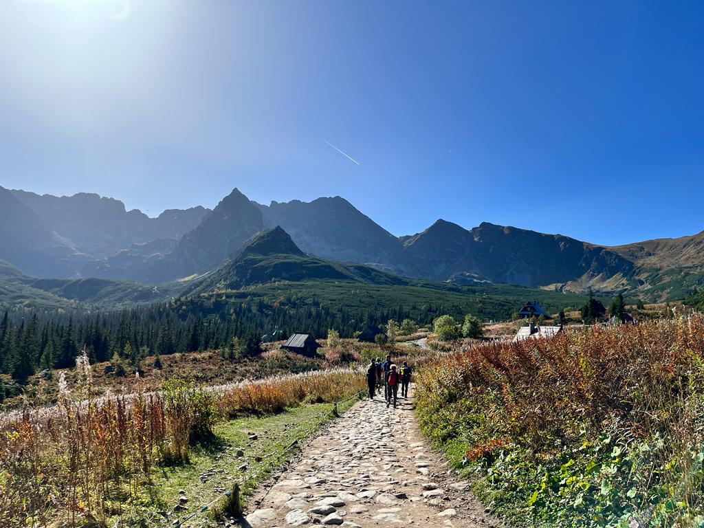
1. Hiking Kasprowy Wierch 1987m.
STARTING POINT: Kuznice, lower cable car station.
HIKING TRAIL: 6km one way.
HIKING ROUTE: Green way from Kuznice through Myślenickie Turnie is the easiest and most popular. But there are other routes to the top of Kasprowy.
HIKING TIME: 3h one way (depending on weather conditions).
DIFFICULTY: Moderate, no technical climbing.
Your starting point is Kuznice – lower cable car station. There are few restaurants and local shops, in case you need some nutrition before the hike. There is a check point on the beginning of the trail, where you need to buy a ticket to enter Tatra National Park. The fee is 2 Euro.
How to get to Kuznice?
- BY CAR – yes but the last 3 km is a private road (which in October 2023 was closed due to maintanance!), so the closest parking is 2km from Kuznice.
- LOCAL BUS/VAN – the best and hussle free option is to take a bus from Zakopane Main Bus to Kuznice, the bus will drop you near the parking place, 50 metres from the cable rail station. There are plenty of shuttle buses running to Kuznice – it will be displayed or written on the fron window of the bus.
Tips before hiking trails in Tatra!
* Get a free map of Tatra Mountains in the Tourist Information Office. Obtain information on trails conditions and weather forecast. * Obtain a PASS to Tatra National Park (it's mandatory) – if you want to avoid queues at the entrance buy it online – I recommend 7 day pass for 7 euro if you are planning to hike more than one day.
Hiking trail to Kasprowy Wierch.
Full post on Hiking Kasprowy Wierch 1987m – everything you need to know you’ll find here. Consider doing a Winter Mountaineering Course level I and II. This was a changing point for me, I learned so much on how to climb in hardest winter, snowy conditions. Please note this route is quite challenging (especially in winter) but it does not require any technical skills, only good fitness level. It will be more challenging in snow, so a good preparation is required. However there are many much more difficult trails than Kasprowy. From Kasprowy Wierch you can continue your hike, there are few marked trails from the top: toward Czerwone Wierchy, Swinica Peak (2301m) and Orla Perc (Eagles’ Path) – which is absoluetly the hardest ridge and extremely dangerous.
Explore Zakopane!
Zakopane is one of the most famous and visited mountain towns in Polish Tatras. The city is busy all year round, offering exciting attractions for visitors who want to find themselves surrounded by mountain beuty. The most famous lively Krupowki Street gathers crowds in local restaurants with traditional cuisine and cosy fireplaces. It all makes Zakopane a huge hub for mountain lovers and winter sport enthusiasts.
These are really three amazing tour options I would highly recommend (Tripadvisor):
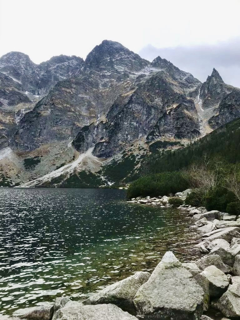
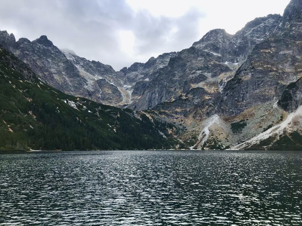
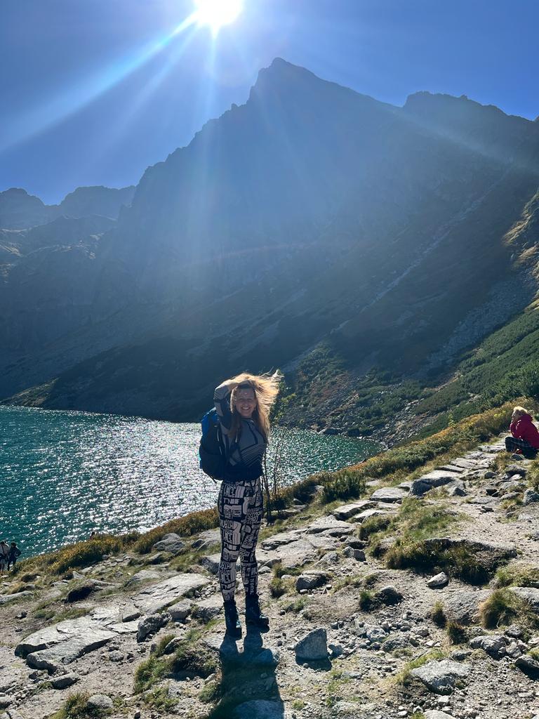
2. Morskie Oko - one of the most stunning natural wonders of Europe.
A road leading to Morskie Oko is not really a hike – it’s a trek. Cars are not allowed in this road, so if you want to see a magnificent Morskie Oko crystal clear lake surrounded by Tatra mountains you need to trek 8 km one way (2.25h). The way leads through an asphalt road, so it’s suitable for families. There is a famous shelter at the lake where you’ll be able to have lunch in one of the most spectacular mountain scenery.
Please DO NOT use horse-drawn carriages, the horses are overworked and it’s an on going battle with city authorities to ban this business.
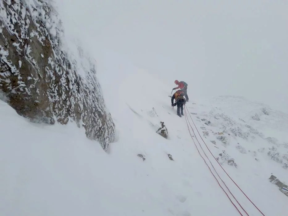
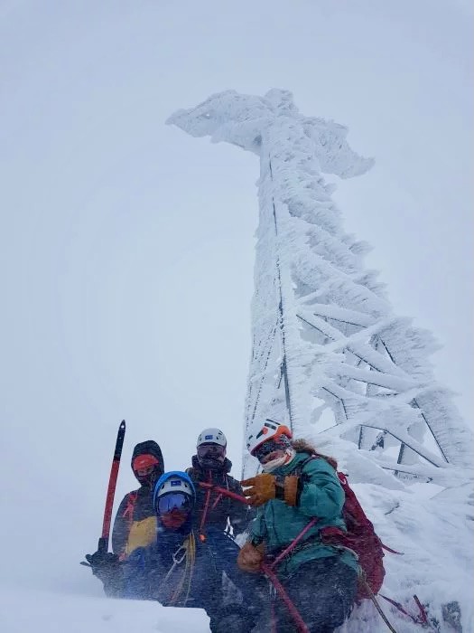
3. Climbing Giewont Peak 1894m.
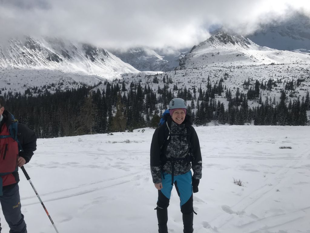
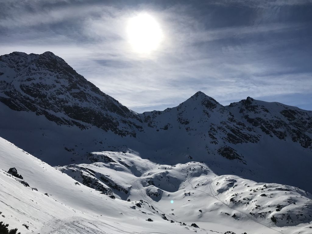
Giewont is probably the second most famous peak in Polish Tatras with a cross on the top and is among top hiking trails in Tatra Mountains. There are several routes leading to the top, from easy hikes to very challenging climbing routes – especially in winter conditions – which was mine last hike (or rather climb at the last stage). The photos are from Giewont from my mountaineering course in January, in minus -25 C in a big snow storm.
The most popular route (and the easiest one) starts in Kuznice and leads through Hala Kondratowa, toward Giewont Peak. This is the BLUE trail, taking approx. 3h to hike up.
Another route leads through Dolina Malej Laki (Malej Laki Valley), Wielka Turnia to Kondracka Pass – this is a YELLOW route, slightly longer approx. 3.5h.
Most of the trails in Polish Tatra Mountains are accesible all year round – however in winter and spring months the trails become extremely challenging. You should always check the weather forecast and avalanche warning. Every year many people die in Tatra Mountains, the weatcher can be extremely changable and the rocky alpine character of Polish Tatra Mountains are often not forgiving.
Best time to hike is September to October, the weather is mostly sunny with little rain, which may be disturbing in summer.
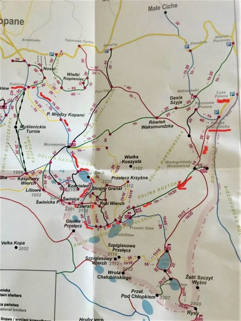
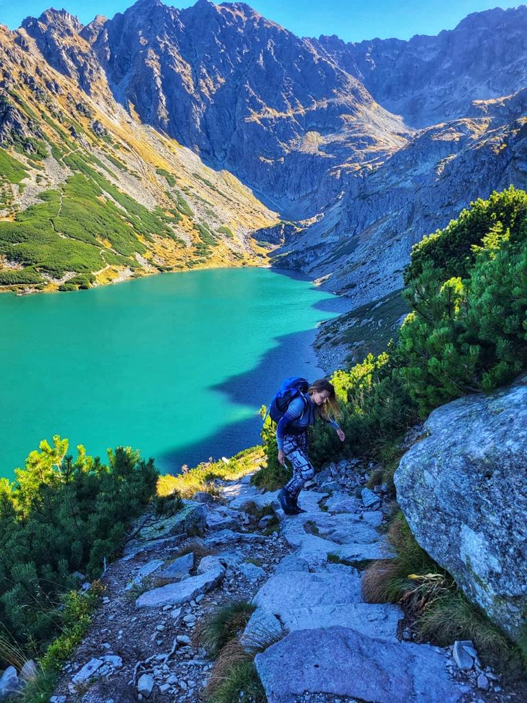
4. Hiking Zawrat Peak 2159m.
Hiking Zawrat, one of the most stunning peak in Tatra Mountains.
Table of Contents Hiking Zawrat is definitely one of the most challenging but scenic
Zawrat Peak is quite challenging but the views on the way are just breathtaking! My hike took me 9 hours, it’s mostly hiking but on the way down there are sections which require climbing – Zawrat is for experienced hikers. The most difficult section leads through a vertical rocky mountain with chains, which are helping descending.
Zawrat trail crosses Orla Perc (Eagle’s Path – the most difficult passing in Tatra Mountains with Alpine level of difficulty).
Here is a complete guide from my hike/climb to Zawrat.
Hiking Zawrat leads through:
- Start of the trail: Palenica Bialczanska
- Wodogrzmoty Mickiewicza
- Dolina Pieciu Stawow/5 Ponds Valley
- Zawrat 2159m
- Czarny Staw Gasienicowy
- Dolina Gasienicowa/Gasienicowa Valley
- Przelecz Miedzy Kopami
- Murowaniec.
If you are planning to reach Swinica Peak – another challenging route, check the trail before hiking – in 2023 Zawrat Saddle leading to Swinica was closed!
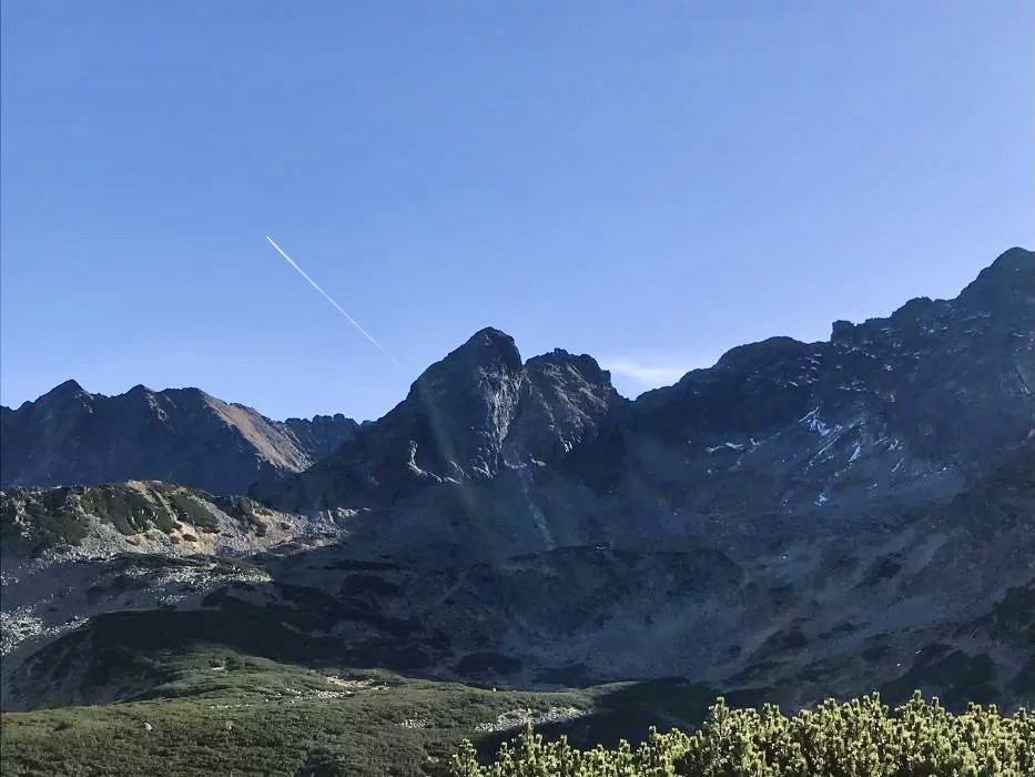
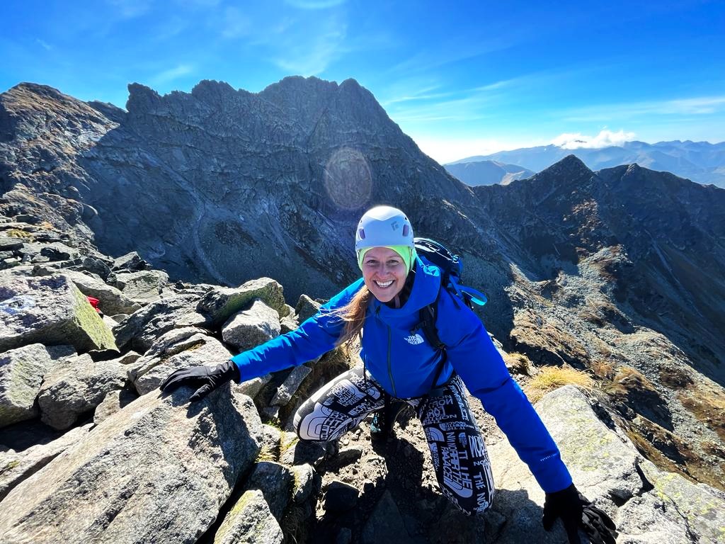
5. Hiking Koscielec Peak 2155m.
Koscielec Peak (2155m) is among top hiking trails in Tatra Mountains. It’s another challenging route starting in KUZNICE.
Route: 18 km (11 miles)
Total Ascent: 1310 meters
Difficulty: Moderate
Hike duration: 8 to 10 hours.
From Kuznice there are two trails: Yellow and Blue leading to Hala Gasienicowa – both take 1.55h. The route I took leads through:
- KUZNICE – PRZELECZ MIEDZY KOPAMI – HALA GASIENICOWA/PTTK MUROWANIEC (THE SHELTER) – CZARNY STAW GASIENICOWY (BLACK POND) – KARB (ridge) – KOSCIELEC – KARB – ZIELONY STAW GASIENICOWY (green pond) – MUROWANIEC – PSIA TRAWKA (The dog’s grass!) – BRZEZINY.
In Hala Gasienocwa there’s PTTK Murowaniec shelter with a hostel. This is one of the most crownded place where hikers and walkers take lunch and enjoy the surrounding mountin scenery. The food is delicious and there are wege optios 😉 As you can see the Black Pond is rather a magnificent emerald lake. From the lake the trails gets more challenging with steep rocky section.
From Karb Ridge (Maly Koscielec – Small Koscielec) to Koscielec peak you should be equiped with a headgear and this is a challenging climb. There is a lot of exposed sections with some rocky formations where climbing is required. This part will take 50 minutes to get you to the windy top!
