Hiking Quilotoa Loop in Ecuador (in Cotopaxi Province) is probably one of the greatest and most spectacular trails in Ecuador. Some sources say it’s the most popular hike in Ecuador since you can walk around the rim of the volcano or go kayaking across the lagoon crater lake .. if visibility allows 😉
For adventurous hikers looking to experience the breathtaking beauty of Ecuador, the Quilotoa Loop is a must-do. This iconic hike through the Andean highlands takes you around the stunning Quilotoa crater lake and through traditional indigenous villages that showcase the true spirit of Ecuador.
Hiking Quilotoa loop in Ecuador - facts.
The trail is quite easy and accessible all year round, but the altitude is the challenge. Quilotoa crater is located at an altitude of 3914 metres, it was formed nearly a thousand years ago.
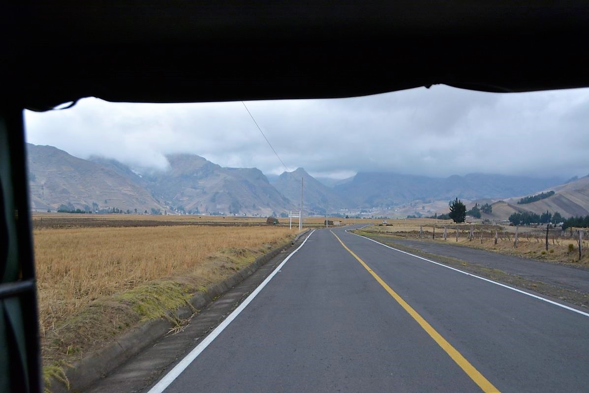
Quilotoa Loop is located 4-5 hours’ drive from Quito, depending on the transportation type – but if you want to make it a real adventure, read my story.
Make sure you have enough preparation and acclimatization before approaching this trail. Let me guide you on how to get to Quilotoa by public transport, and then you can follow some advice on proper acclimatization to ease your hikes in Ecuador.
How to get to Quilotoa Lake from Quito by public bus?
It’s very easy to get to Quilotoa Loop from Quito by public transport.
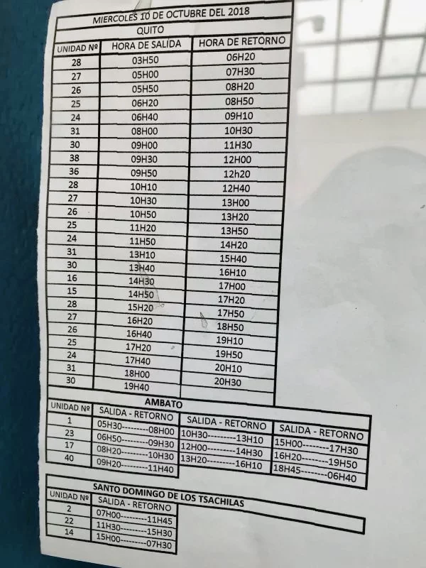
QUITO-LATACUNGA: No matter which Quilotoa Loop hike you are taking, first, you need to reach Latacunga city. There’s a direct bus from Quito to Latacunga.
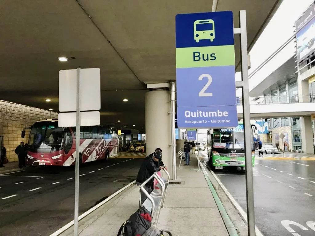
FROM QUITO AIRPORT: If you’re traveling from Quito airport, you need to take a bus to Quitombe terminal (ticket 2$ per person). Just when you go outside the airport terminal – there are 3 bus places:
1. Rio Coca (central station)
2. Quitombe – ask any driver if you need to make sure it’s the right bus. And from Quitombe take a bus to Latacunga, the ride takes about 2h. Buses for Latacunga also leave Quito’s Terminal Terrestre Cumandá.
Quilotoa Loop itinerary.
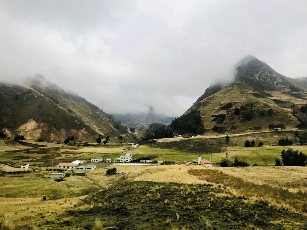
There are many hiking options toward Quilotoa, ranging from 1-day to multi-day hiking trails across stunning landscapes of the Ecuadorian Andes.
For 1-day hikes, there are two most popular Quilotoa Loop hikes:
Quilotoa Loop itinerary 1: Approaching Quilotoa Loop from the north, starting in Chugchilan village (at 3200m). There is a direct bus from Latatunga to Chugchilan Village (drive takes 2.5h),
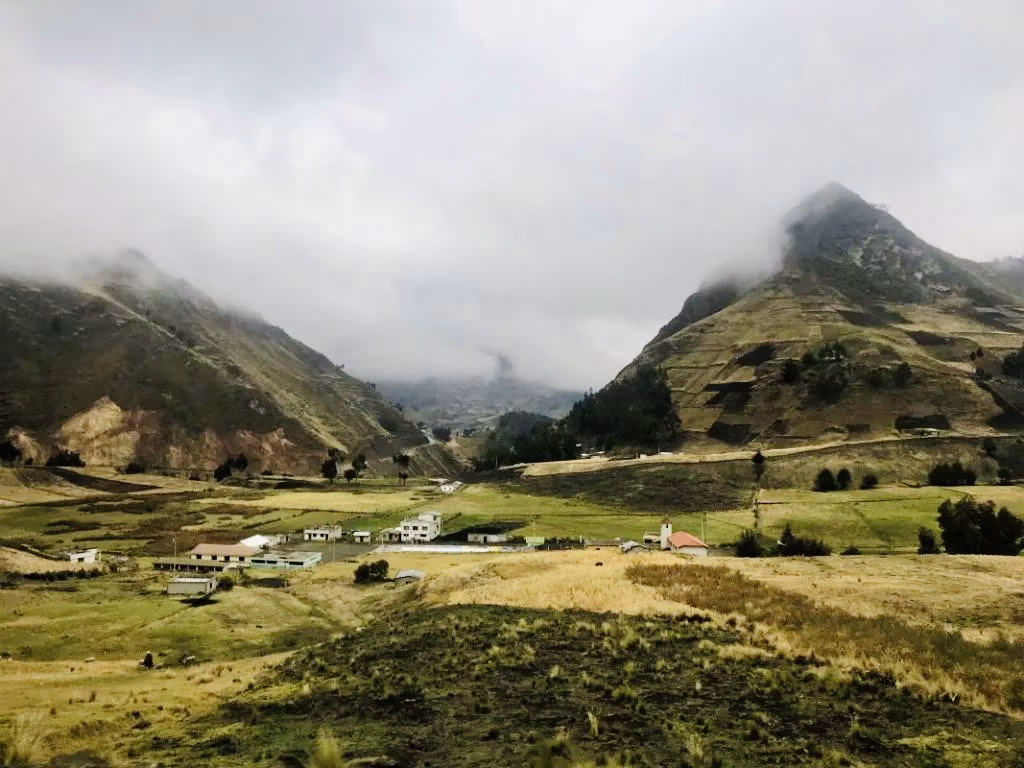
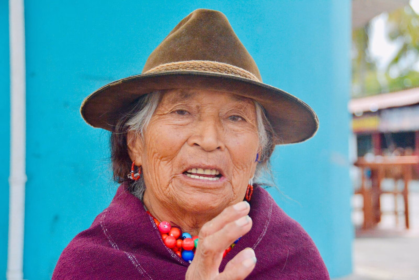
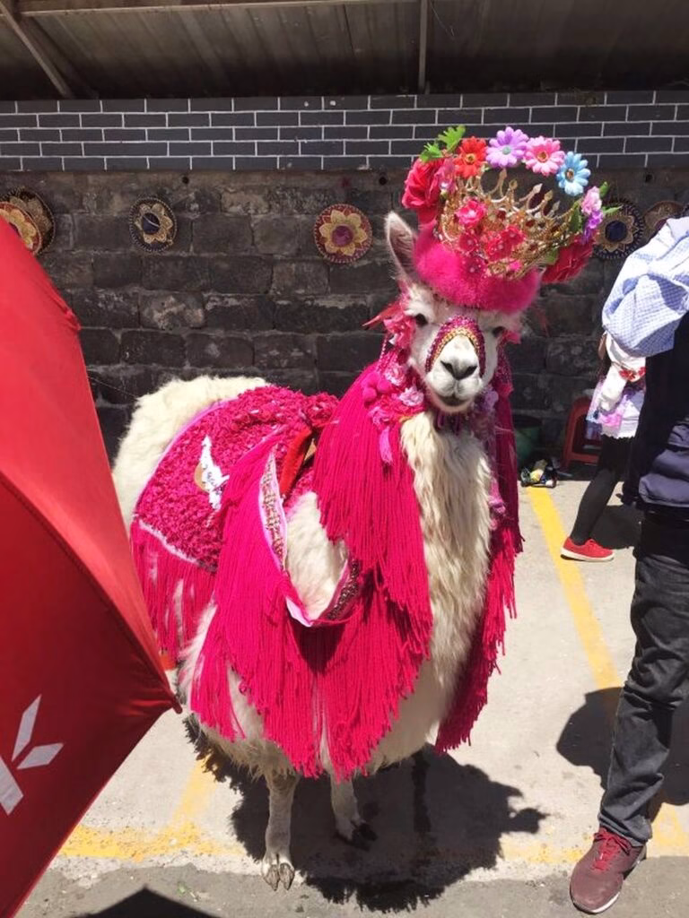
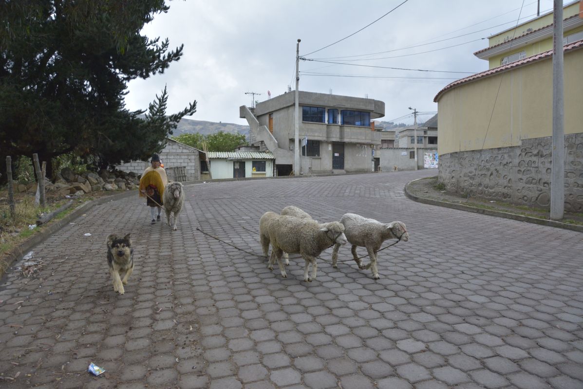
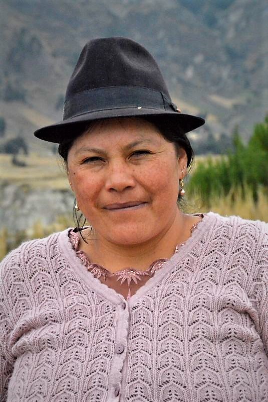
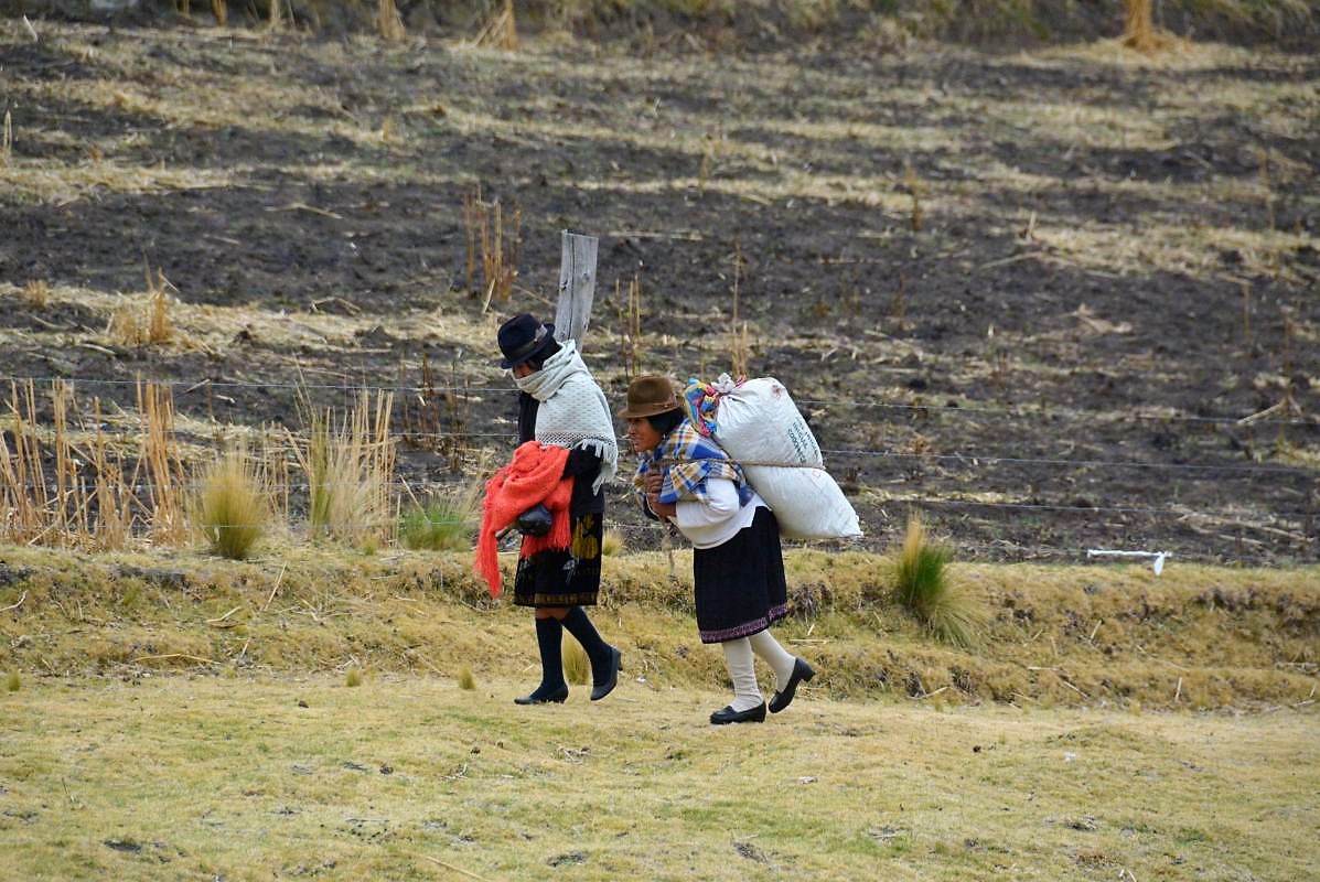
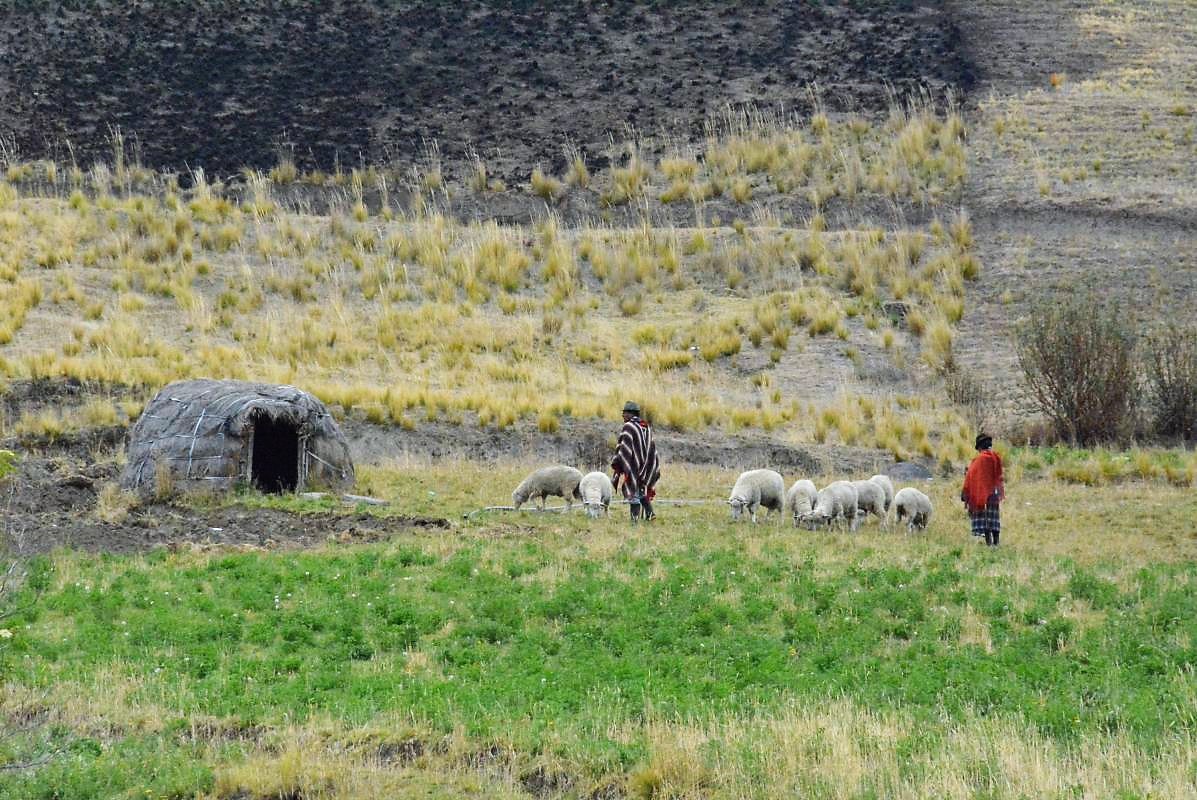
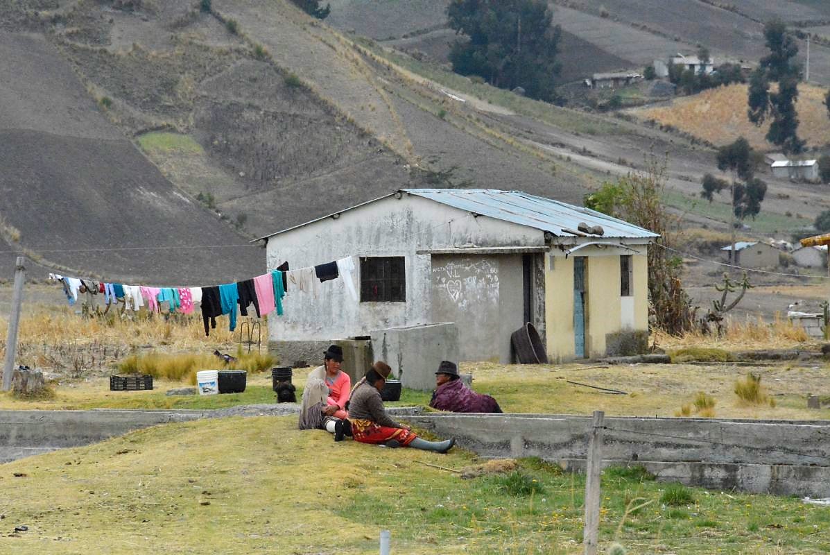
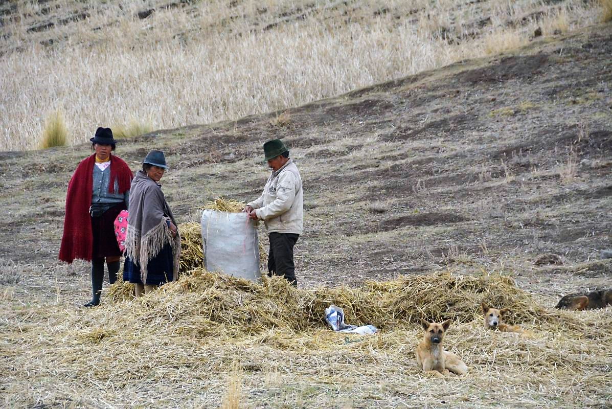
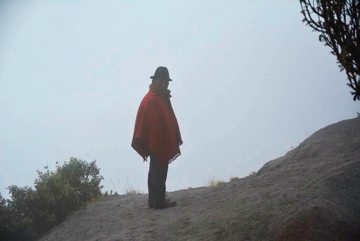
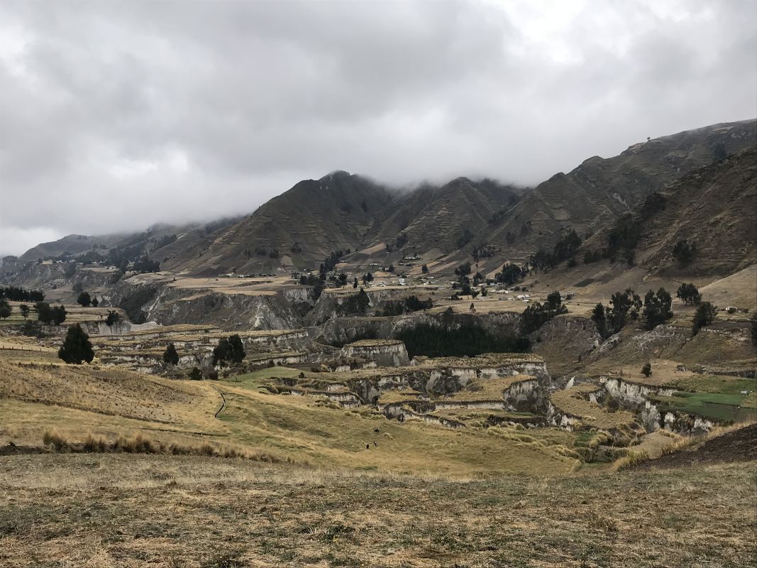
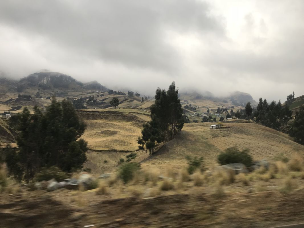
Quilotoa Loop itinerary 2: Approaching Quilotoa from the south from Zumbahua village, which was my trail, and it was fabulous! We took a bus at 8 am from Latacunga bus terminal to Zumbagua village – buses run every hour. From there, we decided to trek about 12 km along magnificent Andean scenery. You will pass many villages and have a chance to observe the local people’s ordinary living and working style and habits. Ecuadorians are lovely, friendly people. There are five major ethnic groups in Ecuador: Mestizo (75% of the population), European, Afroecuadorian, Amerindian, and Montubio. We went to greet, speak, and take photos with them – it was one of the best parts of the whole trip.
Starting point for hiking Quilotoa Loop.
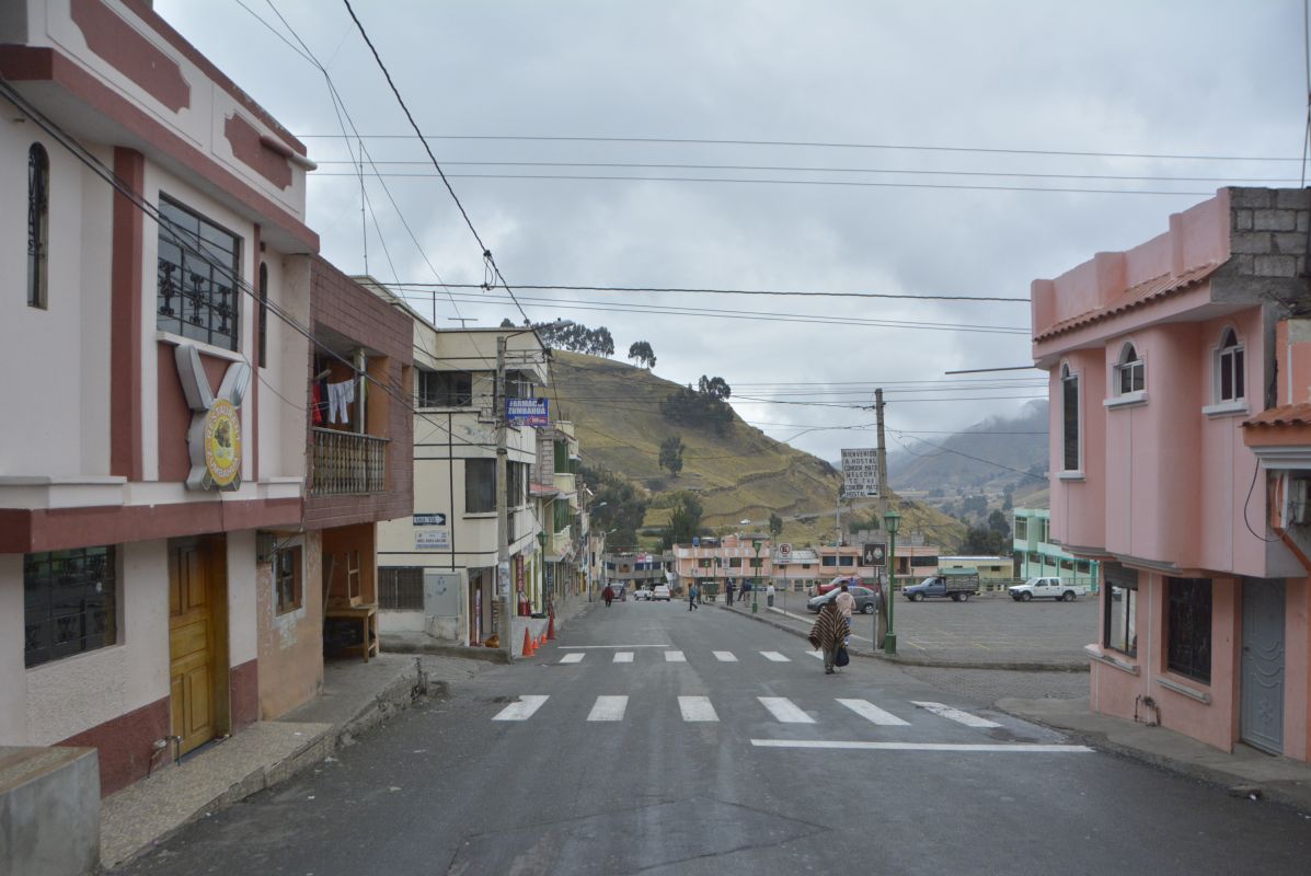
The bus dropped us off in Zumbagua – a lovely, small village located around 12 kilometres from Quiolotoa Crater. Walking through Zumbagua town, we saw many, really nice-looking hostels, completely abandoned.. There was no sign of tourists, nobody was there, and all seemed to be closed a long time ago due to a lack of visitors.
Hiking Quilotoa Loop from the south of Zumbagua town.
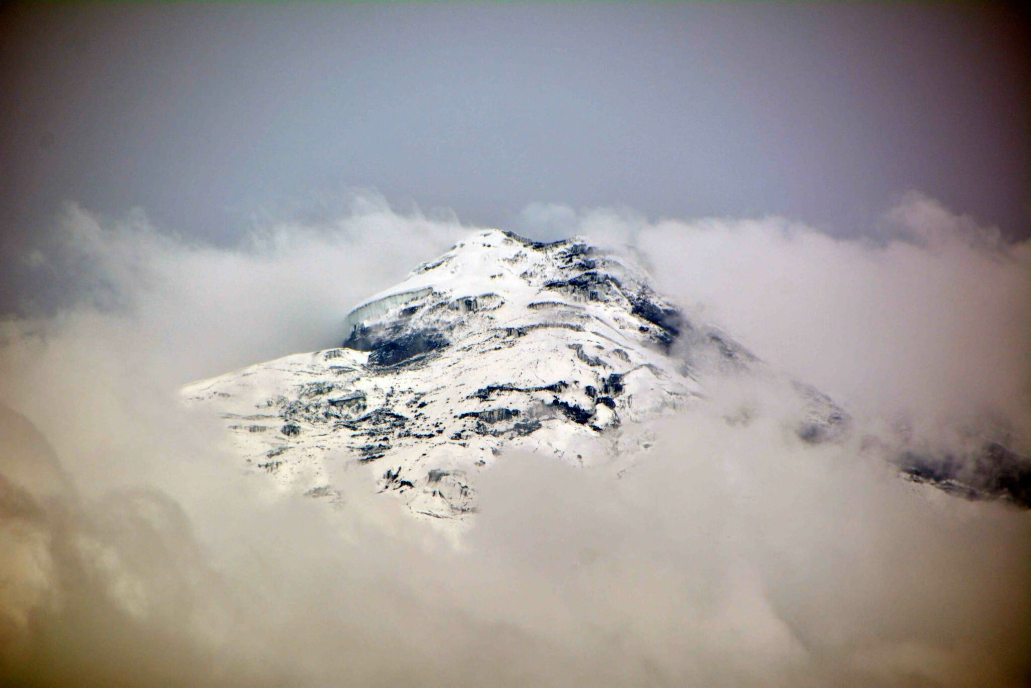
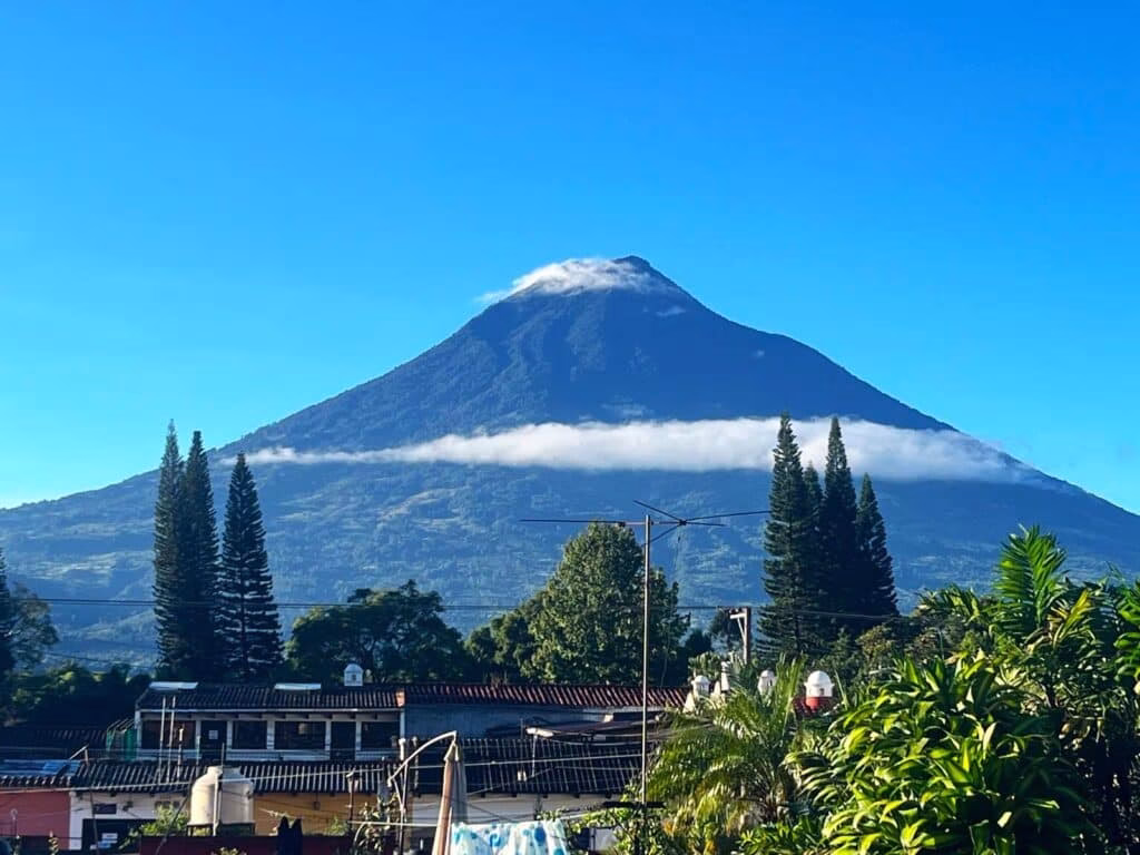
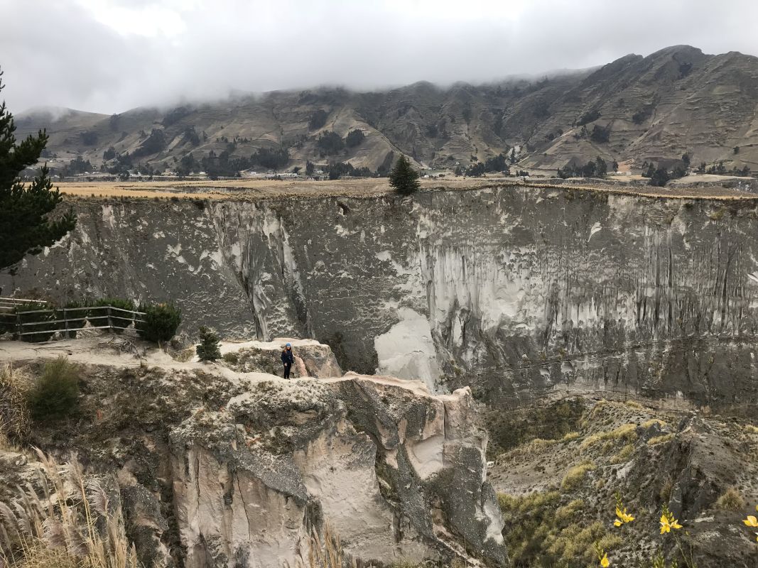
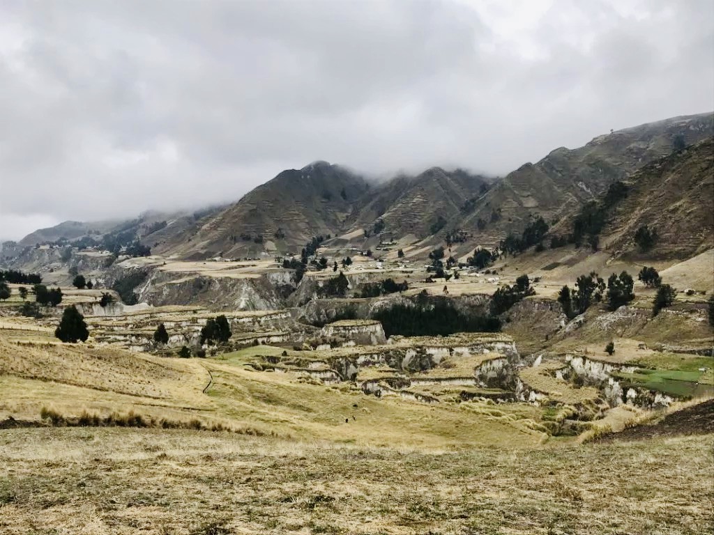
Quilotoa Loop trekking scenery is amazing, one of the best in the Sierra with a great view of Cotopaxi (if the weather is no cloudy!). On the way, you’ll see an amazing Toachi River Canyon with a popular viewing point (in the photo).
At the very end, we decided to hitchhike! One of the private pickup trucks gave us a lift up to the Quilotoa crater starting point. It was such an amazing adventure – you got to try this! Private transportation is probably the easiest way to travel to Quilotoa Loop, unless you are taking a tour, which are quite well organized.
Hiking toward Quilotoa Loop is a great opportunity to connect with local communities. Trekking through charming villages like Chugchilan, Sigchos, and Tigua, is a chance to observe locals, many of whom still practice traditional farming and weaving techniques. The handicrafts are not only beautiful but also tell the story of the rich cultural heritage of the region.
When is the best time to hike Quilotoa loop crater lake?
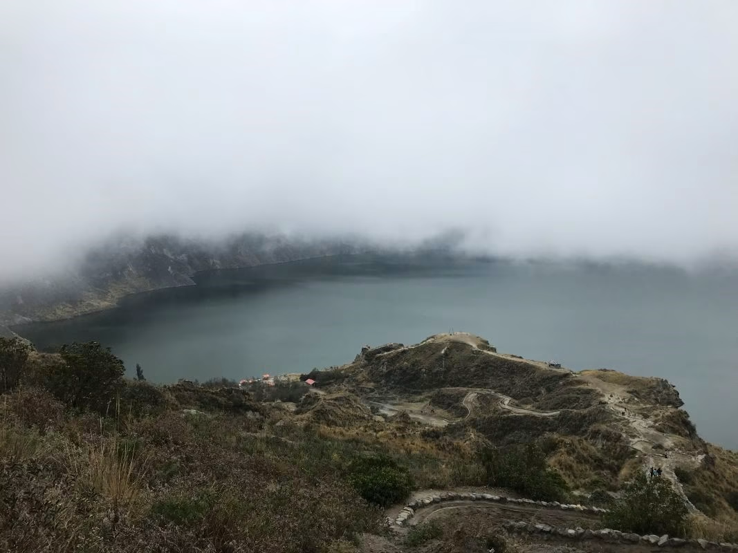
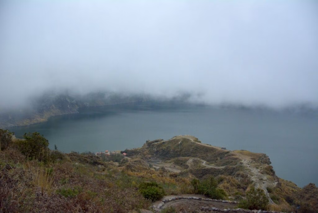
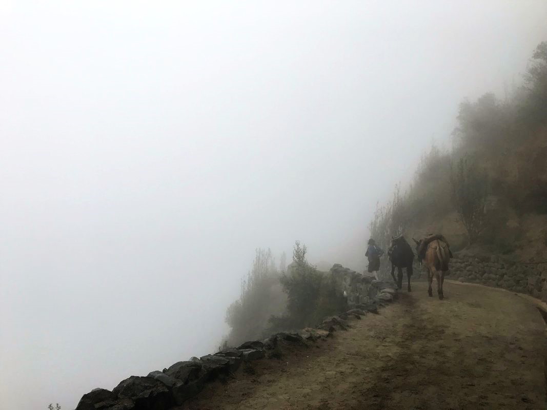
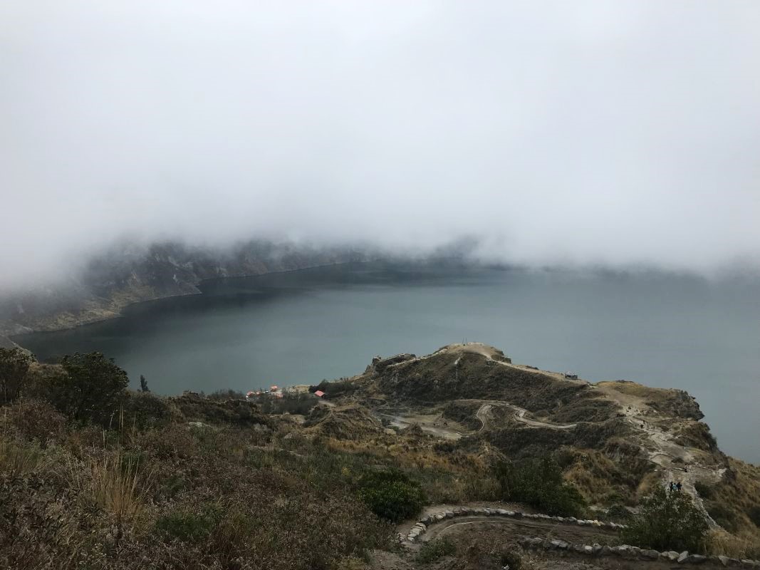
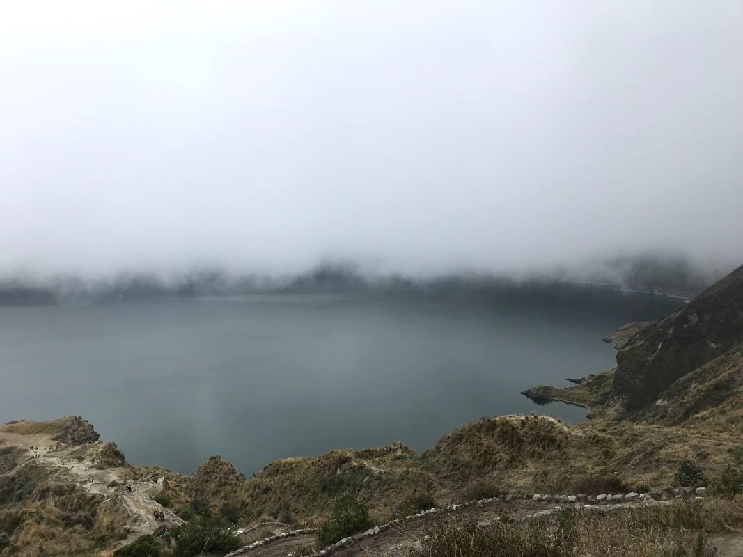
The best time to hike Quilotoa is during dry months from July to September. But it’s impossible to predict weather conditions for this region and altitude. We reached Quilotoa in October, and although it was dry, the crater was completely shrouded in clouds.
The visibility was great along the whole 12-kilometre trail toward Quilotoa, but once we reached the starting point with a ticket office, the visibility went down to 3 metres! We asked the guy in the ticket booth, and he said – this is the beauty of nature 😉
Discover the Wonders of the Quilotoa Loop.
The lovely guy from the ticket booth encouraged us to hike to the crater lake, saying the clouds might lift and unveil a little more of the volcano landscape. And he was right, we did get to see the lake after a few hours spent around the crater; however, the colour was nothing like during sunny weather. The hues of blue and green in the lake change with the sun’s position. It’s possible to hike around the crater and down the crater.
Hiking Quilotoa Loop - Best Tours options:
Taking a tour is a very good idea for Quilotoa, since all transportation and guidance is organized and the options are very affordable:
Quilotoa Lake (Ecuador) - 3914m.
Make sure you have warm clothes while hiking Quilotoa – it might be very cold at the altitude of 3914m. The weather wasn’t too gentle; it got cloudy when we reached the top. There’s a very nice small village near the starting point with various souvenirs – highly recommend this place – lovely stuff, great quality, and price. I bought my favourite blanket and one of the warmest and nicest scarves I’ve ever had! I haven’t come across similar scarves in other parts of Ecuador, really good spot for unique souvenirs (see photo above).
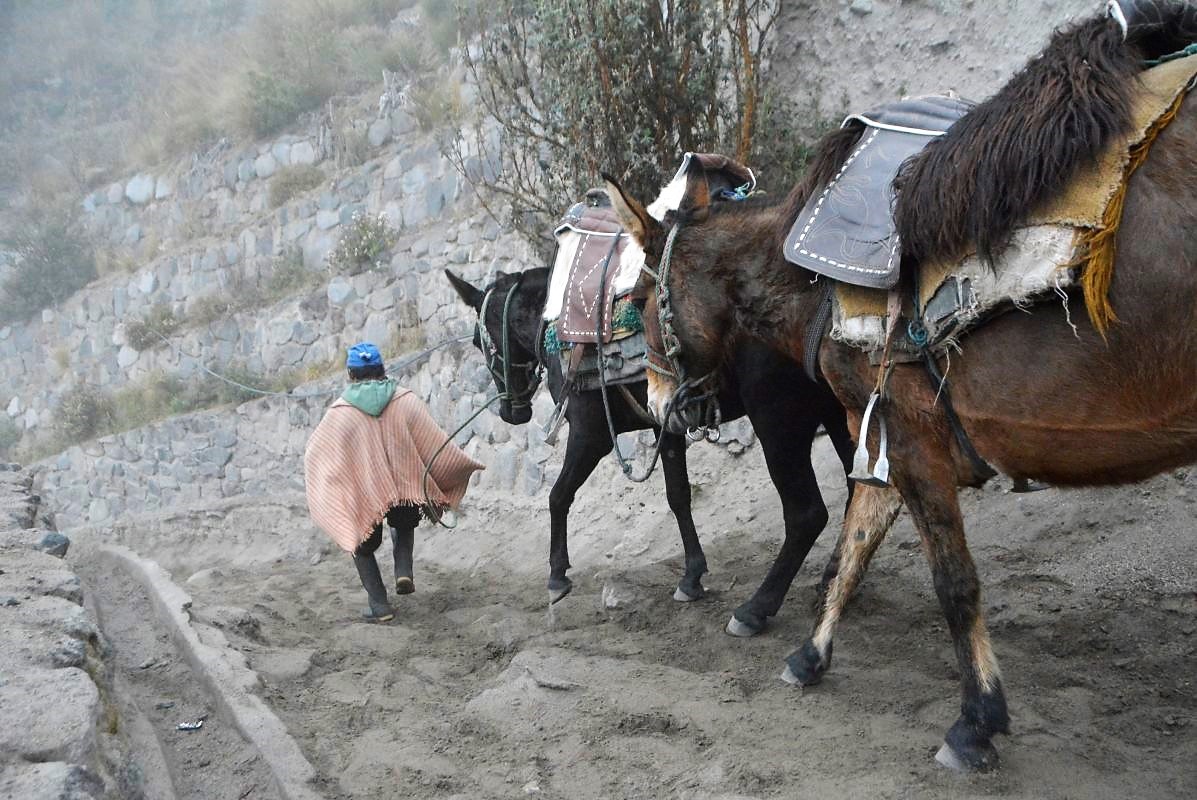
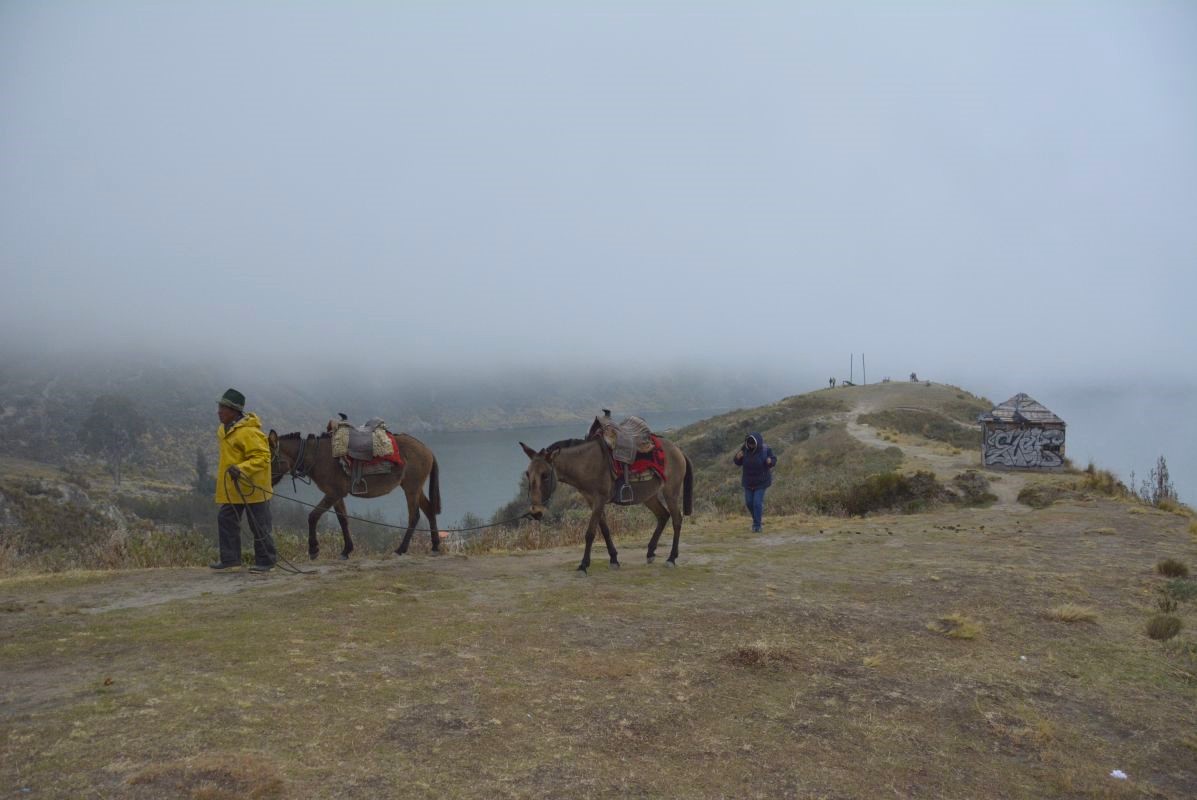
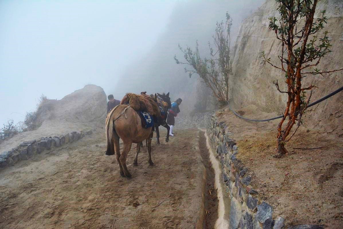
The visibility at this point was poor; once we reached the ticket office, it was even worse! 😉 People will be offering horseback riding, but I would never recommend this type of attraction. The animals may be overworked, and it’s not easy to cope at this altitude.
Quilotoa Volcanic Lake.
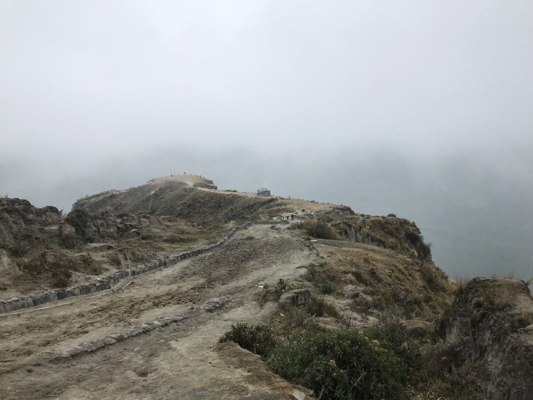
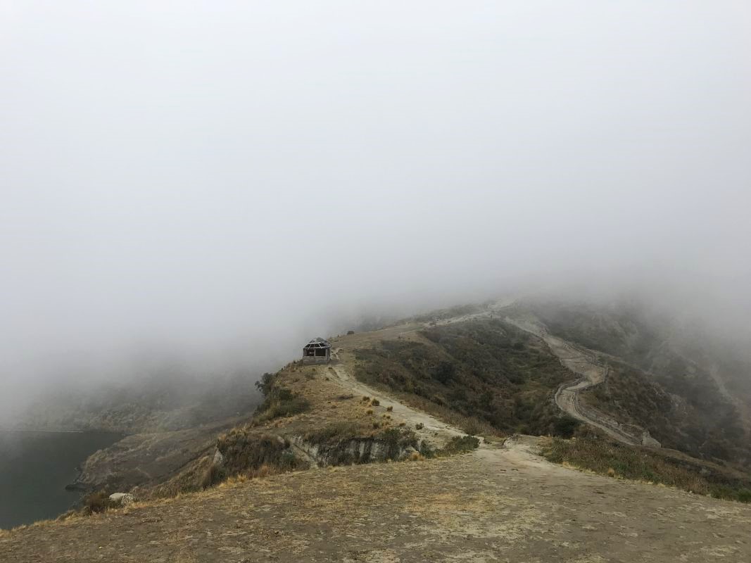
Standing on the rim of the volcano, we could see nothing except ourselves! The visibility was almost zero.. You can hike down toward the crater lake via a sandy path. It takes about 30 minutes to walk down. The best part of the hike is:
- You can hike around the lagoon crater. The crater has 3 km in diameter and it’s considered an active volcano. Quilotoa can be hiked all year, and it’s a perfect area for high-altitude cardio training.
- Hire a kayak to explore the crater lake on your own.
Hiking Quilotoa Loop Crater Lake without a guide.
Wuilotoa hike is doable on your own, the path down toward the crater lake is pretty straightforward and guide is not necessary. If you feel more safe to be accompanied by someone experienced, I would advise booking an organized tour.
What’s more important is the preparation for the hike. If you want to hike down to the crater lake level, make sure you are fit enough to accomplish the whole trail. It is a strenuous hike due to high altitude, and the path from the rim down to the bottom of the lake is quite steep. Hiking back is more difficult than going down.
Before doing the trek, I would highly recommend staying in Quito for a few days for proper acclimatization, especially if you plan to hike to the bottom of the crater. Getting down takes 30 minutes, but going back takes at least an hour, even though it’s only 2 kilometres distance.
Donkeys and horses are available to take you back, but hiring animals is not my thing, as they are usually overworked.
Getting back to Latacunga: we took a taxi to Zumbagua to the bus stop, it’s only $4. Tell a driver to drop you off near a bus stop toward Latacunga (it’s on the main road in the centre of the village). A bus ticket from Zumbagua costs 1.5$, no point in paying 10$ per person for a taxi to Latacunga.
Top rated hotels in Quito for a safe journey!
Is there an entry fee to Quilotoa?
There was no entry fee at the time we were hiking (October 2020). The guy in the small entry booth was very friendly. He encouraged us to believe the weather will improve and the sky will clear up by the time we reach the crater. And it did, visibility was up to 20 metres above the lake surface. 😉
Anyway, this was an incredible hiking day. I highly recommend a 1-day to multi-day trek toward Quilotoa. Pick a multi-day trek for unforgettable adventures along the Andes landscapes. Multi-day treks will lead you through local villages and mountain towns like Sighos (3900m), Chugchilan (3200m), and Saquisilí.
Check Hiking essentials for every adventurer!
Note: This post may contain affiliate links, which are at absolutely no cost to you – I can earn a small commission on sales generated through this website and thanks to that I can share travel guides and inspirations that may help you reach your dream destinations and discover our unique world. I only recommend sites I actually use and have traveled to. Thank you for your support!


