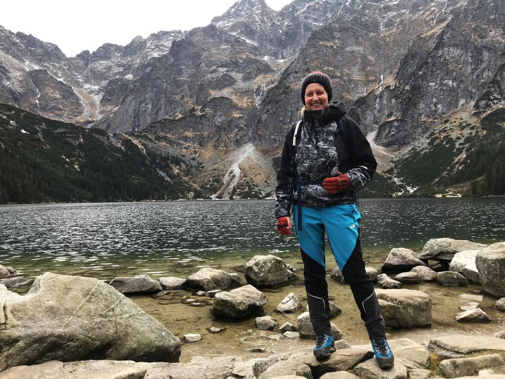
Hi, we’re Karol & Maria from

We’re Madeira photographers offering photoshoots, private photo tours, and photography workshops for people who want to experience the island through photography.

We also share in-depth travel guides and real location tips to help you plan your next adventure in Madeira and beyond.

x

Hiking Zawrat one of the most stunning peaks in the Tatra Mountains.

Hiking Zawrat in the Tatra Mountains is a scenic but challenging adventure. Once you get above the clouds, you will be astonished by the beauty of the dramatic, rocky, dark…

Destinations, Adventures, Climbing, Europe, Mountaineering and Summiting, Poland, Travel Styles
Hiking Zawrat in Zakopane

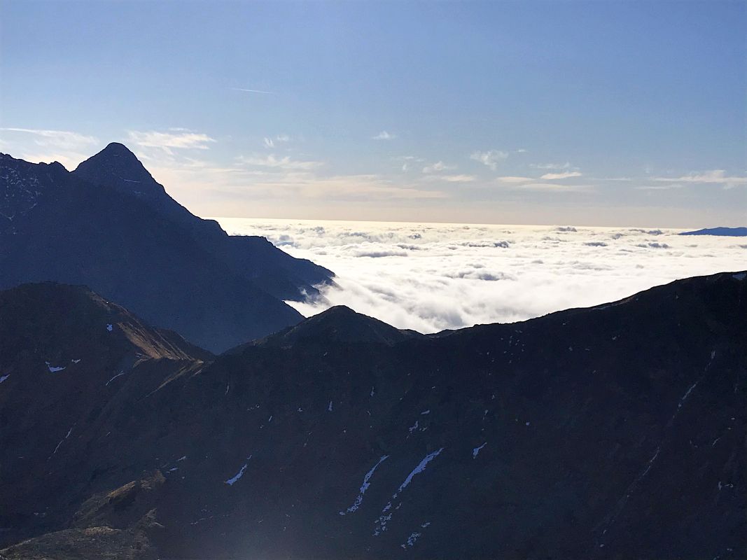
Hiking Zawrat in the Tatra Mountains is a scenic but challenging adventure. Once you get above the clouds, you will be astonished by the beauty of the dramatic, rocky, dark Tatra landscape. The loop I chose for this trail requires some climbing skills, so it’s only for experienced and adventurous hikers and may not be safe in autumn or winter. But before you decide, let me give you a detailed description of the whole trail so you know what to expect in different weather conditions.


Hiking Zawrat in Tatra Mountains.

The Tatra Mountains are located in the Carpathian Mountains, which are the second-longest mountain range in Europe. These mountains are very tough to climb for many reasons e.g., avalanche risk (huge danger in the Tatra mountains in winter and spring season), unpredictable weather, narrow paths and steep icy slopes. Some trails between the peaks are only one-way due to a narrow pass.

You should always have a Tatra National Park mountain map to check the trails. There are plenty of moderate, pleasant hiking trails in the Tatra Mountains, with access to magnificent views of this rocky land.

The Tatra Mountains are very popular among hikers and regular tourists. In peak seasons, most of the trails are really crowded, especially in the lower parts. Zakopane is the most well-known city in the region and a gateway to the Tatra Mountains. 

Zakopane - Tourist Information Office.

If you are there to hike any mountain, the first thing you should do on arrival in Zakopane is visit the TPN Touristic Information Office (TPN – Tatra National Park). This is situated on the way to Kuznice. It is near the roundabout at Jana Pawla Street / John Paul roundabout. Take a minibus from Zakopane bus station to Kuznice and get off at the roundabout. The small wooden house is a tourist information office.


Things to know before hiking Zawrat:

  • Tatra Mountains Map, it’s FREE. You’ll get a map with all hiking trails marked in colour, hiking times between main spots/peaks. Most of the trails are quite well maintained, although in snowy conditions they might not be visible. During snowfalls tracks made by walkers disappear within minutes and cannot be traced. There are many hiking routes in Tatra Mountains, you can choose easy or moderate trails, which are equally rewarding.
  • Always ask which trails are closed due to severe weather conditions (icy sections).
  • Avalanche risk (this is a huge danger in Tatra Mountains and often is catastrophic).
Hiking Zawrat in Tatra Mountains

Pass for Tatra National Park.

  • ENTRY FEE to the Tatra National Park – it is mandatory to purchase an entry ticket (day or week-pass), which is available at the ticket office (there are entry points on major trails) or online – if you are planning to spend a few days in the mountains, you can buy a 7-day pass to TPN, which costs 35 PLN (9 euros).
  • Additionally, you should buy insurance in advance – you should never go hiking in any mountains without medical insurance. The rescue team in a helicopter is busy every day with several accidents across the national park. If you twist your ankle, you won’t be able to descend the mountain on your own, as the trails are too steep and rocky.
  • The colours of the trails on the map are not related to a difficulty level. It is not like with the colour for ski slopes, where black means highly difficult, red – moderate and green – easy. Tatra trails are marked with different colours between major spots, to help you recognize where you are located.

Complete guide on hiking Zawrat Peak 2159m.

My trail to Zawrat was leading through the following peaks and took me 9 hours. Most of the trail is pure hiking but in the upper level there are long sections which require climbing. The most difficult section is the trail down from Zawrat summit leading through a vertical rocky mountain.

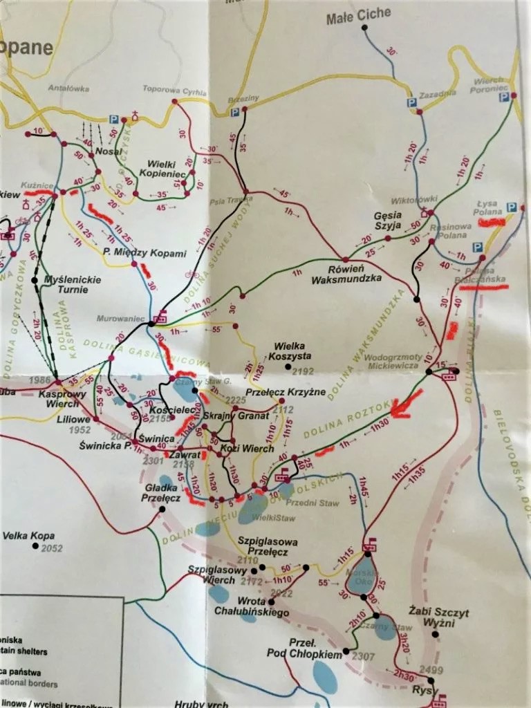
FULL TRAIL (INCLUDING TIMES) TO THE TOP OF ZAWRAT AND BACK (SEE THE MAP ATTACHED): 

1. Palenica Bialczanska (start of the trail) – leading through: 2. Wodogrzmoty Mickiewicza (I know most of you guys will not be able to pronounce it) – 3. Dolina Pieciu Stawow/Five  Ponds Valley (stunning spot) – 4. Zawrat 2159m – 5. Czarny Staw Gasienicowy/Gasienicowy Black Pond – 6. Dolina Gasienicowa/Gasienicowa Valley – 7. Przelecz Miedzy Kopami – Murowaniec.
Hiking Zawrat in Tatra Mountains

1. Palenica Bialczanska - starting point.

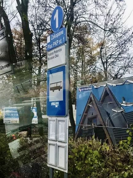
To reach your starting point you need to get a bus from Zakopane (bus stop 1/station 1 – see the photo on the right) to Palenica Bilaczanska /this is the last bus stop just after Lysa Polana/ – there is a huge parking place and an entrance to TPN (Tatra National Park). Buses run every 20 minutes from Zakopane Bus Station stage 1, which is located next to PKP Station/Train station. The bus will run toward Morskie Oko – Sea Eye.


2. Wodogrzmoty Mickiewicza (RED trail).
Hiking Zawrat in Tatra Mountains

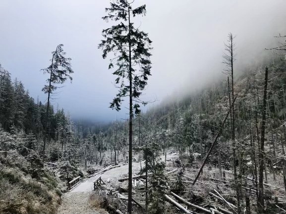
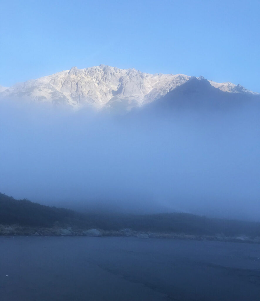
It was a cold morning with a bit of snow and dense fog. The winter aura for hiking Zawrat Peak was amazing. One of the most important things is a proper breakfast – it will supply you with energy, which is quickly lost in cold conditions.

Foggy conditions gave the trail a mystic look and quiet atmosphere. It’s a beautiful, easy path. As you can see, it got so bright and sunny in the higher sections. Hiking time from the starting point to Wodogrzmoty Mickiewicza: 50 minutes.

3. Dolina Pieciu Stawow Polskich - Five Ponds Valley (GREEN trail).

This is one of the most spectacular mountain scenery with a popular mountain shelter, where you can eat your second  breakfast and a hot cup of tea. Till this point it is a very pleasant walk, doable with kids. From the Valley toward Zawrat summit the path is getting much more challenging with steep sections at the end. Hiking time: 2.5 hours.

4. Hiking Zawrat Peak 2159 metres (BLUE trail).

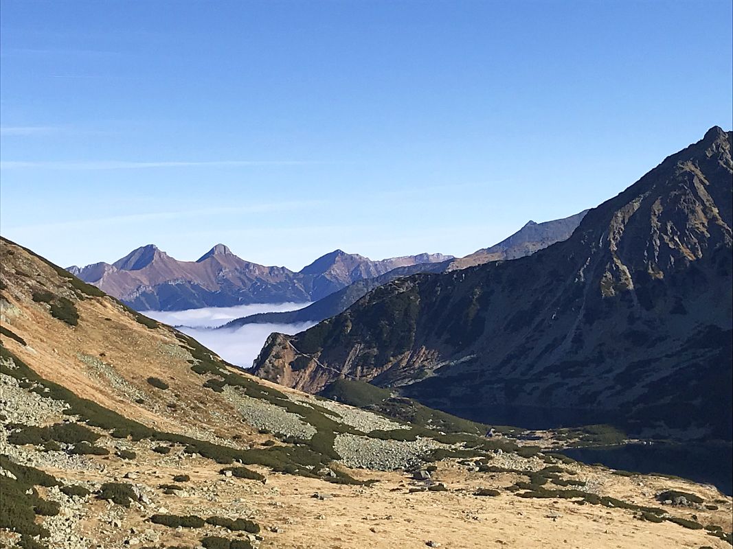
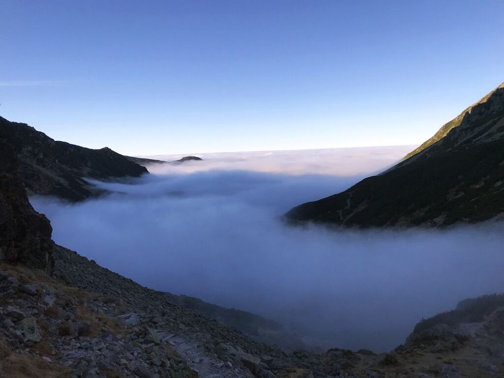
The view from Zawrat peak is breathtaking – it spreads across the whole caldera of Polish and Slovakian Mountains. It is usually very windy at the top, so be prepared and properly equiped. The wind often causes many accidents, as people are literally blown away from the trail. Hiking time from the Valley: 1 h 40 min.
Hiking Zawrat in Tatra Mountains

5. Czarny Staw Gasienicowy – Gasienicowy Black Pond (BLUE trail).

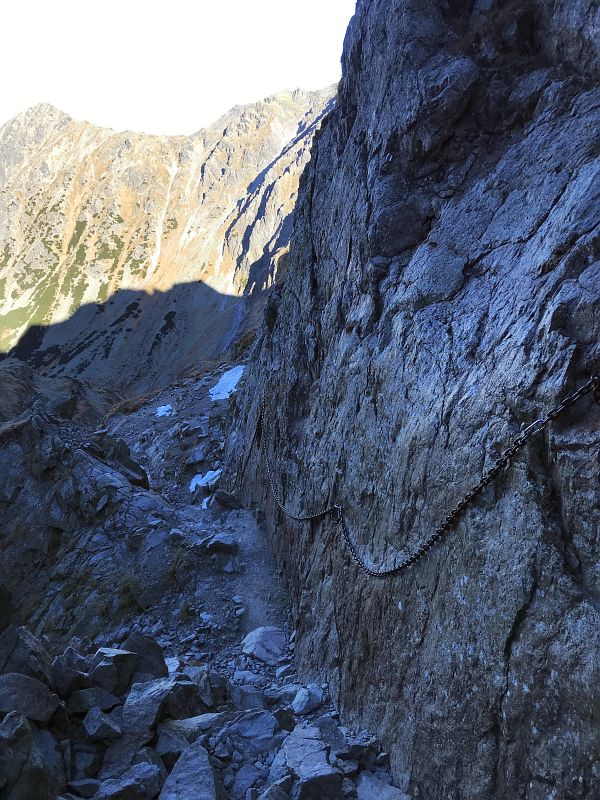
Going down from Zawrat peak toward Czarny Staw Gasienicowy is a very hard descent from a vertical rocky mountain along the security chains! Zawrat has claimed many lives over the years! Don’t do it if you are an inexperienced hiker or if you don’t have any climbing experience, or if you are afraid of heights! Generally, there is no space for a single mistake on this trail.
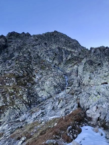
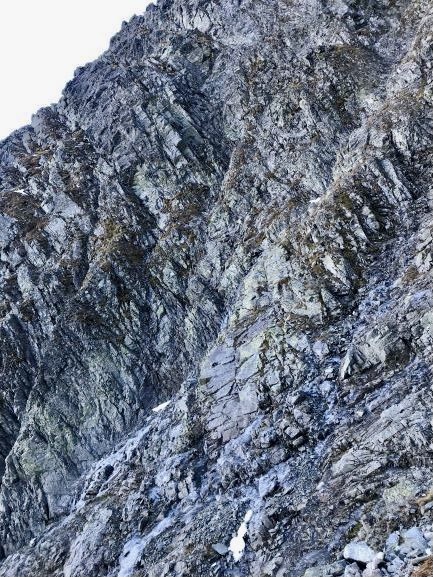
The trail down crosses the most difficult pass in the Tatra Mountains – the Orla Perc mountain ridge – which is said to be an Alpine level of difficulty. I hiked down alone, while the mountains were covered with ice on many sections, which made the descent extremely difficult. I had crampons on and an ice axe.

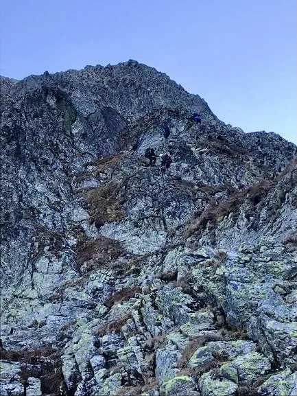
I didn’t have any ropes or a helmet (I know, that wasn’t smart, but with my climbing experience, I gave it a go). But on this trail, you should be fully equipped, even if you’re not going to use it. I captured two people coming down this mountain, and it’s visible how tough it is.

Depending on how quickly you descend the vertical mountain. It took me: 1-1.5 hours.

6. Dolina Gasienicowa - Gasienicowa Valley (BLUE trail)

Once you came down from the vertical mountain, your trail leads along Gasienicowy Czarny Staw – Gasienicowy Black Pond. This crystal clear lake is surrounded by high mountains range. The views are absolutely stunning. At this stage the trail becomes easy and pleasant. Be careful as the stones. – they often get wet and slippery, because of the microclimate around the lake (blue trail). 30 minutes.

7. Murowaniec – Kuznice (BLUE trail).

This sevtion of the hike is a very pleasant walk through the forest. Now I could feel my body was tired after releasing the volumes of adrenaline. There are plenty mini buses from Kuznice to Zakopane. Bus ticket 5 PLN/1 Euro. The buses are located just at the end of the hiking trail next to the restaurants. Hiking time to Kuznice: 1.5 hours


Swinica Zawrat hike.

IF you wish, you can continue hiking from Zawrat Peak to Swinica Peak. This is a comparatively more difficult hike than the one from Zawrat down to Czarny Staw Gasienicowy/Gasienicowy Black Pond. It is the most challenging trail in the Polish Tatra Mountains, at the Alpine level.

If you are planning to hike Kasprowy Wierch, check my full guide here: Hiking Kasprowy Wierch in Tatra Mountains.

Hiking Zawrat Peak– general summit information:

  • Height: 2159 m Zawrat
  • Length of the trail: 22 km
  • Time: 9 hours
  • Total ascent and total descent are similar, approx. 1400 m
  • Level of difficulty of this trail: Moderate to Difficult on the mountain section.

Zawrat Hotel.

There are plenty of accommodation options in Zakopane, but these two are fabulous fun and comfort for a reasonable price:

Looking for amazing relaxation after climbing expeditions, check best place near Zakopane – Thermal Springs – Terma Bania, in Bialka Tatrzanska. Amazingwater complex with number of hot pools, sauna and steam rooms. 


Note: This post may contain affiliate links, which are at absolutely no cost to you – I can earn a small commission on sales generated through this website and thanks to that I can share travel guides and inspirations that may help you reach your dream destinations and discover our unique world. I only recommend sites I actually use and have traveled to. Thank you for your support!


Related Blogs

03 October 2026
The best travel tips on incredible things to do in Rome, Italy.
The main question before traveling to Rome is how do I visit one of the busiest cities on Earth? Only...
23 September 2026
Aurora Borealis in Rovaniemi - Best Time, Places & Tips for seeing the Northern Lights!
Here’s everything you should know about aurora hunting in Rovaniemi (Lapland), a city known for...
22 September 2026
What to do in Helsinki - 15 Unique things to see in Finish Capital.
Helsinki is Finland’s largest city and serves as a hub for culture, politics, and education. But...
06 September 2026
10 Best Things to do in Cape Verde: Epic hikes & Unforgettable adventures.
Cape Verde was a spontaneous destination and turned out to be an extremely fun, authentic and easygoing...
30 August 2026
25 Things to do in Corfu, Greece: best travel tips, Beaches & Unforgettable places to visit.
Corfu was a huge surprise for me in almost every way – the island turned out to be one of the most...
14 August 2026
11 Inspiring Things to do in Cape Town (2027 Guide).
Cape Town is located on the south-western tip of the Republic of South Africa, surrounded by the Atlantic...
10 May 2026
Amazing one-week Tenerife itinerary for adventurous travelers!
Like all the Canary Islands, Tenerife is truly unique. The mix of Spanish culture, African climate, and...
27 April 2026
Check the most amazing places in Mallorca - beaches & hidden spots.
At first, I wasn’t considering Mallorca as my priority travel destination. Mainly because it has...
07 April 2026
Lac Rose (Lake Retba), Senegal: All to know when visiting the Pink Lake.
Lac Rose, a pink lake, is situated on Cap Vert, 35 km north of Dakar. The pink lake in Senegal is one...
07 April 2026
Bandia Reserve Senegal: Safari Guide, Prices & Honest Review.
Bandia Reserve is a great and easily accessible destination from Dakar for a day trip. It’s 3500 hectares...
Picture of Hey - I'm Eva!

Hey - I'm Eva!

I share a great passion for volcano hiking, mountain climbing and reportage photography. I travel the freestyle way, reaching the most remote locations on the planet on solo adventures. My blog aims to inspire with outrageous but affordable travel & hiking itineraries to anywhere in the world, so everyone can craft their wildest adventurous dream trip! Traveling is freedom, allowing you to see the true world, meet communities, and grow. Taste it!

Hiking Zawrat in Zakopane

Hiking Zawrat in the Tatra Mountains is a scenic but challenging adventure. Once you get above the clouds, you will be astonished by the beauty of the dramatic, rocky, dark Tatra landscape. The loop I chose for this trail requires some climbing skills, so it’s only for experienced and adventurous hikers and may not be safe in autumn or winter. But before you decide, let me give you a detailed description of the whole trail so you know what to expect in different weather conditions.


Hiking Zawrat in Tatra Mountains.

The Tatra Mountains are located in the Carpathian Mountains, which are the second-longest mountain range in Europe. These mountains are very tough to climb for many reasons e.g., avalanche risk (huge danger in the Tatra mountains in winter and spring season), unpredictable weather, narrow paths and steep icy slopes. Some trails between the peaks are only one-way due to a narrow pass.

You should always have a Tatra National Park mountain map to check the trails. There are plenty of moderate, pleasant hiking trails in the Tatra Mountains, with access to magnificent views of this rocky land.

The Tatra Mountains are very popular among hikers and regular tourists. In peak seasons, most of the trails are really crowded, especially in the lower parts. Zakopane is the most well-known city in the region and a gateway to the Tatra Mountains. 

Zakopane - Tourist Information Office.

If you are there to hike any mountain, the first thing you should do on arrival in Zakopane is visit the TPN Touristic Information Office (TPN – Tatra National Park). This is situated on the way to Kuznice. It is near the roundabout at Jana Pawla Street / John Paul roundabout. Take a minibus from Zakopane bus station to Kuznice and get off at the roundabout. The small wooden house is a tourist information office.


Things to know before hiking Zawrat:

  • Tatra Mountains Map, it’s FREE. You’ll get a map with all hiking trails marked in colour, hiking times between main spots/peaks. Most of the trails are quite well maintained, although in snowy conditions they might not be visible. During snowfalls tracks made by walkers disappear within minutes and cannot be traced. There are many hiking routes in Tatra Mountains, you can choose easy or moderate trails, which are equally rewarding.
  • Always ask which trails are closed due to severe weather conditions (icy sections).
  • Avalanche risk (this is a huge danger in Tatra Mountains and often is catastrophic).
Hiking Zawrat in Tatra Mountains

Pass for Tatra National Park.

  • ENTRY FEE to the Tatra National Park – it is mandatory to purchase an entry ticket (day or week-pass), which is available at the ticket office (there are entry points on major trails) or online – if you are planning to spend a few days in the mountains, you can buy a 7-day pass to TPN, which costs 35 PLN (9 euros).
  • Additionally, you should buy insurance in advance – you should never go hiking in any mountains without medical insurance. The rescue team in a helicopter is busy every day with several accidents across the national park. If you twist your ankle, you won’t be able to descend the mountain on your own, as the trails are too steep and rocky.
  • The colours of the trails on the map are not related to a difficulty level. It is not like with the colour for ski slopes, where black means highly difficult, red – moderate and green – easy. Tatra trails are marked with different colours between major spots, to help you recognize where you are located.

Complete guide on hiking Zawrat Peak 2159m.

My trail to Zawrat was leading through the following peaks and took me 9 hours. Most of the trail is pure hiking but in the upper level there are long sections which require climbing. The most difficult section is the trail down from Zawrat summit leading through a vertical rocky mountain.

FULL TRAIL (INCLUDING TIMES) TO THE TOP OF ZAWRAT AND BACK (SEE THE MAP ATTACHED): 

1. Palenica Bialczanska (start of the trail) – leading through: 2. Wodogrzmoty Mickiewicza (I know most of you guys will not be able to pronounce it) – 3. Dolina Pieciu Stawow/Five  Ponds Valley (stunning spot) – 4. Zawrat 2159m – 5. Czarny Staw Gasienicowy/Gasienicowy Black Pond – 6. Dolina Gasienicowa/Gasienicowa Valley – 7. Przelecz Miedzy Kopami – Murowaniec.

Hiking Zawrat in Tatra Mountains

1. Palenica Bialczanska - starting point.

To reach your starting point you need to get a bus from Zakopane (bus stop 1/station 1 – see the photo on the right) to Palenica Bilaczanska /this is the last bus stop just after Lysa Polana/ – there is a huge parking place and an entrance to TPN (Tatra National Park). Buses run every 20 minutes from Zakopane Bus Station stage 1, which is located next to PKP Station/Train station. The bus will run toward Morskie Oko – Sea Eye.


2. Wodogrzmoty Mickiewicza (RED trail).

Hiking Zawrat in Tatra Mountains

It was a cold morning with a bit of snow and dense fog. The winter aura for hiking Zawrat Peak was amazing. One of the most important things is a proper breakfast – it will supply you with energy, which is quickly lost in cold conditions.

Foggy conditions gave the trail a mystic look and quiet atmosphere. It’s a beautiful, easy path. As you can see, it got so bright and sunny in the higher sections. Hiking time from the starting point to Wodogrzmoty Mickiewicza: 50 minutes.

3. Dolina Pieciu Stawow Polskich - Five Ponds Valley (GREEN trail).

This is one of the most spectacular mountain scenery with a popular mountain shelter, where you can eat your second  breakfast and a hot cup of tea. Till this point it is a very pleasant walk, doable with kids. From the Valley toward Zawrat summit the path is getting much more challenging with steep sections at the end. Hiking time: 2.5 hours.

4. Hiking Zawrat Peak 2159 metres (BLUE trail).

The view from Zawrat peak is breathtaking – it spreads across the whole caldera of Polish and Slovakian Mountains. It is usually very windy at the top, so be prepared and properly equiped. The wind often causes many accidents, as people are literally blown away from the trail. Hiking time from the Valley: 1 h 40 min.

Hiking Zawrat in Tatra Mountains

5. Czarny Staw Gasienicowy – Gasienicowy Black Pond (BLUE trail).

Going down from Zawrat peak toward Czarny Staw Gasienicowy is a very hard descent from a vertical rocky mountain along the security chains! Zawrat has claimed many lives over the years! Don’t do it if you are an inexperienced hiker or if you don’t have any climbing experience, or if you are afraid of heights! Generally, there is no space for a single mistake on this trail.
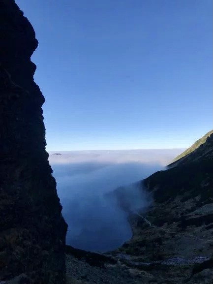
The trail down crosses the most difficult pass in the Tatra Mountains – the Orla Perc mountain ridge – which is said to be an Alpine level of difficulty. I hiked down alone, while the mountains were covered with ice on many sections, which made the descent extremely difficult. I had crampons on and an ice axe.

I didn’t have any ropes or a helmet (I know, that wasn’t smart, but with my climbing experience, I gave it a go). But on this trail, you should be fully equipped, even if you’re not going to use it. I captured two people coming down this mountain, and it’s visible how tough it is.

Depending on how quickly you descend the vertical mountain. It took me: 1-1.5 hours.

6. Dolina Gasienicowa - Gasienicowa Valley (BLUE trail)

Once you came down from the vertical mountain, your trail leads along Gasienicowy Czarny Staw – Gasienicowy Black Pond. This crystal clear lake is surrounded by high mountains range. The views are absolutely stunning. At this stage the trail becomes easy and pleasant. Be careful as the stones. – they often get wet and slippery, because of the microclimate around the lake (blue trail). 30 minutes.
7. Murowaniec – Kuznice (BLUE trail).

This sevtion of the hike is a very pleasant walk through the forest. Now I could feel my body was tired after releasing the volumes of adrenaline. There are plenty mini buses from Kuznice to Zakopane. Bus ticket 5 PLN/1 Euro. The buses are located just at the end of the hiking trail next to the restaurants. Hiking time to Kuznice: 1.5 hours


Swinica Zawrat hike.

IF you wish, you can continue hiking from Zawrat Peak to Swinica Peak. This is a comparatively more difficult hike than the one from Zawrat down to Czarny Staw Gasienicowy/Gasienicowy Black Pond. It is the most challenging trail in the Polish Tatra Mountains, at the Alpine level.

If you are planning to hike Kasprowy Wierch, check my full guide here: Hiking Kasprowy Wierch in Tatra Mountains.

Hiking Zawrat Peak– general summit information:

  • Height: 2159 m Zawrat
  • Length of the trail: 22 km
  • Time: 9 hours
  • Total ascent and total descent are similar, approx. 1400 m
  • Level of difficulty of this trail: Moderate to Difficult on the mountain section.

Zawrat Hotel.

There are plenty of accommodation options in Zakopane, but these two are fabulous fun and comfort for a reasonable price:

Looking for amazing relaxation after climbing expeditions, check best place near Zakopane – Thermal Springs – Terma Bania, in Bialka Tatrzanska. Amazingwater complex with number of hot pools, sauna and steam rooms. 


Note: This post may contain affiliate links, which are at absolutely no cost to you – I can earn a small commission on sales generated through this website and thanks to that I can share travel guides and inspirations that may help you reach your dream destinations and discover our unique world. I only recommend sites I actually use and have traveled to. Thank you for your support!
 

Related Blogs

03 October 2026
The best travel tips on incredible things to do in Rome, Italy.
The main question before traveling to Rome is how do I visit one of the busiest cities on Earth? Only...
23 September 2026
Aurora Borealis in Rovaniemi - Best Time, Places & Tips for seeing the Northern Lights!
Here’s everything you should know about aurora hunting in Rovaniemi (Lapland), a city known for...
22 September 2026
What to do in Helsinki - 15 Unique things to see in Finish Capital.
Helsinki is Finland’s largest city and serves as a hub for culture, politics, and education. But...
06 September 2026
10 Best Things to do in Cape Verde: Epic hikes & Unforgettable adventures.
Cape Verde was a spontaneous destination and turned out to be an extremely fun, authentic and easygoing...
30 August 2026
25 Things to do in Corfu, Greece: best travel tips, Beaches & Unforgettable places to visit.
Corfu was a huge surprise for me in almost every way – the island turned out to be one of the most...
14 August 2026
11 Inspiring Things to do in Cape Town (2027 Guide).
Cape Town is located on the south-western tip of the Republic of South Africa, surrounded by the Atlantic...
10 May 2026
Amazing one-week Tenerife itinerary for adventurous travelers!
Like all the Canary Islands, Tenerife is truly unique. The mix of Spanish culture, African climate, and...
27 April 2026
Check the most amazing places in Mallorca - beaches & hidden spots.
At first, I wasn’t considering Mallorca as my priority travel destination. Mainly because it has...
07 April 2026
Lac Rose (Lake Retba), Senegal: All to know when visiting the Pink Lake.
Lac Rose, a pink lake, is situated on Cap Vert, 35 km north of Dakar. The pink lake in Senegal is one...
07 April 2026
Bandia Reserve Senegal: Safari Guide, Prices & Honest Review.
Bandia Reserve is a great and easily accessible destination from Dakar for a day trip. It’s 3500 hectares...
Picture of Hey - I'm Eva!

Hey - I'm Eva!

I share a great passion for volcano hiking, mountain climbing and reportage photography. I travel the freestyle way, reaching the most remote locations on the planet on solo adventures. My blog aims to inspire with outrageous but affordable travel & hiking itineraries to anywhere in the world, so everyone can craft their wildest adventurous dream trip! Traveling is freedom, allowing you to see the true world, meet communities, and grow. Taste it!