Hiking Mount Agung in Bali is an extraordinary experience, but it’s a hard climb.. I did not expect it to be that challenging, but this is the type of accomplishment real hikers look for 😉
Rising 3,031 meters above sea level, Mt Agung is the highest peak of the beautiful Bali island. This majestic volcano offers breathtaking views, including a magical sunrise trek and an advantageous hiking experience. However, it’s a tough adventure, so there are several important factors to consider before climbing Mount Agung – proper preparation and planning are key to ensuring a safe and enjoyable hike up.
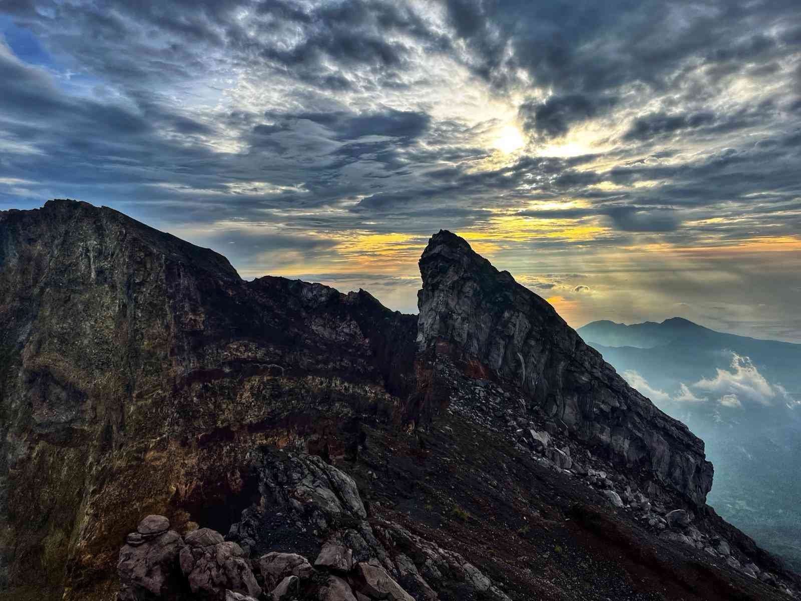
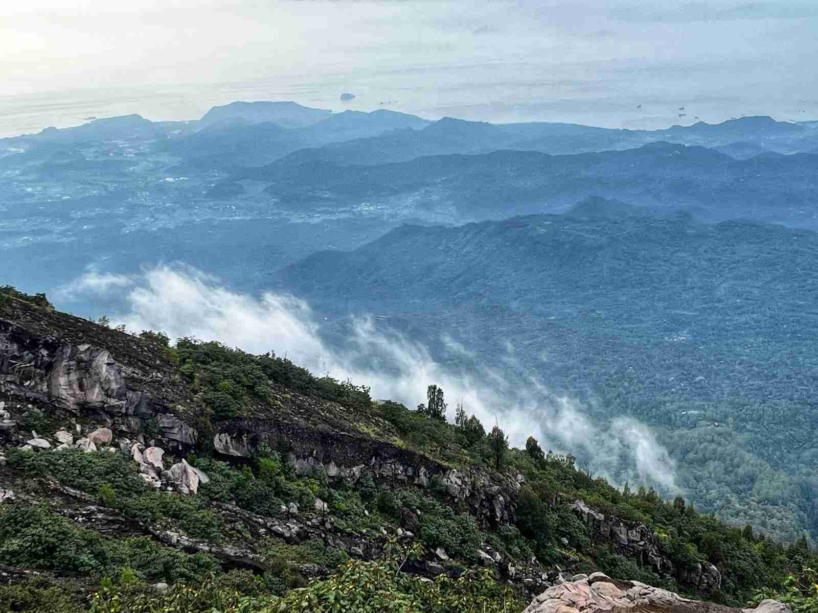
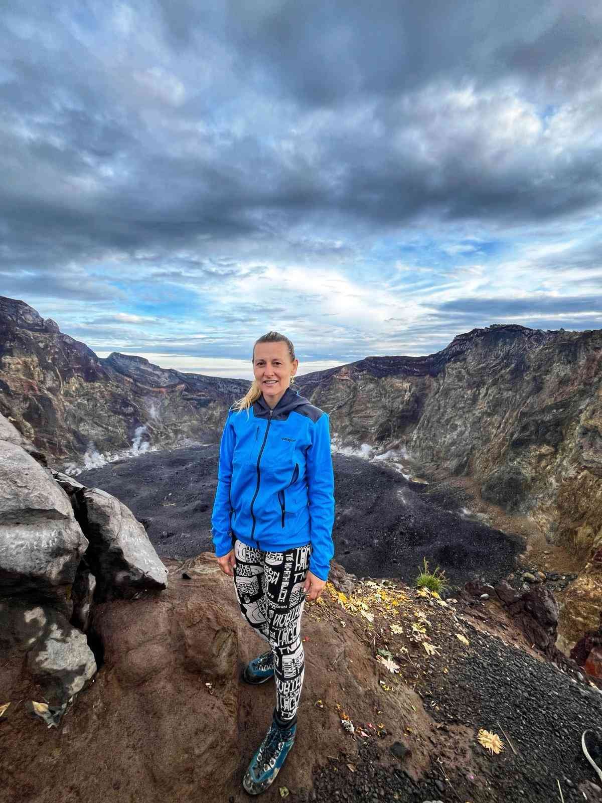
Hiking Mount Agung - the highest peak in Bali.
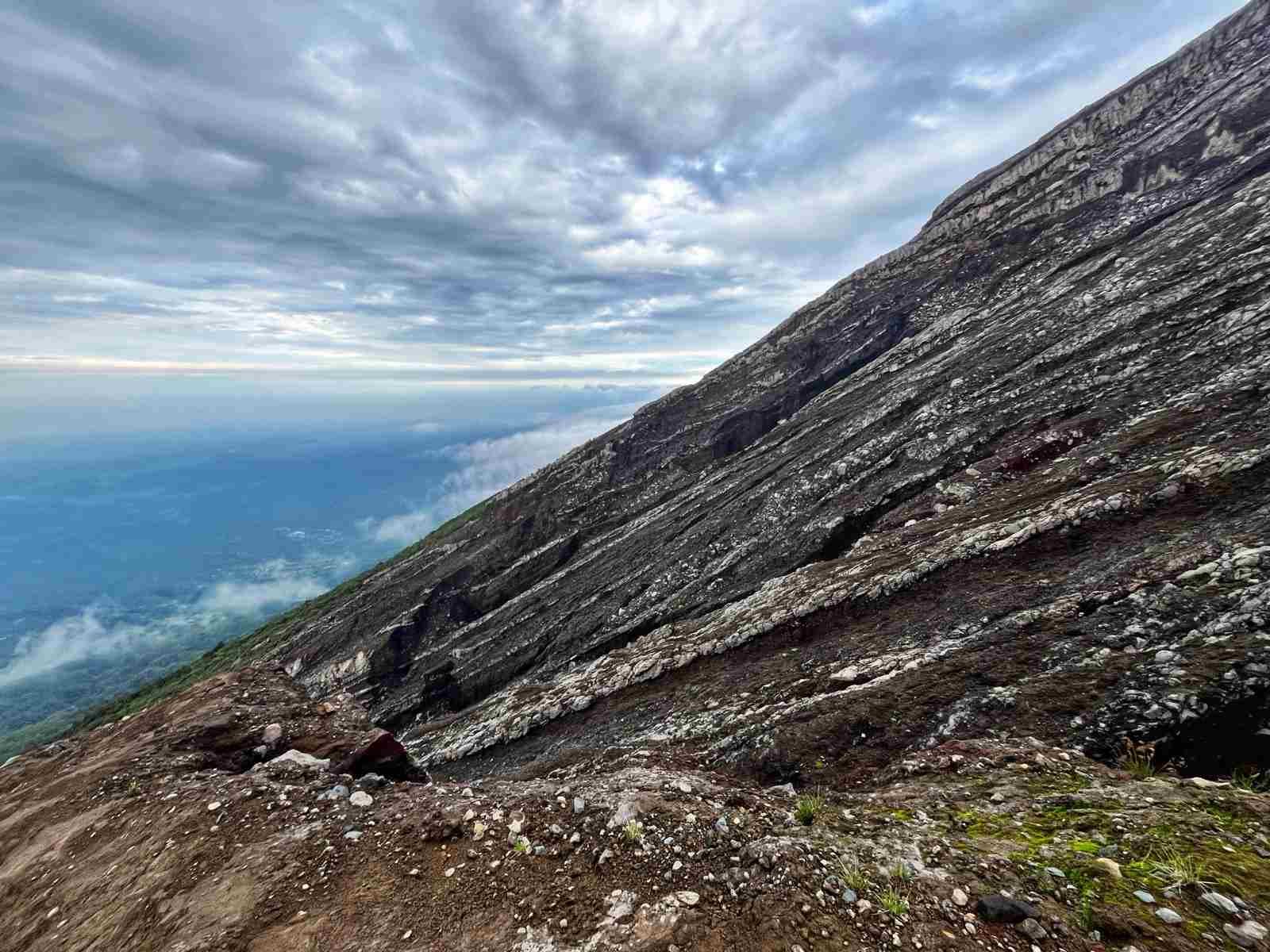
The ascent of Mount Agung typically begins in the early hours of the morning to reach the summit in time for the breathtaking sunrise. The trail is challenging, with steep and rocky terrain, so it’s important to pace yourself and take regular breaks to rest and hydrate (it was incredibly humid in March). As you ascend, the air becomes thinner, so acclimatization is key to avoiding altitude sickness.
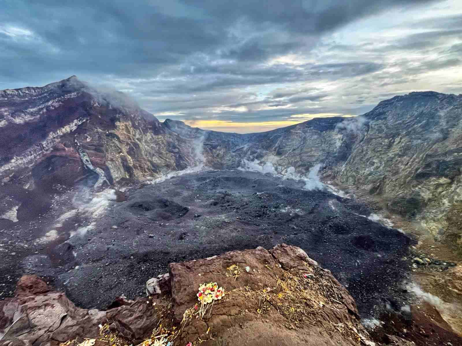
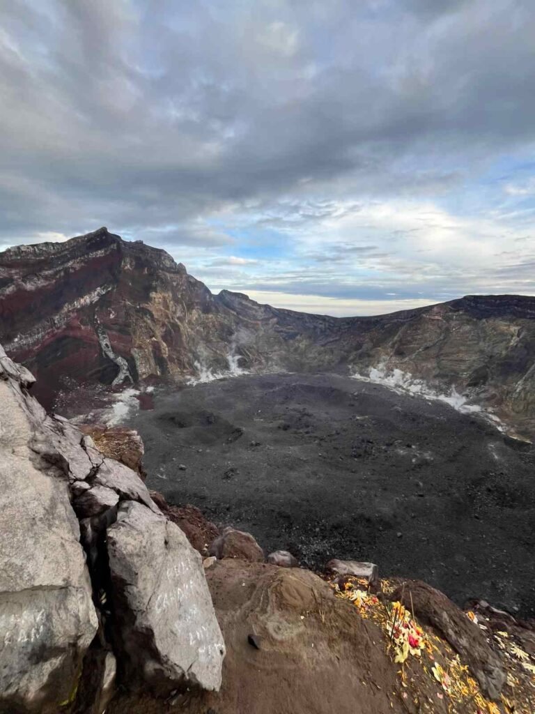
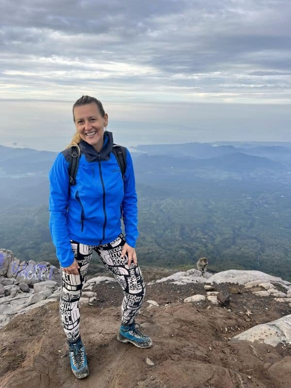
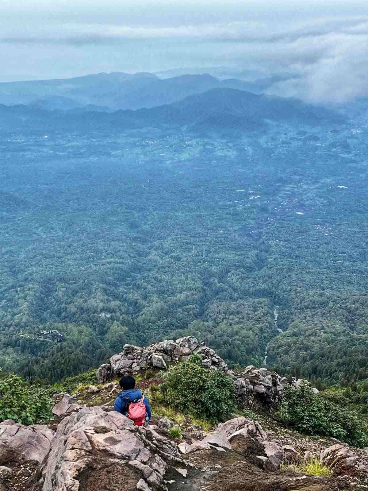
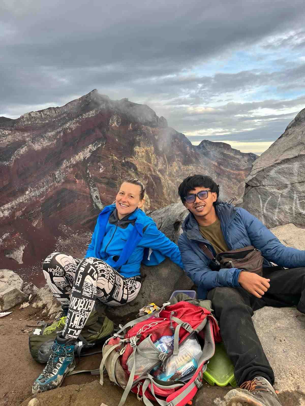
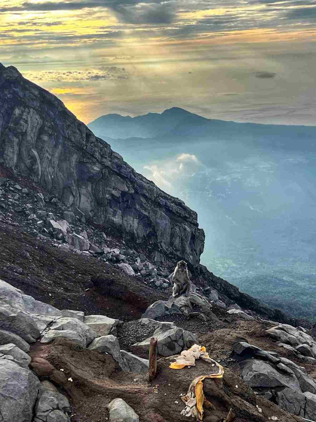
The hiking path toward the crater rim of the active volcano leads at first through jungle scenery, bringing you on a rocky trail and eventually on solidified lava slopes. The feeling at the top is indescribable. The view of the massive, smoking crater is magnificent. The landscape spreads across Bali and surrounding Lombok island with Rijiani Peak towering above the clouds.
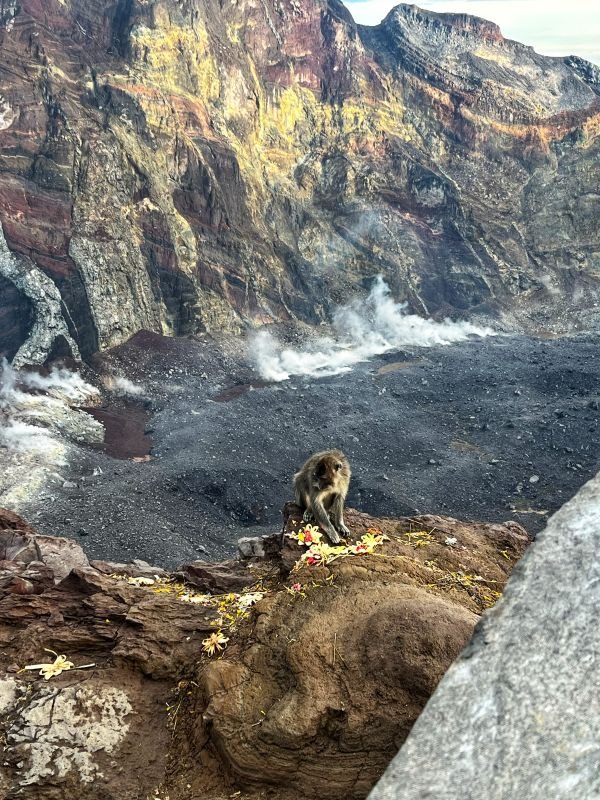
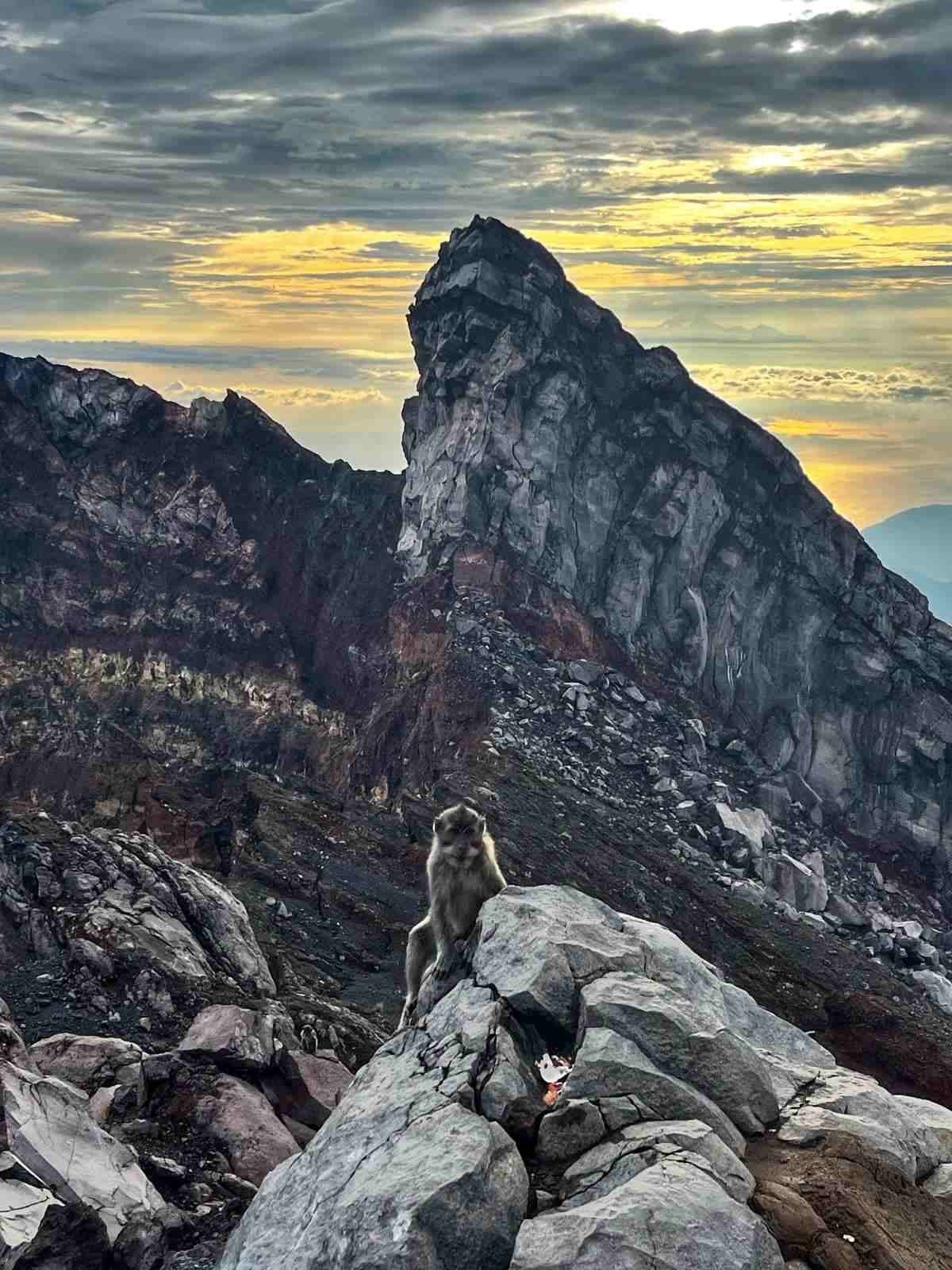
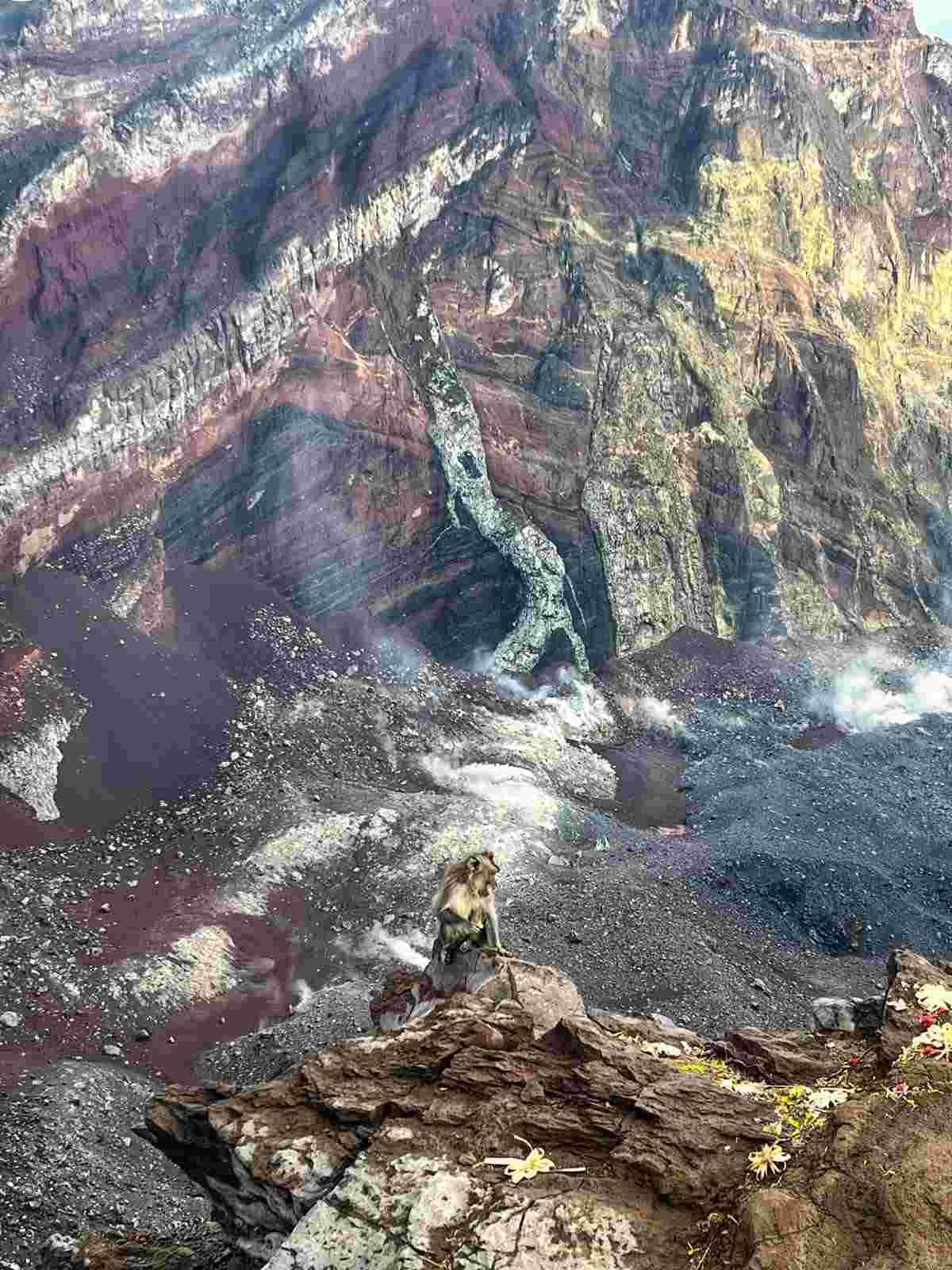
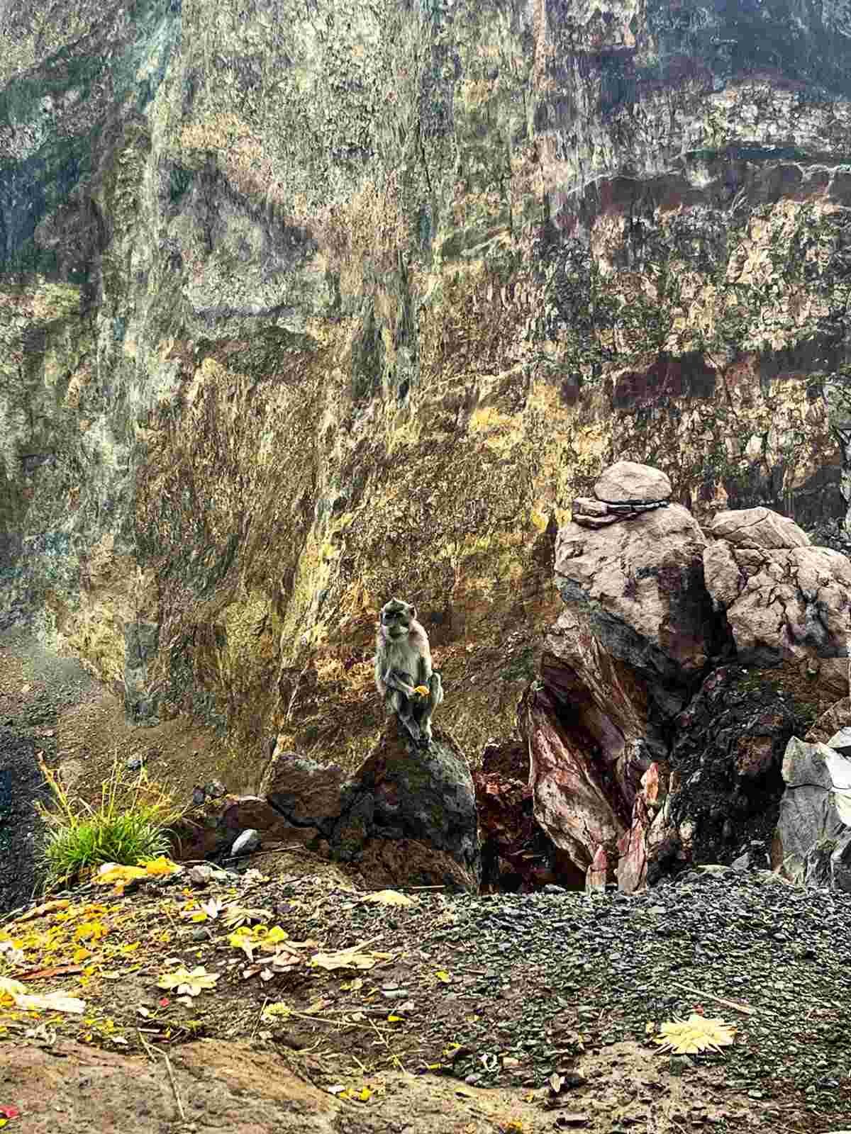
Something very interesting – if it happens, you are the last to leave the top after sunrise – be prepared for furry company to come along 😉
The moment people leave the top of the mountain, wild monkeys come to the crater rim searching for food remnants. They are totally wild (not like in a Monkey Sanctuary in Ubud), you won’t be able to get close for a picture, but they would be very happy if you leave some natural food – banana, fruits (perhaps biscuits, just please don’t leave junk food).
Mt Agung trekking.
There are two primary trekking routes to the summit: the Pasar Agung Temple route and the Besakih Temple route. Each path offers unique scenery and challenges.
- Pasar Agung Temple Route – is the shorter route, typically starting around midnight to catch the stunning sunrise. The trek here is steeper and more direct
- Besakih Temple Route – this route is longer, taking about 8 hours to summit, but the journey offers a more gradual incline.
The ideal time for Mt Agung trekking is during the dry season from April to September, when the weather is cooler and more predictable.
Mount Agung Sunrise Hike via Pasar Agung Temple.
- STARTING POINT: 1500 metres above sea level.
- LEVEL OF DIFFICULTY: Hard to Extreme. Climbing Mount Agung is considered to be a very challenging and demanding trek with climbing sections – there are no ropes and no helmets are required, which I think should be mandatory on this route.
- TOTAL ASCENT: 1500 m/or 1700 m via the long route,
- HIGHEST POINT: 3031 metres/or 3142m if approached by the long route,
- GUNUNG AGUNG PEAK: 3142 metres (the highest peak),
- There are no mosquitoes at this elevation.
- Climbing Mt Agung Volcano is not allowed for women during their menstruation period – Mt. Agung is a sacred mountain.
Agung Volcano - the most sacred and highest mountain in Bali.
Mount Agung is the highest point on the island and holds spiritual significance for the Balinese people.
Gunung Agung Volcano is considered the most sacred mountain in Bali and is often referred to as the “Mother Mountain” by the Balinese people. It is believed to be the abode of the gods and the spiritual center of the island.
In Balinese Hindu belief Mount Agung represents the cosmic axis, connecting the physical and spiritual worlds. It holds important spiritual and symbolic significance in Balinese cosmology. Balinese people believe a god lives on every mountain (just like Nepalese people) – Mount Agung is home to Mahadewa.
Is it difficult to hike Mt Agung?
Yes – hiking Mount Agung is very challenging. There aren’t many tourists climbing Agung Volcano. It is the most difficult hike in Bali and Java, similar to the extremely challenging Mount Rinjani Volcano Hike in Lombok. Do not compare this hike to Mount Batur, which is a short, easy hike.
Hiking Mount Agung requires good physical condition as the climb is demanding and requires a reasonable level of fitness. Hiring a local guide who can provide valuable insights and ensure your safety throughout the journey is key – I saw people doing it alone, but I would never recommend it in Indonesia.
Taking the shorter route, you are going to hike the elevation of 1500 meters, reaching a height of 3,031 meters (9,944 feet).
Agung Volcano climb in Indonesia.
If you are planning to climb Agung Volcano, you should have hiking experience and be prepared for steep, rugged terrain. The ascent to the summit of Mount Agung involves steep rock climbing with sections of loose rocks and gravel. Mount Agung should be approached only by experienced & adventurous hikers.
It was one of the most difficult hikes I have ever done, including Everest Base Camp & Teide Volcano in Tenerife (both ways on foot).
Do you need a guide for hiking Mount Agung?
Hiking Mount Agung without guide is possible, but it’s not recommended. They provide invaluable knowledge about the terrain and cultural significance. Generally, it is said that a guide is mandatory for hiking Mount Agung for a few reasons: hikers’ safety and the fact that it is a sacred mountain.
I would never advise undertaking Mount Agung hike alone. It is really one of the toughest hikes I have done in terms of terrain difficulty, and don’t forget it is a night hike. It is highly recommended to have a local guide for your safety and changing weather conditions.
However, I don’t believe anyone would prevent you from doing the hike alone. This is a heavy hike, the mountain is not too popular, and there can be few or just one other person hiking the mountain along with you.
REMEMBER – there is no rescue team at the mountain, in the past there were few fatalities among hikers (including Indonesians and one American who died descending the mountain).
Agung is an active volcano.
Yes – Agung is an active volcano with the biggest eruption in 1963, which left all the surrounding lava fields. The last eruption took place in 2018-2019 which resulted in hundreds of flights being cancelled and massive evacuation of local people.
Getting a guided tour to Mount Agung Sunrise Trekking in Bali.
You need to book your tour in advance, you can do it online with this highly rated Mount Agung Sunrise Trekking in Bali.
The tour guide is very experienced, which is highly important for this challenging hike. I have used Klook in a lot of tours across Asia and they are unbeatable, especially in China & Hong Kong (where Klook HQ is located).
How long does it take to hike Mount Agung?
Depending on a route you take, the shorter one via Pasar Agung Temple takes approx. 3-4 hours to hike up and at least 3.5h hours to hike down. It took me 2.15h to hike down but only because I’m quite strong in descending mountains and I’m quite sh*t on hiking up, which took me 4.5h here.
The long route – for very experienced hikers – takes 5-7 hours to go up and 5-6 hours to hike down.
IT IS NOT possible to do this hike in a rainy weather – it’s too steep and slippery.
Hiking Mount Agung via Pasar Agung Temple.
Hotel pick-up: around 00:00 (midnight) from Ubud.
Start of the hike: 1.45 am-2 am.
Hiking time to the top: 3 h- 4.5 h – for the sunrise for ~ 6am.
Hiking distance: 4 kilometres (one way).
Hiking Mount Agung involves a significant elevation gain of around 1500-1900 meters (5000 to 6400 feet), depending on the starting point!
Hiking down: depending on your skills, from 3h – 8h. I spoke to local guides after the hike, due to the difficulty of the terrain, hiking down usually takes more here than hiking up.
Requirements: You need to be in good physical fitness. It’s a hard climb, especially tricky on the way down.
Pasar Agung Temple - Start of the hiking trail.
There will be just few people hiking the mountain daily.
There are two stands at the parking place, where you can get your morning (night) coffee, drinks, snacks, anything. You also need to register before approaching the trail, there is a local guy at the starting point with a notebook.
Set of steps will take you in front of the temple, which looks amazing with the night sky background.
Stage 1 of hiking Mount Agung via Pura Pasar Agung.
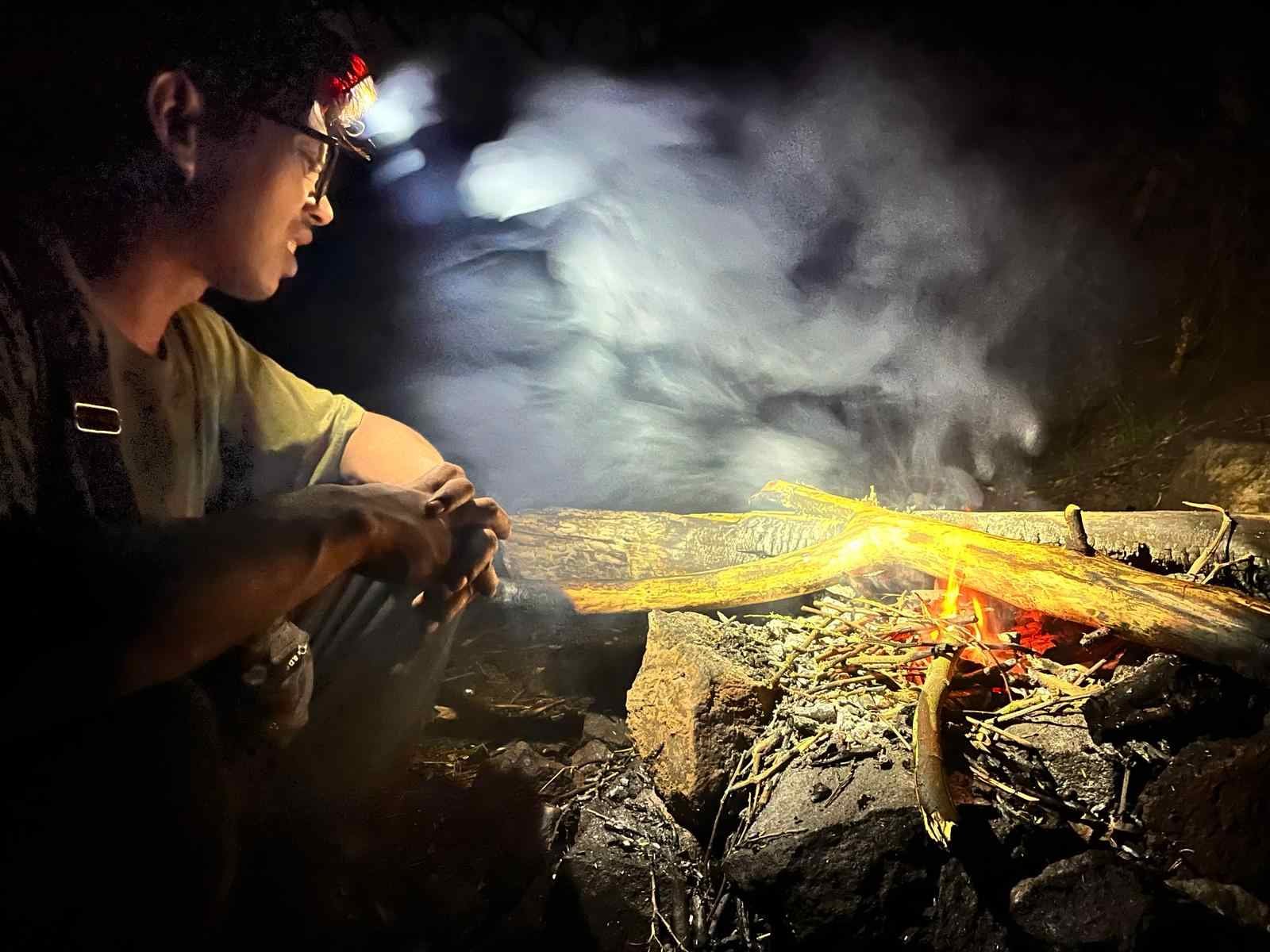
The first 20% is a jungle hike, the challenging path leads through a tropical forest. It is a hard hike from the start, you will need to use your hands to pull yourself up and hike a muddy route. Once you reach a fireplace – you’re half-way.
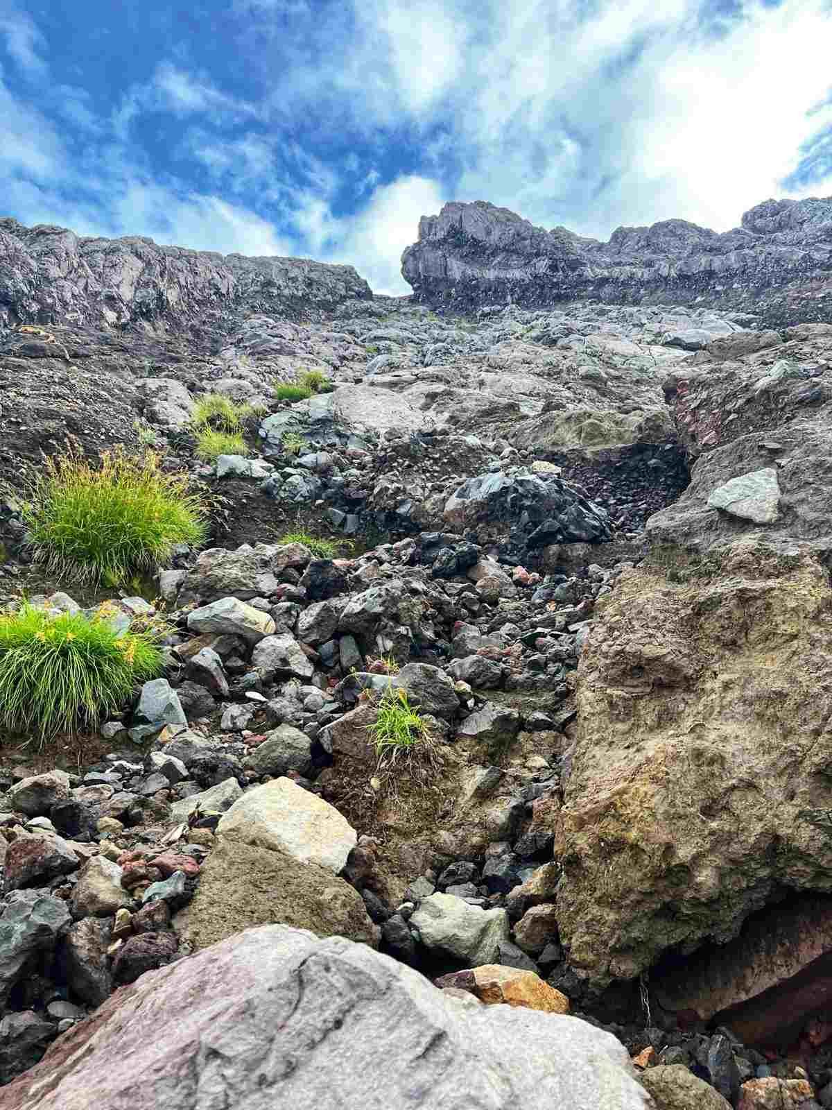
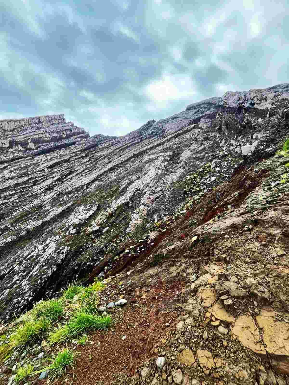
Stage 2 - red lava stones trek.
The trail leads through a steep and rugged terrain, with sections of loose rocks and gravel. The red lava stones – horribly difficult to hike. There are no trees at this level, just pure rocks.
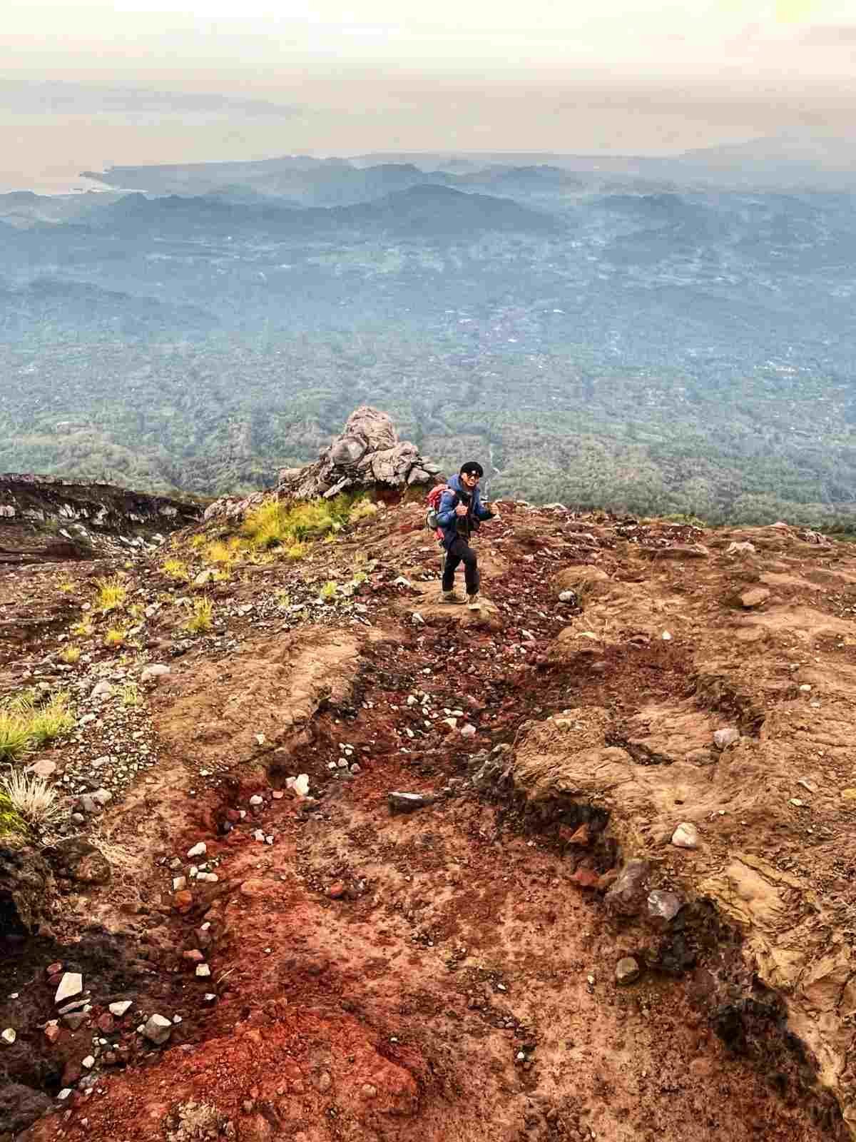
Stage 3 - steep rock sections climb.
At the last stage you are climbing almost vertical rock sections in the dark with a tiny headlight. Be careful here and don’t rush.
The route to Mt Agung massive crater.
My guide said 25% of people resign after the first 30 minutes of the hike .. (You’ve got to admit it’s a bit funny, they must know it’s a hard hike, right?), but on the other hand, it is good that they do not push themselves for the ascent.
Only 10% of all climbers are faster with their descent than ascent.
He said they never encourage people to hike further, because in a situation of an injury, they have to carry people down on their backs! Wait.. what??? While it seems completely impossible, he said it happened many times in the past – otherwise, they would be left on the mountain. Again, there is no rescue team, no helicopter evacuation available.
Hiking Mount Agung via Besakih Temple.
Pick up at 8.30 pm-9 pm. Starting point: Besakih Temple.
Pura Pasar Agung can be a starting point for both hiking routes. However, the trail splits and you would need to know where to turn for the Besakih route.
The difficulty is similar/this route is slightly more challenging comparing to the shorter hike. Covering 7 kilometers in 6 to 7 hours, reach the summit of Mount Agung with last section very challenging.
You are reaching the highest point of Mount Agung 3,142 meters above sea level.
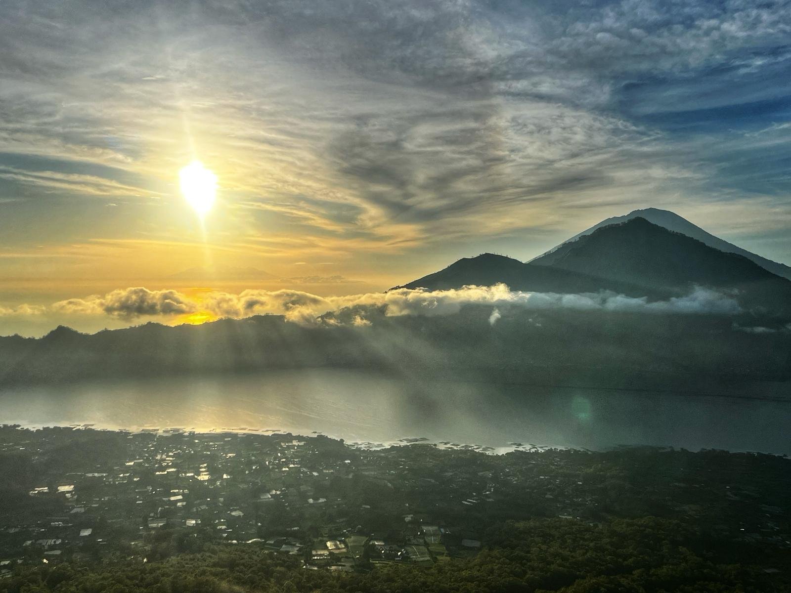
Sunrise from Mount Agung.
Once you reach the summit the view at sunrise is truly stunning. You will witness the sky changing colors as the sun rises over the horizon, casting warm light over the island and illuminating the nearby peaks. On clear days you may see as far Rinjani Peak in Lombok.
What to take for hiking Mount Agung in Bali?
Weather conditions on Mount Agung can be a little unpredictable. Check the weather forecast before starting the hike and be prepared for sudden changes in temperature and visibility. It can easily get cloudy and it is not unusual for the temperature to drop to 6-7 degrees Celsius.
Must have equipment:
- Headlight (the guide will have one for you, but I prefer to carry mine).
- Plenty of water
- Best hiking shoes you can have! This is the most important thing for this trek! There are really steep rocky sections you may consider as climbing. It would be good to have rock boots with smooth rubber soles. I had my long climbing shoes I use for Himalayan hikes.
- Hiking poles (the guide will have them for you).
- Few extra layers, windproof & rainproof jacket.
- Food, high protein snacks, cholocate.
Weather for hiking Mount Agung.
The weather conditions on Mount Agung can be unpredictable, so it’s crucial to check the forecast and plan your hike during the dry season (from April to September). March hike was quite stable in terms of the weather, very little rain and wind. But during the wet season, from October to March, the trail can become slippery and hazardous, making it unsuitable for hiking.
Trekking to Mount Agung.
Mount Agung holds spiritual significance for the Balinese people, it’s important to respect the local customs and regulations during the hike. Also, be mindful of any potential volcanic activity, as Mount Agung is an active volcano, and check for any travel advisories before planning your trip. If you are hiring a local guide, he should know if the weather forecast permits hiking.
Thinking of Mount Batur Sunrise Hike – check all you need to know before going on this tour.
Note: This post may contain affiliate links, which are at absolutely no cost to you – I can earn a small commission on sales generated through this website and thanks to that I can share travel guides and inspirations that may help you reach your dream destinations and discover our unique world. I only recommend sites I actually use and have traveled to. Thank you for your support!


")

