
Hiking Glencoaghan Horseshoe Loop was one of the toughest one-day expeditions I’ve done in my entire life. It was a big surprise to find such a difficult mountain trail in hilly Ireland. 😉 It’s a perfect route for adventurous hikers!
Get prepared for a challenging adventure heading into this caldera, placed in the stunning landscape of County Kerry. Navigation and preparation are key, especially if you are hiking alone, like me. Glencoaghan peaks are usually covered with clouds, the visibility will likely be limited. Here are all the essential details about the Glencoaghan Horseshoe route map and hiking difficulty.
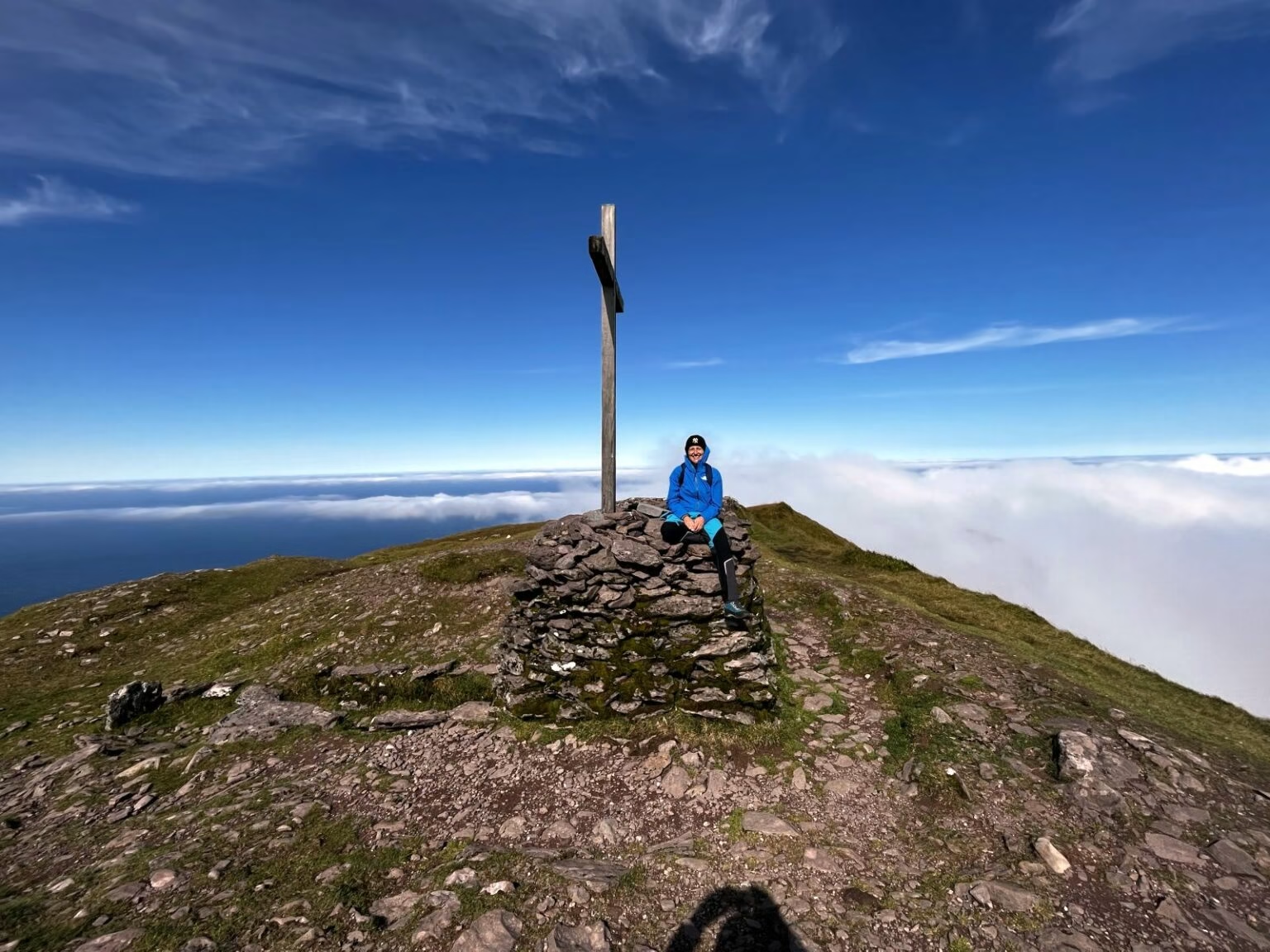
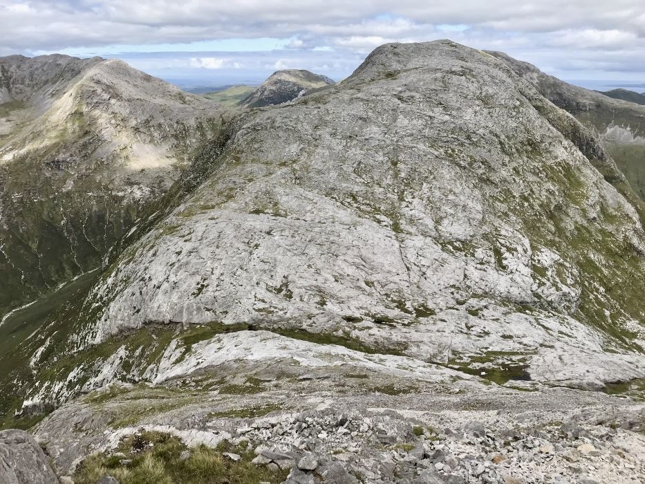
Hiking Glencoaghan Horseshoe loop!
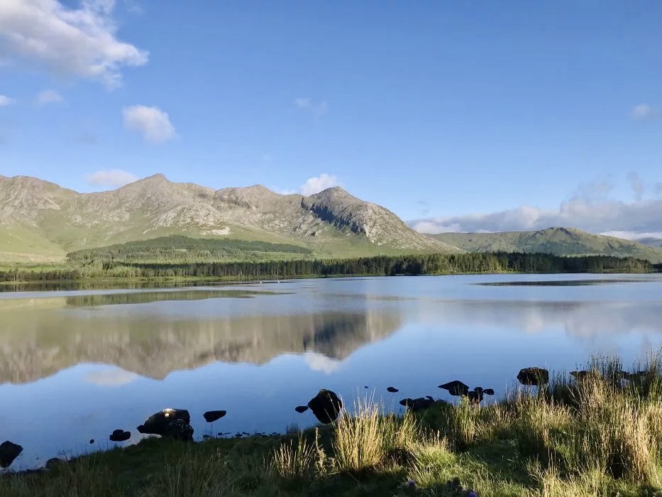
Glencoaghan is a valley in the Twelve Bens in stunning Connemara National Park (County Galway). This caldera contains 6 peaks, with the tallest – Benbaun 730m and the smallest – Benglenisky at 516m.
The Glencoaghan Horseshoe is a popular and challenging hiking route located in the Twelve Bens mountain range. This circular route offers stunning views of rugged peaks, cliffs, and corrie lakes. The route is about 14 kilometers long.
A good fitness level is required to undertake this trail. Mountain weather is often unpredictable, so you should always be prepared for bad, cold and wet conditions.
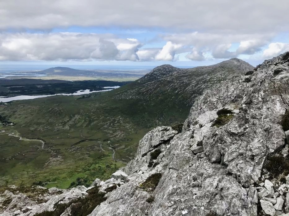
Glencoaghan Horseshoe route map.
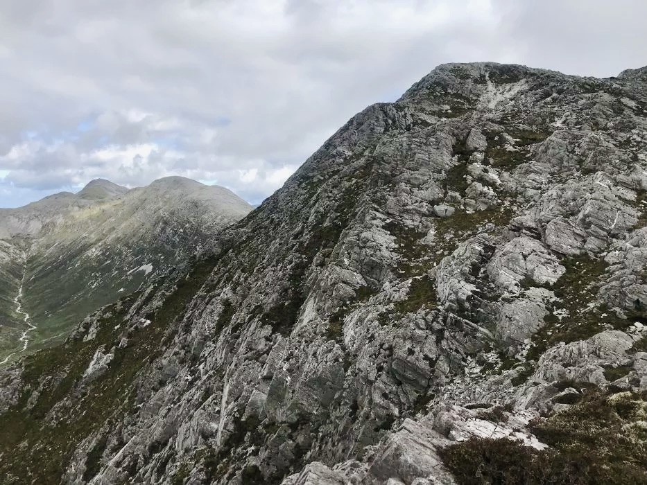
The walk should be done anticlockwise, as there are a few steep rocky sections and it’s much easier to do it this way. I have to say the beginning of the ‘trail’ is completely not visible. If not 5 other hikers ahead of me, I would struggle to find the way up. And let’s be honest, most of the trail is just a sheep track, as the route is not maintained.
The trail begins with a moderate ascent. As you gradually gain height, the views open up to the surrounding peaks and valleys. Be prepared for changing weather conditions—typical of this region. Local weather is upredictable, so don’t forget to pack your waterproof gear.
How to get to Glencoaghan Horseshoe?
Driving the main road N59 west direction toward Lutty town (Google says Ten Bens Cottage is there) this is a tiny road on your right. It’s the closest road visible on a map to Derryclare – the first summit of Glencoaghan Horseshoe Loop.
However, this starting point is not convenient for the finish, as you need to walk back 5 km to reach your car from the Benelttery Youth Hostel or… take a ‘shortcut’ which is more of a survival trail than a shortcut! Anyway, the start of the trail is tough, but I was very lucky with the weather and it gave me a really quiet, pleasant morning and rewarding views.
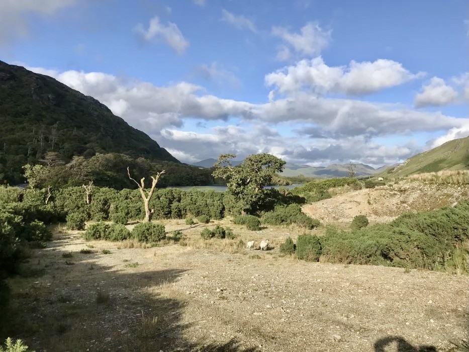
I left my car on a tiny road – farming area, closest I could get to the starting point of the trail.
Hiking Glencoaghan Horshoe Loop starting point.
The typical starting point for the Glencoaghan Horseshoe is at the parking area near Ben Lettery Youth Hostel.
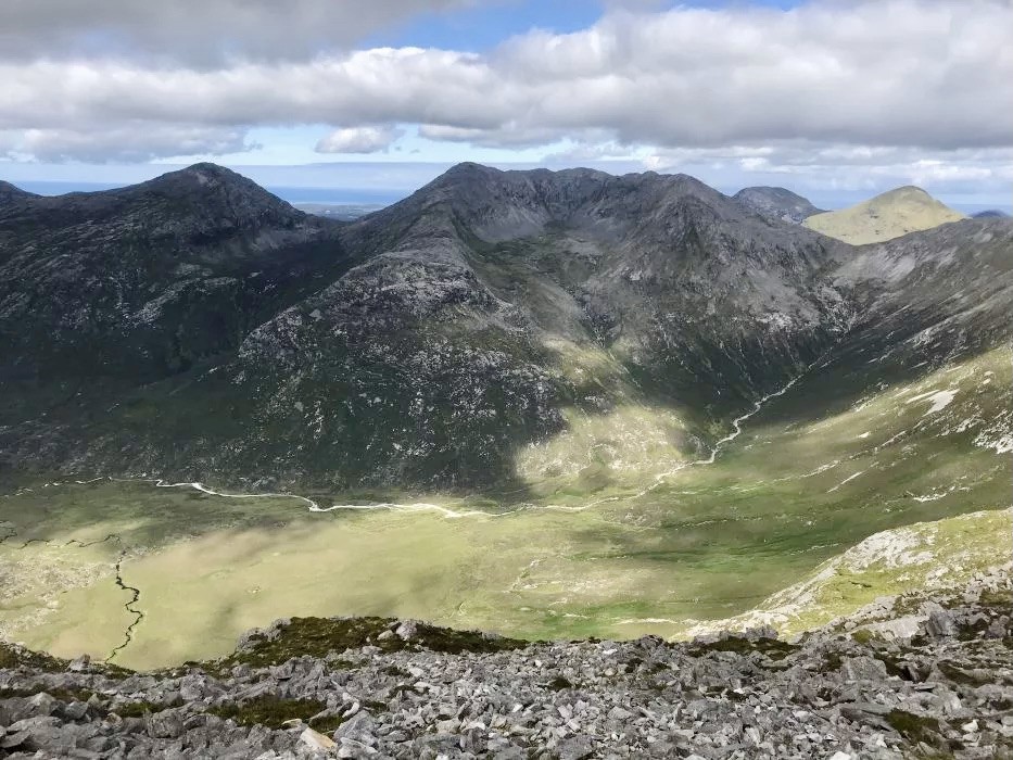
From there, you follow the trail that ascends the steep slopes of Ben Lettery before reaching the ridge that forms the horseshoe shape. The route then takes you over several peaks, including Ben Breen, Benbreen North Top, Benbreen Central Top, Benbreen South Top, and Benbrack.
How long does it take to hike Glencoaghan?
Actually, I’m quite surprised people say the average time for this walk is 8-9 hours, as it’s really tough and I would rather say it takes 9-10 hours to accomplish the loop. Hiking Glencoaghan Horseshoe Loop (6 peaks) takes all day. In the middle of the trail, I was already quite tired, because some sections are really steep with pure rock climbing, demanding but still pretty safe. I remember reading it is advised to carry a rope with you – no surprise at all!
- Start your hike at 7-8 a.m. at the latest (remember it takes time to reach the starting point).
- The trail is 12 km long, leading through a number of peaks
- It took me more than 9 hours to accomplish it.
Itinerary description.
For the majority of hikers, the walk finishes at the Ben Lettery Youth Hostel – also called Ben Lettery Hostel. When you take the southwest direction before the last mountain, Ben Lettery, you’ll be able to reach Ben Lettery Hostel. Although it leaves you 5 km from your car (the starting point). The last descent is very steep and stony, and may be challenging for tired legs. Many hikers told me you will always find somebody who will give you a ride from Benelterry Youth Hostel back to your car.
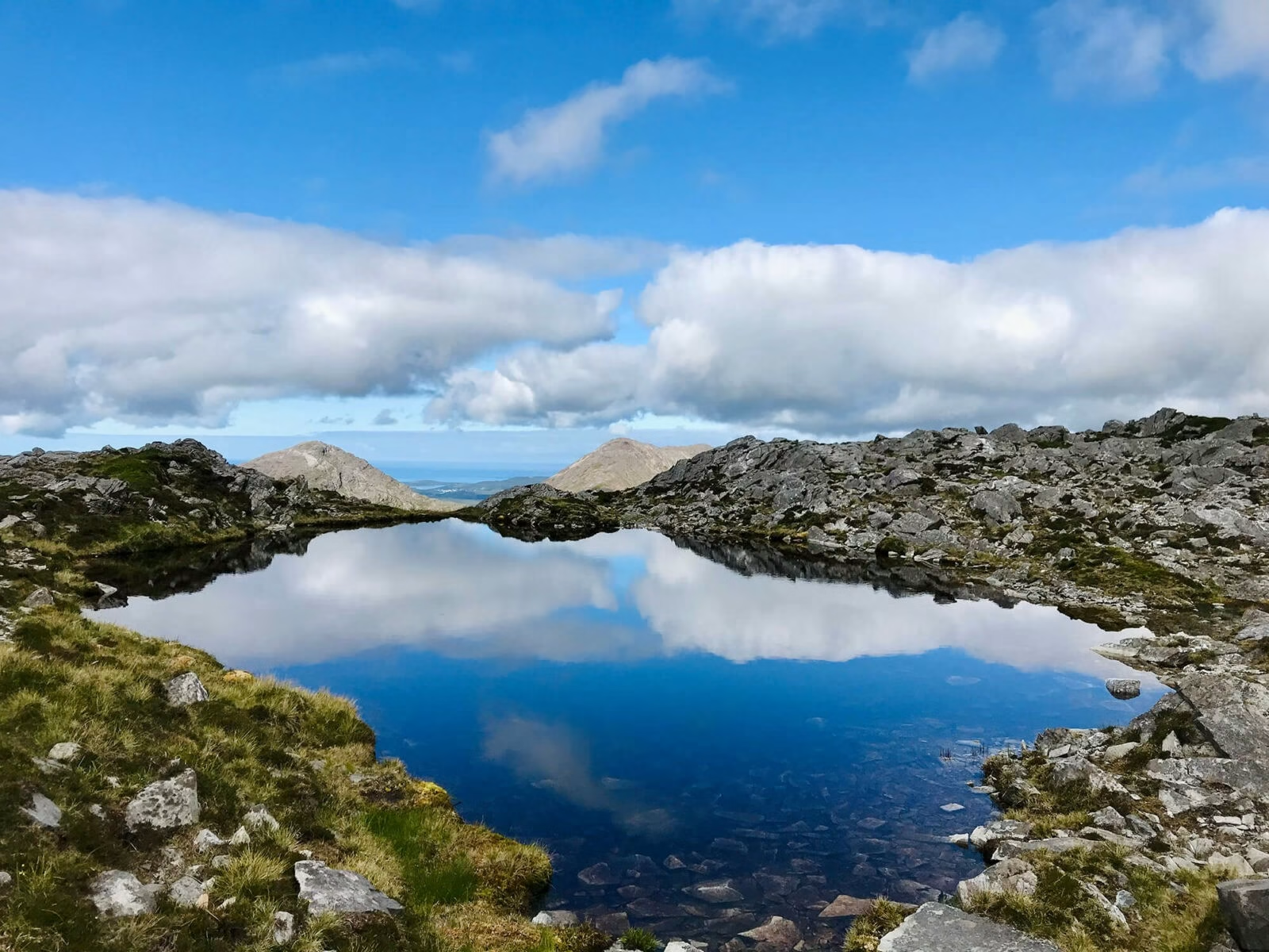
Hiking Glencoaghan the views are stunning, unless the weather is very bad. The summits of Glencoaghan Horseshoe loop are: Derryclare, Bencorr, Bencollaghduff, Benbreen, Bengover, Benlettery (last – the private one).
Connemara National Park is spectacular, the panoramic views are the star of the show.
Where to stay in Connemara?
As mentioned above Ben Lettery Youth Hostel is quite a typical starting point for hiking Glencoaghan Horseshoe, thus a lot of people choose to stay there for the night prior hiking day. You can search for accommodation on booking.com.
Two alternatives stays I can highly recommend:
- Lovely Connemara Haven Bed and Breakfast
- A really fabulous place – Cashel House Hotel
How difficult is hiking Glencoaghan?
The last 2 hours felt like an eternity. I was struggling walking down the steep valley, even though it seemed like an easy walk from the top of the mountain.
I remember passing the sheep, biting the grass from the front of their mouth. I don’t know how I managed to reach my car, at the very end, I was so tired that I could feel every single bone howling in my body. The sun was giving me a warm goodbye and I couldn’t stop thinking where I would be right now if the weather was against me! It was even hard to imagine that!
GENERAL ADVISE FOR hiking Glencoaghan – you should be prepared for steep and rocky terrain, as well as some scrambling in sections. Proper hiking gear, including sturdy hiking boots, layered clothing, waterproofs, plenty of water, snacks, and a map and compass, are essential for this challenge.
The route.
I’m always the master of my ceremony, so I left all other hikers and took the shortcut to get to my car. Just at the last stage, you’ll see an extremely steep mountain – Benlettery, ahead of you (it’s probably too steep to climb, but it’s also private property). I took the left well ahead of the mountain, toward the valley and through muddy fields.
Don’t take this road if it’s raining, you will get stuck in the mud and it will be very hard to get through. It was a very dry day for me. I took a chance but still got a bit wet and had to cross 3 rivers. At that stage, it didn’t make any difference to me, as my feet were dying and I was praying to reach the end of my trail. The only thing I felt was a horrible pain in my feet and a disturbing headache.
Benlettery mountain - IMPORTANT NOTICE.
Hiking Gleancoaghan Horseshoe Loop anticlock wise way, Benlettery would be last mountain on your way. It’s very important to know Ben lettery is a private property and there is no permission for public to walk over the mountain and surrounding farm land. Most hikers would probably not be aware of this fact, but walkers cause many issues on the farms: damage of fences, anilams disruption and cause biosecurity isuues.
The land owners are extremely kind people, so please try to be respectful toward their work, private nature space and help them avoid all those problems: try not to disturb fauna and flora life 😉 and avoid fenced territories.
What to bring for hiking Glencoaghan:
- Good hiking shoes are a must
- compass
- whistle
- water (enough for 12 hours) and snacks (nuts, protein bars), a sandwich,
- Most essential – windproof and rainproof jacket, warm clothing
- hiking poles – you could but not essential
- painkillers, basic first aid kit
- power bank
- maps
What I can advise is not to overdress. I made this mistake, as everyone was telling me how bad the weather is usually there. I dressed warmly and got sweaty quickly… Wear lighter clothes, especially at the beginning.
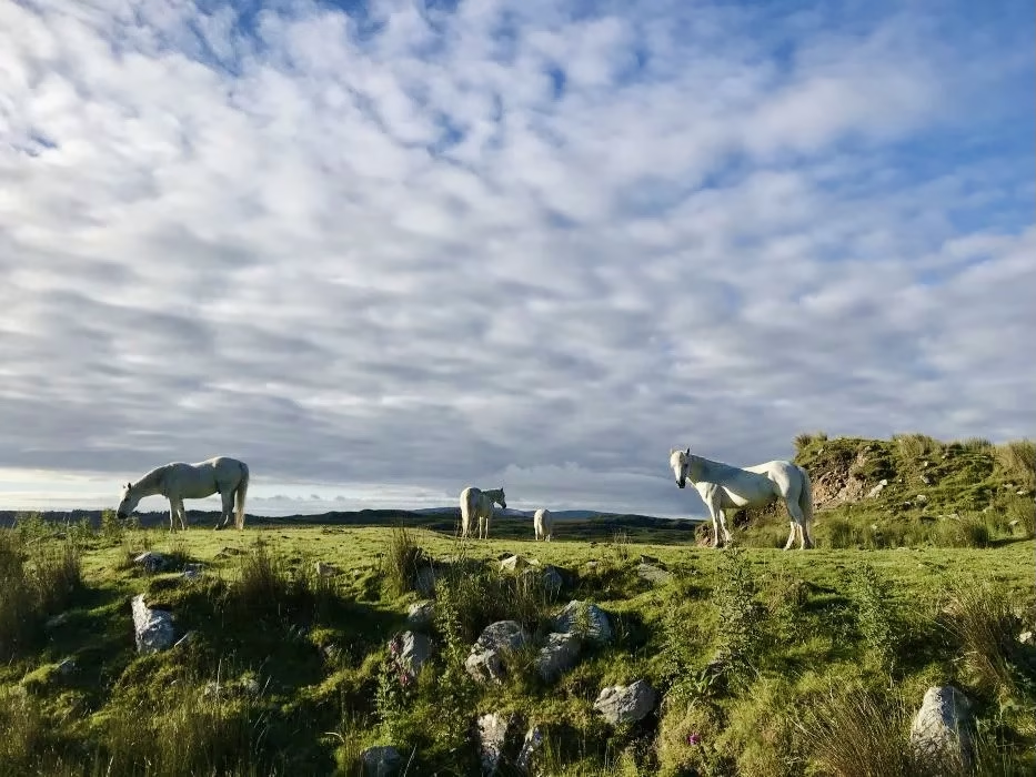
Explore Connemara National Park.
Glencoaghan Horseshoe Loop is only one of many stunning hiking and walking trails in Connemara National Park. This whole protected Wildlife Service area is a part of the Wild Atlantic Way, most routes would treet you with stunning mountain views and pieceful nature landscapes.
Visitor Centre is located near Letterfrack Village, check the website for more information: www.nationalparks.ie/connemara/
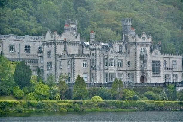
You cannot visit Connemara without seeing the magnificent Kylemore Abbey and its victoria gardens– a Benedictine monastery founded in 1920 on the grounds of Kylemore Castle, in Connemara.
Looking for exceptional adventures - Check most scenic hikes in Ireland!
Into the wild Ireland – 10 best things to do in Kerry!
County Kerry is a hilly region of the south-east of Ireland, considered as one of the most iconic parts of the Emerald
Hiking Ireland – top 10 best hikes in Ireland.
Despite the fact the island’s highest peak is only 1038 metres tall, there are many fantastic, highly challenging one or multi-day hiking
6 most scenic hiking trails in Ireland.
Ireland the Emerald Isle has a lot to offer in terms of natural beauty. The name refers to the color of the
Note: This post may contain affiliate links, which are at absolutely no cost to you – I can earn a small commission on sales generated through this website and thanks to that I can share travel guides and inspirations that may help you reach your dream destinations and discover our unique world. I only recommend sites I actually use and have traveled to. Thank you for your support!
