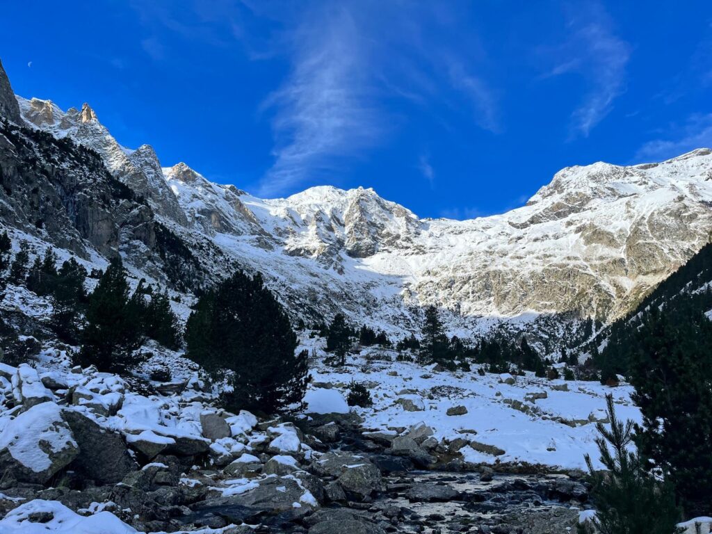
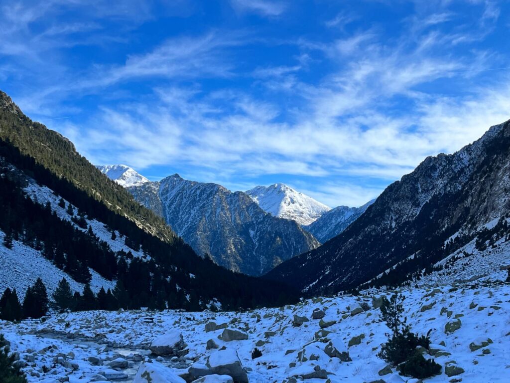
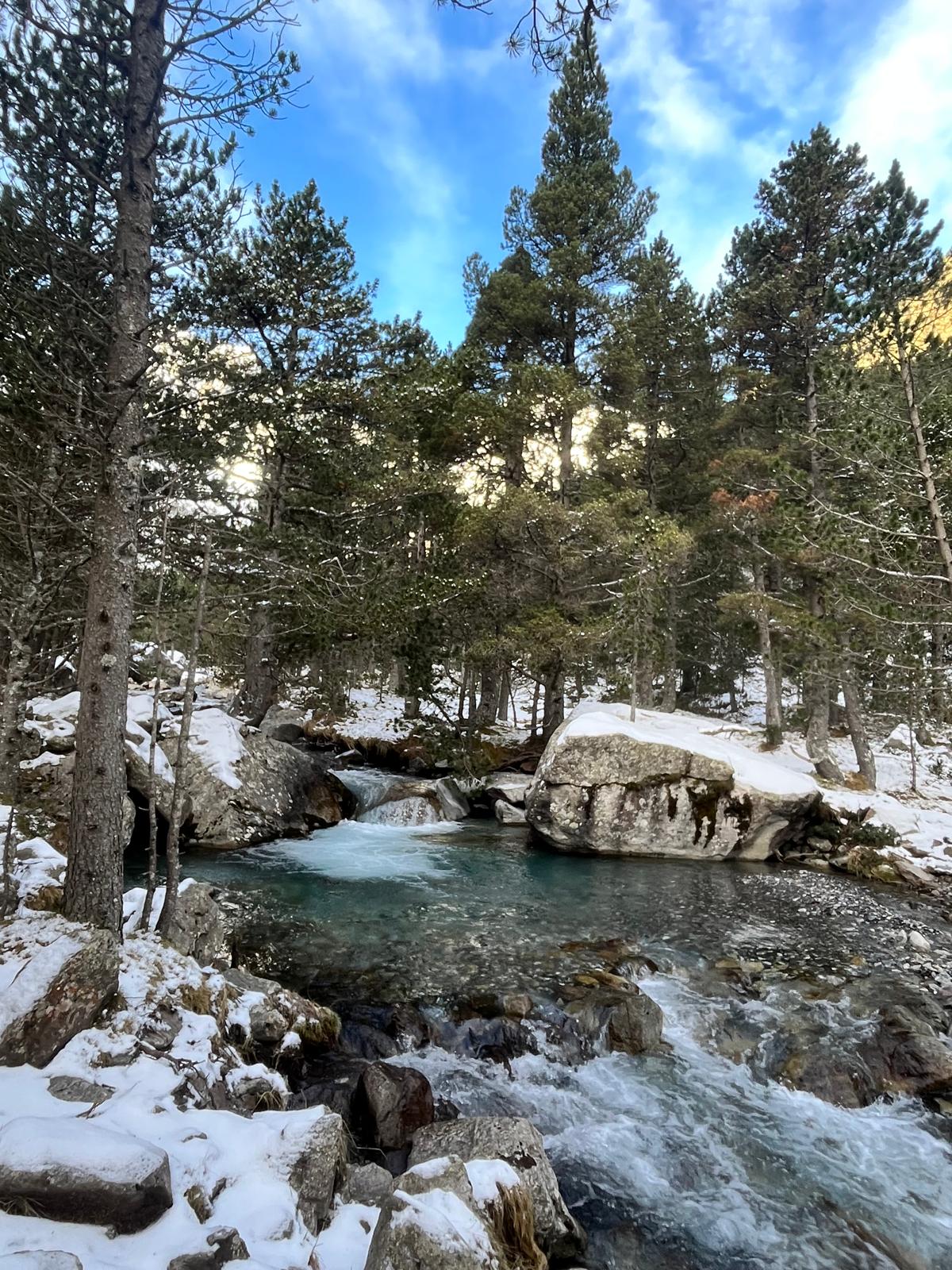
The Pyrenean landscape is magic and unique, as the majority of the mountains are wild, unexplored and even unattended areas. You will likely meet nobody while hiking in the Spanish Pyrenees.
Hiking in the Spanish Pyrenees.
This was my first experience hiking in the Spanish Pyrenees, and I must say this cardillera looks magnificent, but it’s very different to all other European mountains. You will not find hiking maps; the majority of the trails remain without any direction signs, so better to have online maps and a compass in your backpack (the signal is weak in many areas, so dowload off-line maps).
Aragonese Pyrenees - the tallest limestone massif in Europe!
The Pyrenees are a natural border spreading between Spain and France for over 450 kilometres.
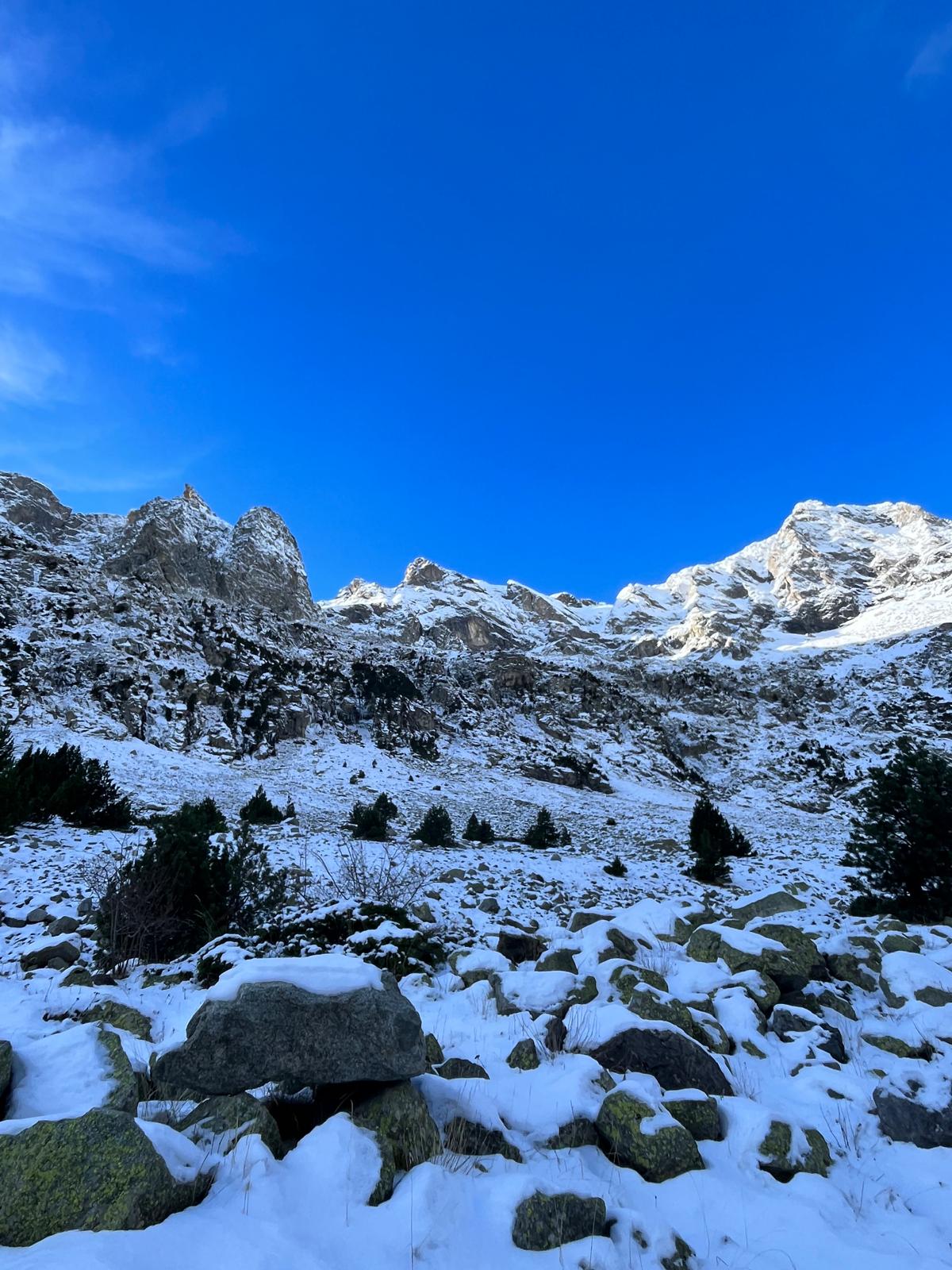
Aneto, at an altitude of 3404 metres, is the highest peak in the Pyrenees on the Spanish side in Huesca Province. The mountain landscape of snowy peaks, glacial lakes and deep canyons is wild and breathtaking.
Best car rental in Spain.
I rented my car as usual on RENTALCARS.COM, which is the world’s largest online car rental service, comparing offers from the majority of rental companies. By selecting your preferences, you can get the best deal on your desired car category.
I chose Drivalia this time, and I have to say the service was top class! From the shuttle van from the airport to the rental office, smooth pick-up and drop-off. All rental conditions were clearly communicated and explained.
IMPORTANT NOTE: There are two countries you are allowed to drive to: France and Andorra. You need to purchase extra insurance of Euro 20/per each trip (minimum payment is Euro 40).
Alternatively you can go on a very popular tour from Barcelona across the 3 countries: Spain, Andora and Pyrenees or join a fabulous tours in Pyrenees:
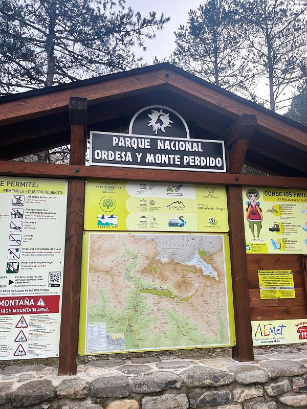
Hiking in Ordesa National Park.
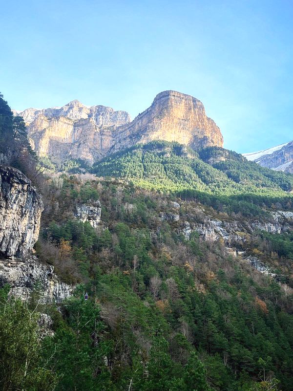
Ordesa National Park is the most visited part of the Spanish Pyrenees with Ordesa-Viñamala UNESCO Biosphere reserve and spectacular Mont Perdu (3355m) – the third highest peak of the Pyrenees.
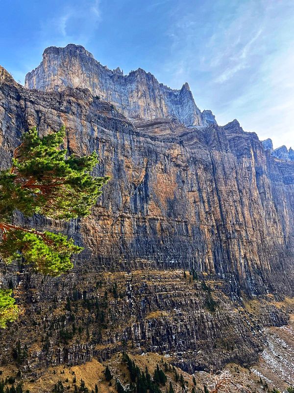
Ordesa’s beauty is shaped by green valleys, dramatic canyons and vertical rocky mountains. The landscape is unbeatable, and the park is a great destination for hiking in the Spanish Pyrenees. The Park is also the tallest limestone massif in Europe.
There are more than 20 hiking trails and a number of rock climbing options in Ordesa National Park. Most interesting trails:
- Circo Cotatuero
- Cascadas del Río Cinca
and for more active hikers:
- Faja Racon (dangerous trail! – check more details below)
- Monte Perdido glacier
The best base for hiking trails in Spanish Pyrenees.
Staying in one of the charming villages of the Pyrenees and/or medieval towns is the right decision.
1. BROTO – charming small town located in Broto Valley. Broto is a great tourist hub, an ideal place if you are staying over for a few nights and a fantastic getaway for a number of hikes in the area. All accommodation options HERE.
2. TORLA-ORDESA – a highly popular mountain town in the heart of the Aragonese Pyrenees.
3. SALLENT DE GALLEGO – lovely town located at the foot of a dramatic mountain range. It’s a perfect getaway for hiking trails across one of the highest peaks in the Pyrenees, but also for some skiing adventure. Choose accommodation HERE.
4. BIELSA – an amazing village with 500 inhabitants surrounded by incredible nature. Check accommodation options HERE.
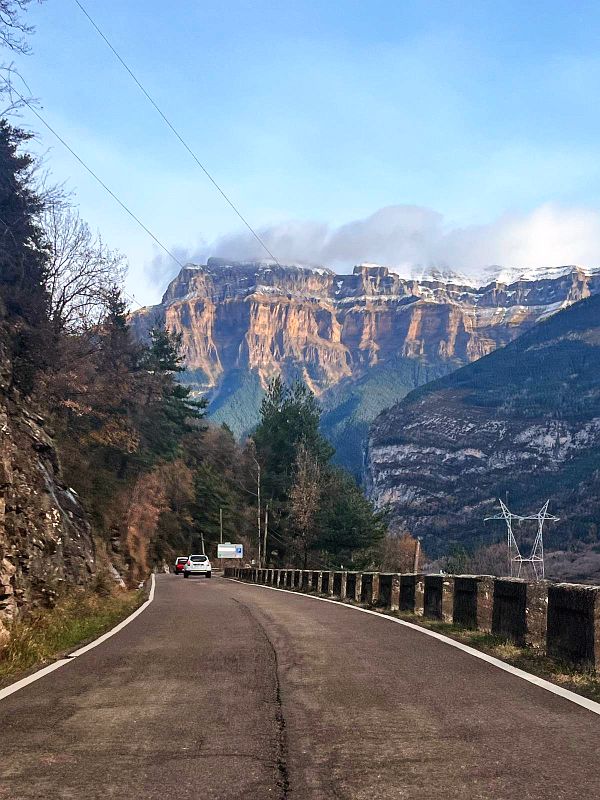
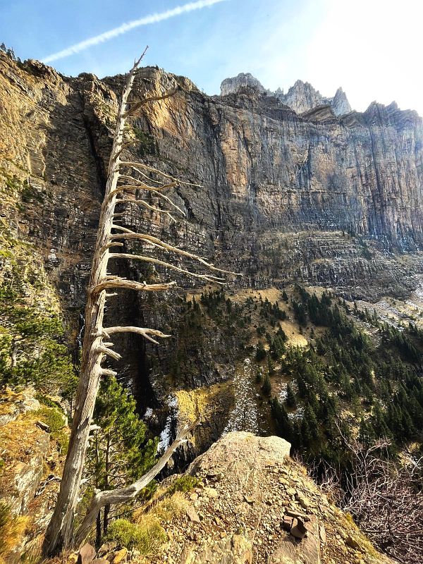
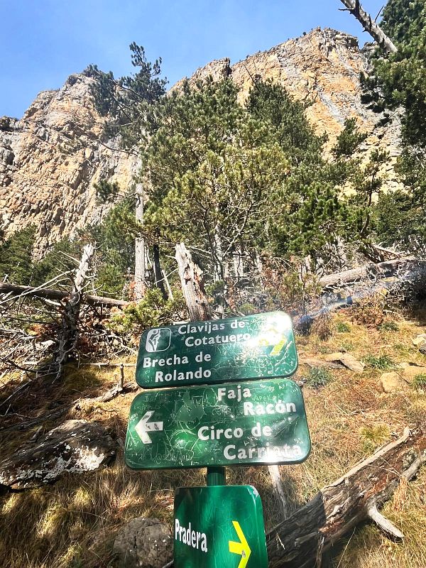
Hiking Clavijas de Cotatuero (and Circo Cotatuero).
For my first hiking in the Spanish Pyrenees, I chose Clavijas de Cotatuero. Perhaps the first half is a bit monotonous, but then it gets challenging and the views from the top are just outrageous!
There are barriers on the way to the parking that will go down to close the road completely for the winter season.
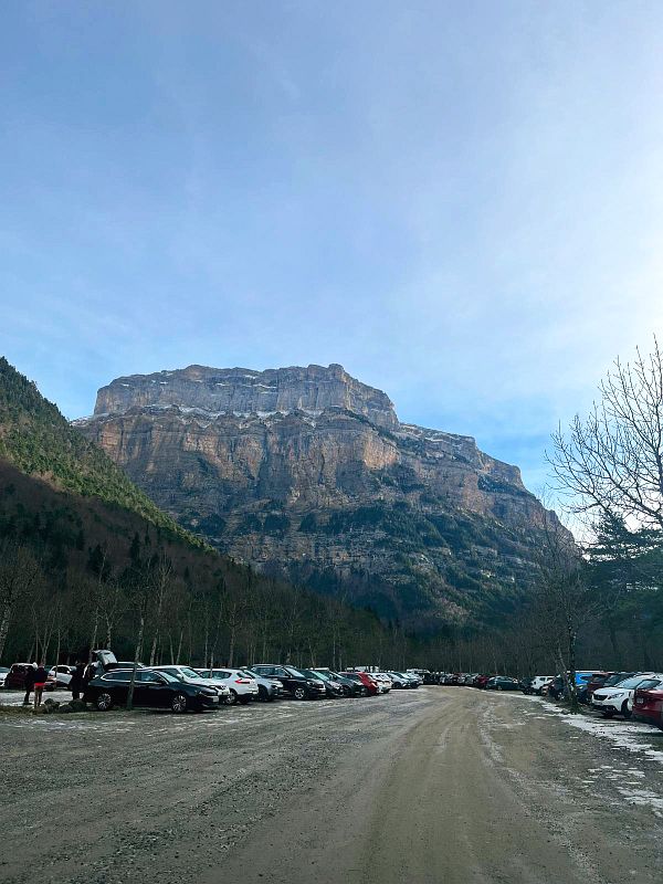
Starting point: Ordesa y Monte Perdido National Park – Car Parking (it’s a huge car parking – I was shocked seeing a couple of hundred cars, as there was almost no traffic on the way). Parking is FREE of charge, but the restaurants and toilets were closed!
Difficulty level: MODERATE
Hiking time: 2h hiking up, 1.5h going down.
Highest point: almost 2000 metres.
This is also a starting point for several trails:
- Clavijas de Cotatuero
- Brecha de Rolando
- Faja Racon
- Circo de Carriata
- Hunters Path
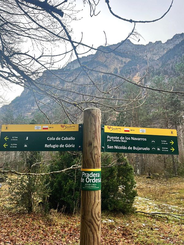
- Pradera de Ordesa
- Cascadas del Estrecho – Waterfall
Just at the beginning you can choose from number of trails and pleasurable walks. If you take the Cola de Caballo direction, 200 metres later, the route splits between the main trail toward Cascado del Estrecho and a tiny path toward Circo de Cotatuero.
NOTE: There is a warning sign regarding Faja Racon trail – which is considered dangerous due to rocks and snowfall. That is very true – in the way up, I was constantly hearing rocks falling and smashing over the stony ground. I also had to watch for the snow pieces falling down from the top of the vertical rock sections that you will be passing by on the way to Circo de Cotatuero.
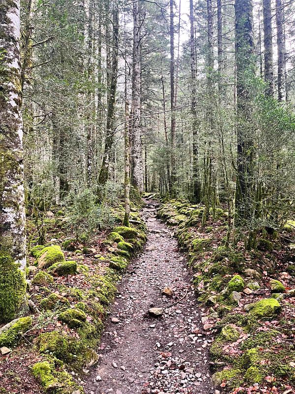
The trail leads through a beautiful, old forest. It will take 1-1.5h before you reach any mountain views, but there is an amazing waterfall on the way, and you can walk the white bridge and take stunning photos! Eventually, the signs split the road between Faja Racon and Clavijas de Cotatuero. From there it’s only 20 minutes to reach one of the most amazing viewing points I’ve seen – a tiny rocky shelf – Clavijas de Cotatuero.
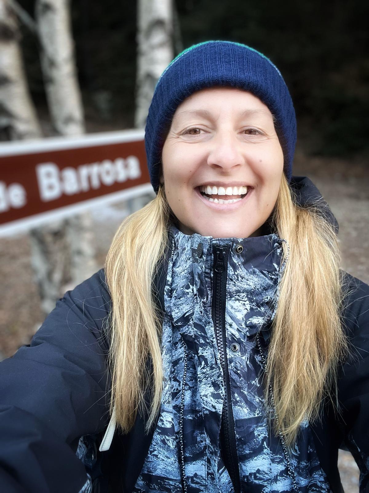
Hiking incredible Barrosa Circus Route.
Barrosa Circus Route (also Camino de Las Pardas) is a fabulous trail as a warm-up for hiking in the Spanish Pyrenees. With its spectacular scenery and easy terrain, it’s an ideal destination for less experienced hikers who wish to feed their eyes with breathtaking mountain views.
Getting there: Drive road A-138 toward the French border. I thought I’d be leaving my car in Parking Salcorz, but there’s no need for that. 100 metres before it, there’s a tiny parking space for a few cars next to the Barrosa Valley road sign. This is also the beginning of your hiking trail.
STARTING POINT: Barrosa Valley road sign.
Hiking time to the abandoned mountain shelter: 1.5-2h one way.
Difficulty level: Easy/Moderate at the later stage.
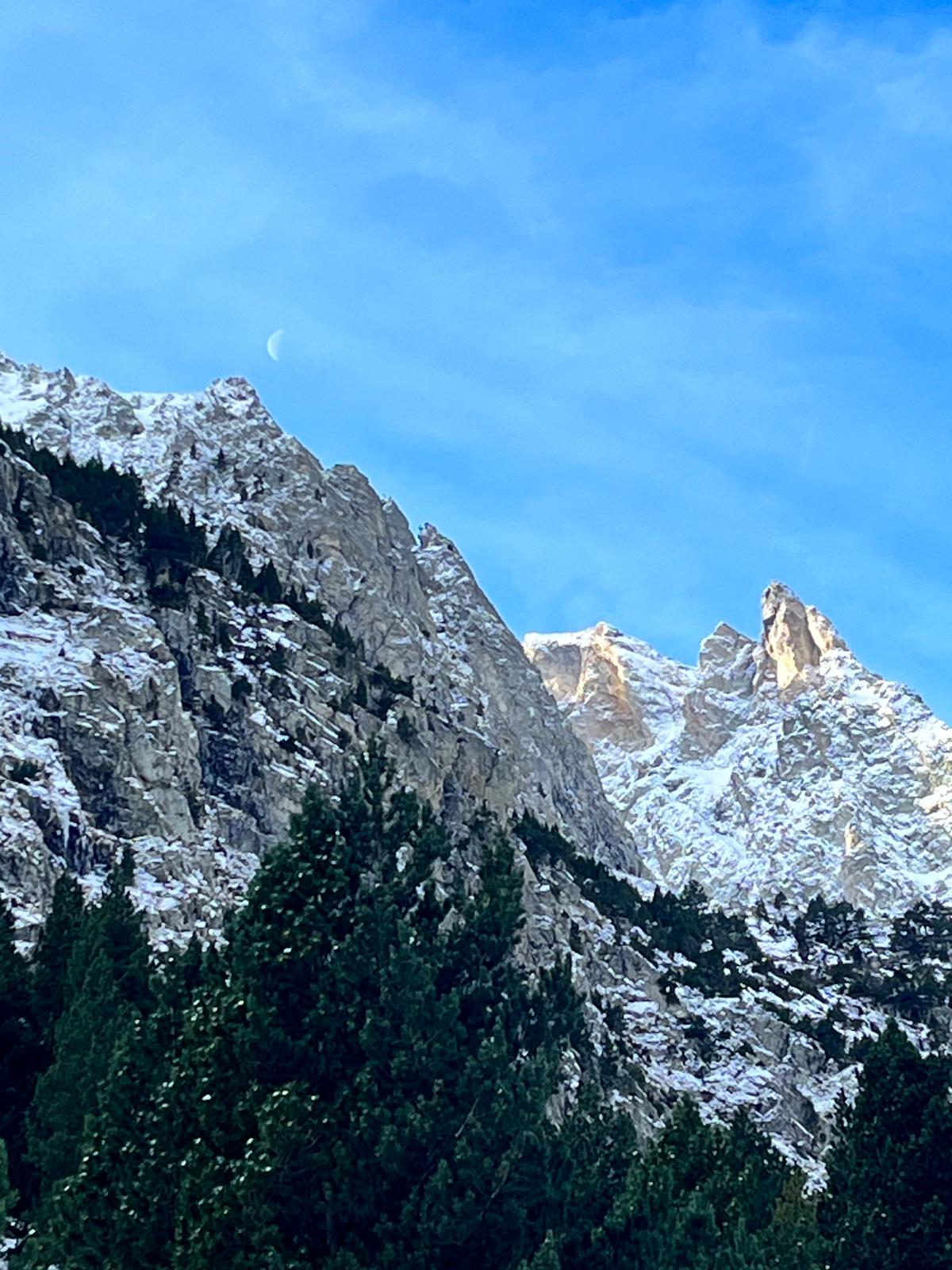
Shortly, you will be leaving the tiny route of Minas de Liena on your left to continue your hike along the Barrosa Valley. The route leads along beautiful Rio Barrosa with a few mountain pools on the way. This few kilometres trail takes you eventually to Refugio de la Barrosa – an abandoned mountain shelter, surrounded by massive snowy peaks with Ribinera Peak in front of you, rising at 3000 metres.
The shelter is located at an altitude of 1770m. Passing the shelter, you’ll be following the Camino de las Padras trail to reach Puerto de Barrosa. This section becomes much more challenging, so be prepared for extensive hiking.
Famous GR-11 Pyrenees Trail.
A GR-11 is extremely well known 840 kilometres trail through the most magnificent spots in the mountains of Navarra, Aragon and Catalonia – Southern Pyrenees. The trail unveils the true beauty of the Pyrenees and its diverse landscape.
Scenic hiking trails through GR-11.
Here are a few more options for hiking in the Spanish Pyrenees, among magnificent scenery.
CHISAGUES – PINETA
- Chisagues – starting point
- Route: Pineta (this is stage 19 of the famous GR-11 trail)
- Ticket required to enter the park – you can scan QR code on the road sign.
BIELSA – VALLE DE PINETA
- Starting point: Bielsa small town
- Route: Valley de Pineta
Some other hiking trails in the Pyrenees.
- Traverse the Pyrenees to marvel at the picturesque town of Jaca – a gateway to outdoor adventures.
- Ordesa National Park – discover the dramatic Monte Perdido mountain.
Accessibility: Some trails may require booking or permits.
Safety Precautions: Carry sufficient water/food/snacks (there is nothing available on the trails), wear appropriate footwear, and pay attention to any trail restrictions.
- Pico de Aneto – The highest peak in the Pyrenees mountain range, offers breathtaking views and a challenging mountaineering experience. Hiring a certified guide is recommended.
Safety Precautions: Proper mountaineering equipment, physical fitness, and experience are essential.
Mallos de Riglos impressive rock formations attract many climbers and hikers.
Difficulty Level: Varies depending on the chosen routes.
Note: This post may contain affiliate links, which are at absolutely no cost to you – I can earn a small commission on sales generated through this website and thanks to that I can share travel guides and inspirations that may help you reach your dream destinations and discover our unique world. I only recommend sites I actually use and have traveled to. Thank you for your support!


")


