
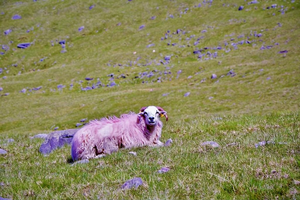
Carrauntoohil – the highest point of the island (1038 metres) is located in Macgillycuddy’s Reeks Mountains in County Kerry, around 20 km from Killarney. Carrauntoohil is a great trekking destination in Ireland. Hiking Carrauntoohil via Devil’s Ladder is a challenging but spectaculat adventure – mountains of Kerry are one of the most dramatic and scenic of the country.
Hiking Carrauntoohil via Devil's Ladder.
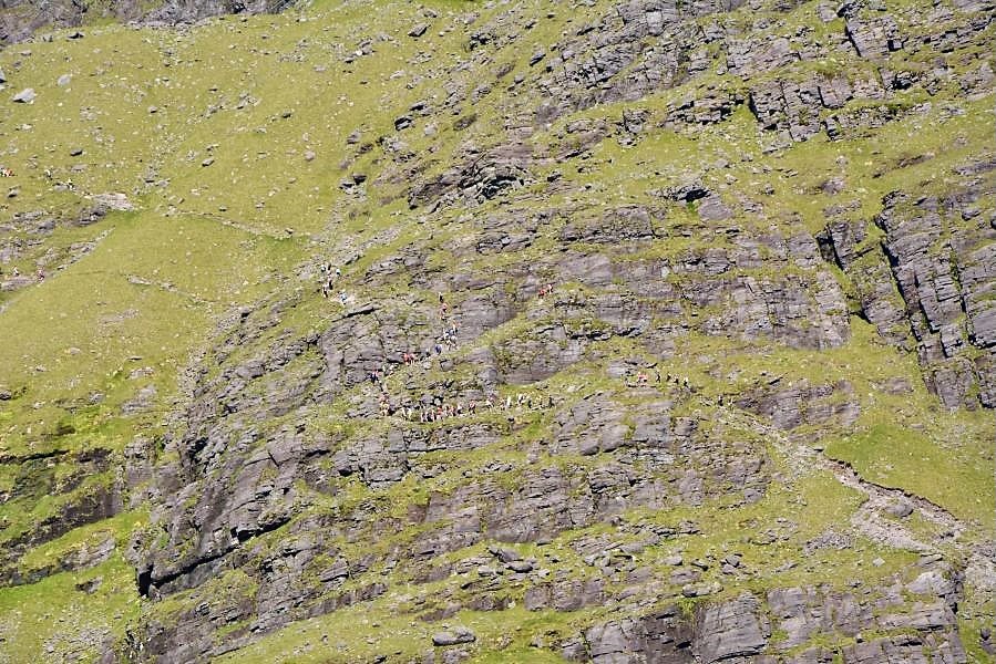
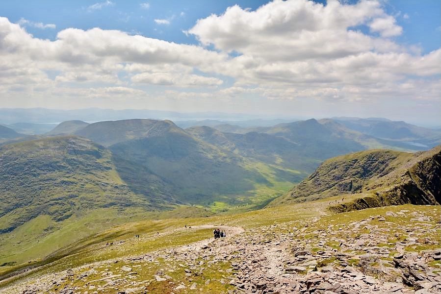
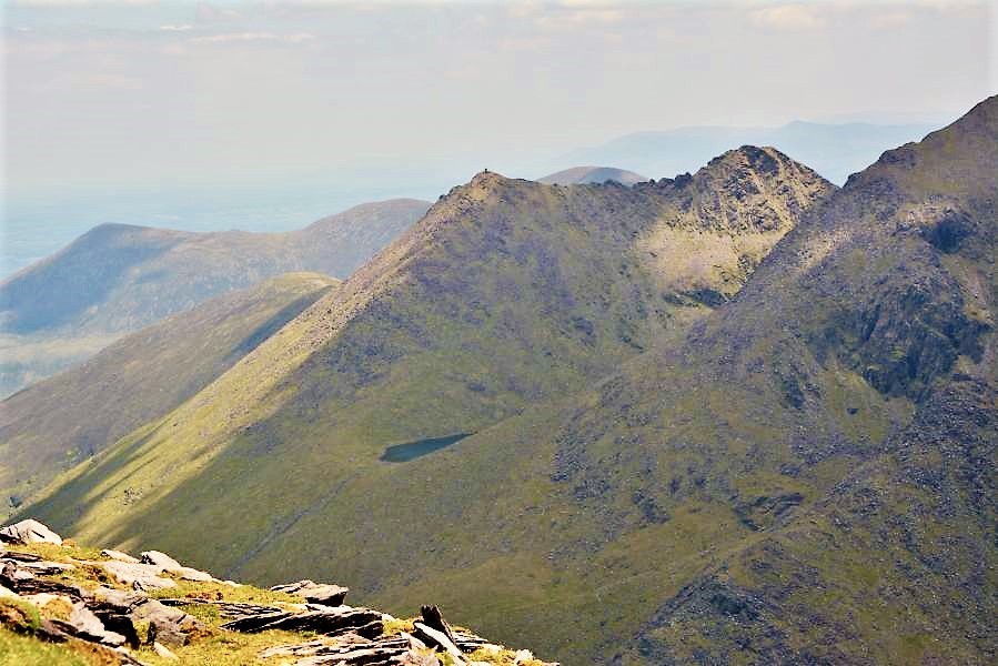
There are few trails to the summit of Carrauntoohil but the traditional and most popular route leads through the Devil’s Ladder. As per the name you would guess it is a challenging trail and it should not be approached by unexperienced hikers. There aren’t many signs on the way up but the path would be visible enough. The beginning of the route is flat and it’s hard to imagine it turns into a steep rocky trail. While it is doable to hike up this route, I don’t think it would be possible to go down the same way. You would be taking the long way back down instead.
Is Devil's Ladder hike difficult?
Hiking Carrauntoohil via Devil’s Ladder is challenging and if you don’t have decent hiking experience it is advicable to take a guide. No special equipment is needed to climb the mountain, however there are number of things to be aware of.
- The route has become more dangerous in recent years due to loose stones.
- Weather forecast – check weather conditions before you leave, due to closeness to Atlantic Ocean, the weather near Carrauntoohil may change rapidly.
- Good hiking gear (especially shoes) are a must.
- Carry plenty of water (I always have hot honey ginger tea – great energy BOOSTER), wind and rain proof jacket, food and high protein snacks (nuts, energy bars, black chocolate).
Devil's Ladder hiking trail.
There are several trails to the top of Carrauntoohil (alternative routes: Caher Route and Brother O’Shea’s Gully).
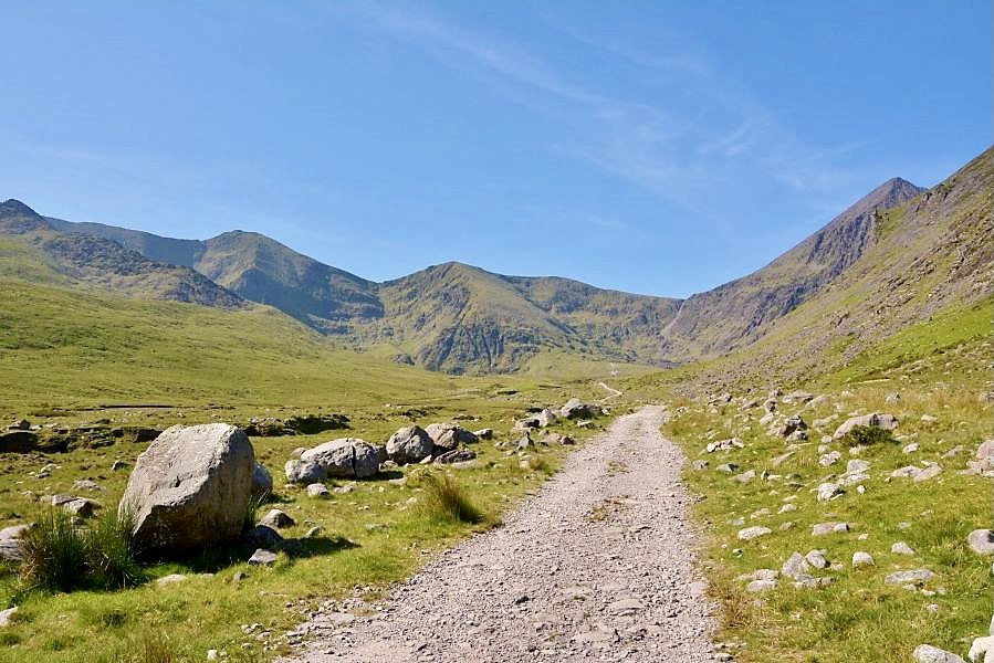
STARTING POINT FOR DEVIL’S LADDER HIKING TRAIL is CRONINS YARD – a convenient car parking with great tourist information and absolutely lovely camping site with very good facilities. There is a small caffee/restaurant with very tasty food.
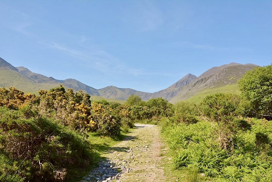
The first stage of the trail after crossing the bridge leads through beautiful flat hilly scenery. The path is well maintained and it’s easy to spot the path.
Further the trail you’ll be approaching a steep rocky section. Do not go behind people who are hiking ahead of you, to avoid any falling stones. If you stop to take a break to admire surrounding breath-taking views, always make sure there isn’t anyone ahead of you, to avoid being hit by any stones while you’ll be looking the opposite way. I’ve seen how is there and you should really pay attention to your safety. This section can be really difficult especially in rough weather conditions.
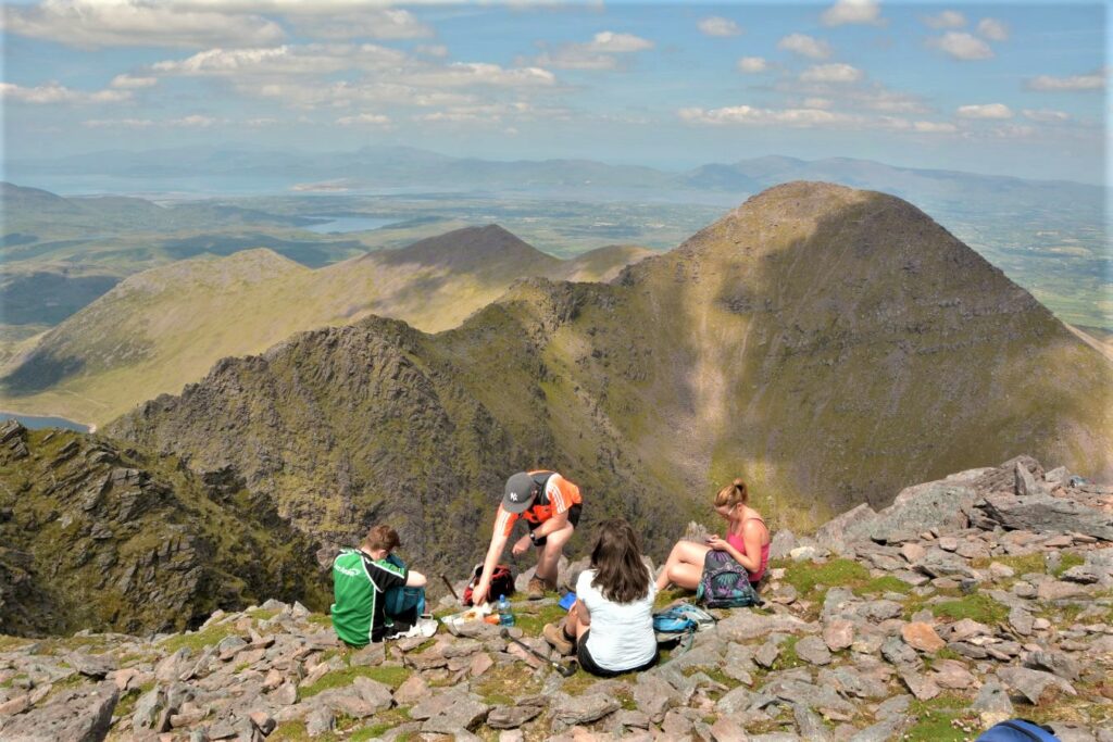
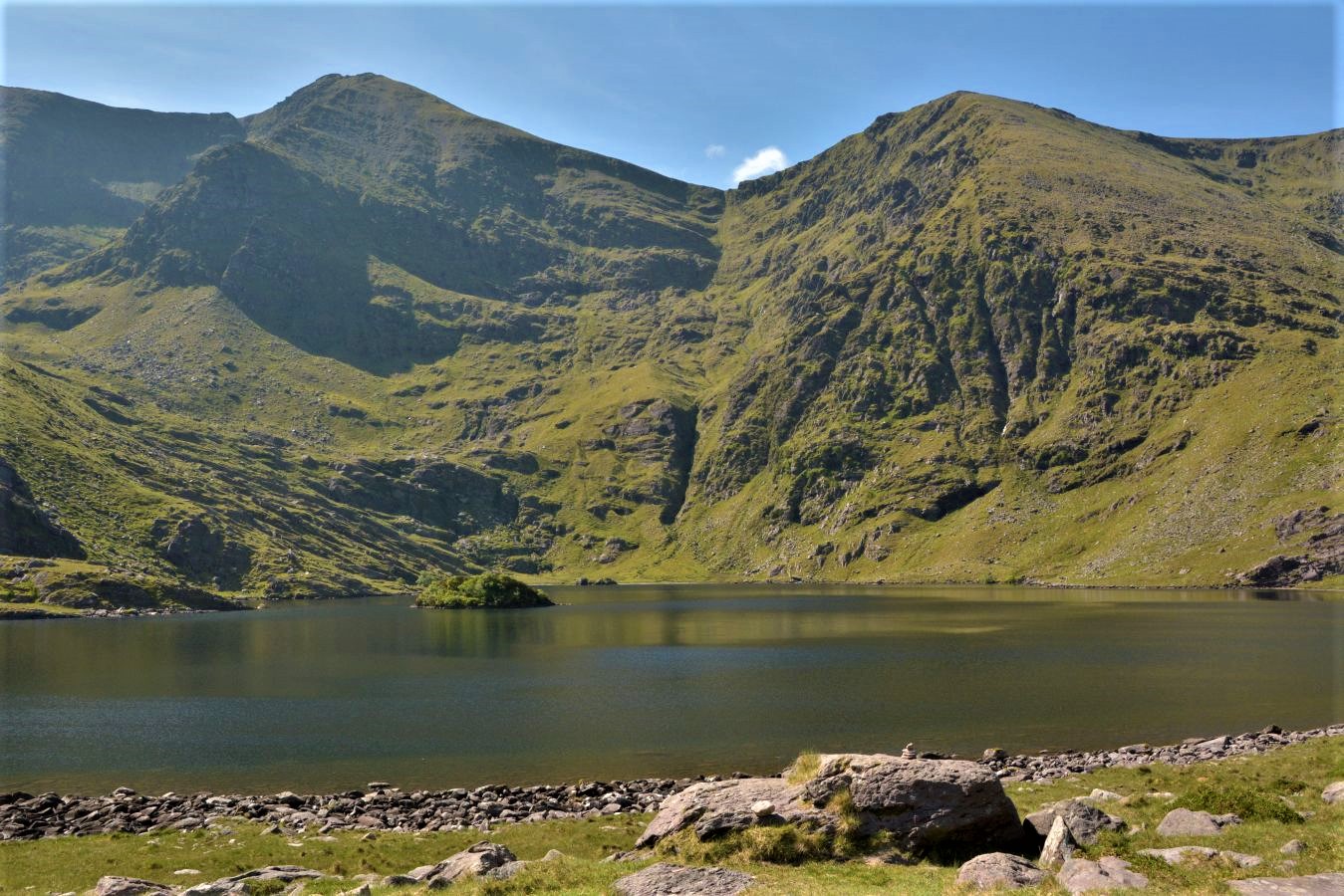
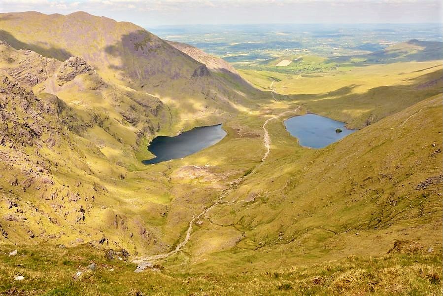
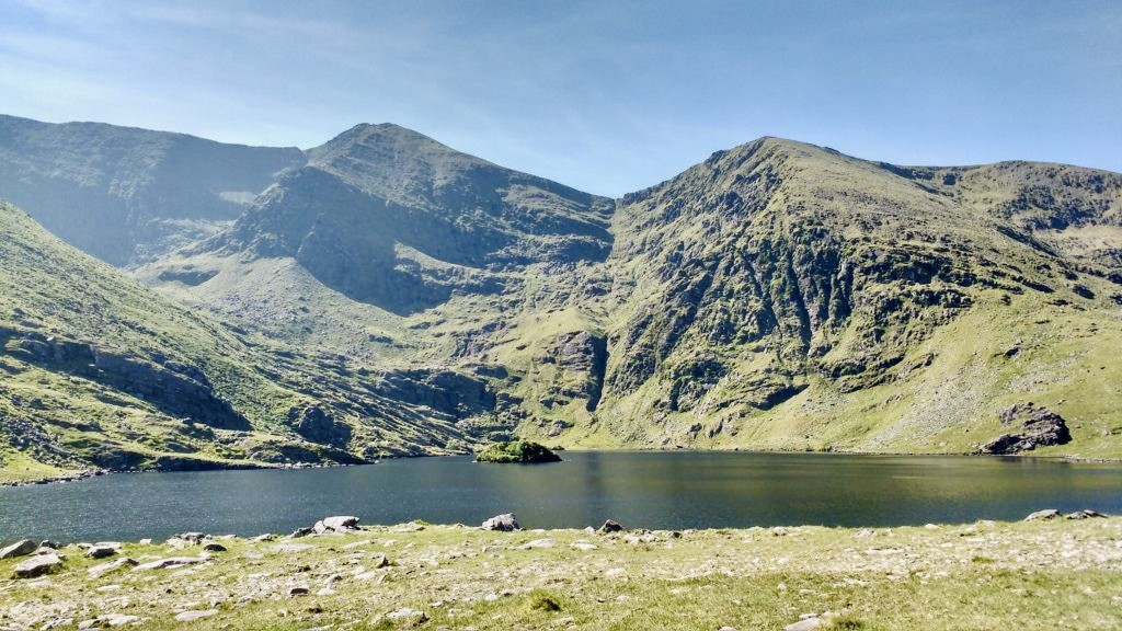
There are two stunning lakes, shaped in human lungs, which are visible from the higher level. The views of the surrounding green mountains are spectacular. Once you complete the steep ladder section, take right direction toward the last section of the trail – the big cross on the summit. There will be plenty of people (in good weather conditions) having lunch and rest on the top.
How long does it take to hike Carrauntoohil?
The whole way to the top took us around 3 hours. It was unusual day for Ireland – we hiked in 28 Celsius degrees in a sunny and clear weather conditions. Hiking down Carrauntoohil takes another 3 hours.
Hiking time may differ depending on weather conditions. The weather for us was extremely generous and it was a beautiful bright day. Hiking Carrauntoohil took us almost 7 hours with a long lunch break on the top and lots of landscape shooting.
HEIGHT: the highest mountain on the island of Ireland at 1,038.6 metres!
Starting point: CRONINS YARD – Tourist information, camping and caffee shop.
Duration: 6-7 hours up and down.
Difficulty: Moderate/Difficult. Beginning of the route is easy but then it gets really steep with rocky sections and loose stones.
